
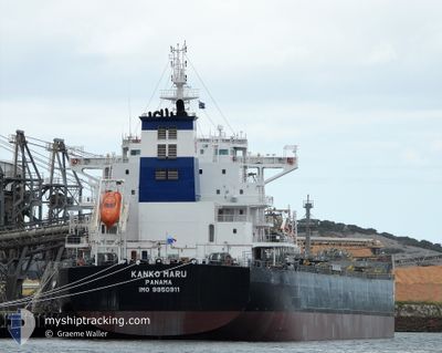
KANKO MARU
Cargo
Current Trip
| Time Travelled | 18 days |
|---|---|
| Remaining Time | --- |
| Distance Travelled | 5600.85 nm |
| Remaining Distance | --- |
| AVG Speed | 12.7 Knopen |
| MAX Speed | 14.7 Knopen |
| AVG Wind | 13.3 knots |
| MAX Wind | 25 knots |
| MIN Temp | 17.3°C / 63.14°F |
| MAX Temp | 28.6°C / 83.48°F |
| Diepgang | 12.9 M |
| Positie ontvangen | 3 d geleden |
Current Position
| Lengtegraad | --- |
|---|---|
| Breedtegraat | --- |
| Status | Under way using engine |
| Snelheid | 14.1 Knopen |
| Koers | 324.5° |
| Gebied | Laccadive Sea |
| Station | T-AIS |
| Positie ontvangen | 3 d geleden |
Information
The current position of KANKO MARU is in Laccadive Sea with coordinates 7.78204° / 76.71768° as reported on 2025-02-11 18:29 by AIS to our vessel tracker app. The vessel's current speed is 14.1 Knopen
The vessel KANKO MARU (IMO: 9950911, MMSI: 352001856) is a Cargo It's sailing under the flag of [PA] Panama.
In this page you can find informations about the vessels current position, last detected port calls, and current voyage information. If the vessels is not in coverage by AIS you will find the latest position.
The current position of KANKO MARU is detected by our AIS receivers and we are not responsible for the reliability of the data. The last position was recorded while the vessel was in Coverage by the Ais receivers of our vessel tracking app.
The current draught of KANKO MARU as reported by AIS is 12.9 meters
Weather
| Temperature | 23.1°C / 73.58°F |
|---|---|
| Wind Speed | 8 knots |
| Direction | 256° WSW |
| Pressure | 1012.6 hPa |
| Humidity | 82.4 % |
| Cloud Coverage | --- |
Featured Company
Last Port Calls
| Port | Arrival | Departure | Time In Port |
|---|---|---|---|
| 2025-01-22 21:14 | 2025-01-28 00:32 | 5 d | |
| 2025-01-15 15:08 | 2025-01-17 09:36 | 1 d | |
| 2025-01-01 11:04 | 2025-01-02 05:40 | 18 h | |
| 2024-12-14 03:04 | 2024-12-18 04:39 | 4 d | |
| 2024-12-09 07:12 | 2024-12-10 23:16 | 1 d | |
| 2024-12-04 02:00 | 2024-12-06 05:04 | 2 d |
Most Visited Ports (Last year)
| Port | Arrivals | |
|---|---|---|
| 2 | ||
| 2 | ||
| 1 | ||
| 1 | ||
| 1 | ||
| 1 |
Last Trips
| Origin | Departure | Destination | Arrival | Distance | |
|---|---|---|---|---|---|
| 2025-01-17 20:36 | 2025-01-23 07:44 | 612.57 nm | |||
| 2025-01-02 13:40 | 2025-01-16 02:08 | 1744.69 nm | |||
| 2024-12-18 12:39 | 2025-01-01 19:04 | 2953.58 nm | |||
| 2024-12-11 06:16 | 2024-12-14 11:04 | 626.47 nm | |||
| 2024-12-06 12:04 | 2024-12-09 14:12 | 809.46 nm | |||
| 2024-10-31 19:05 | 2024-12-04 09:00 | 5973.65 nm |
Events
| Tijd | Evenement | Details | Positie / Bestemming | Info |
|---|---|---|---|---|
| 2025-02-15 07:42 | Stop beweging | 16.17 nm, South of SALEHAABAD ISLAND |
24.53532 / 66.99068
PK BQM
|
Snelheid: 0.3 kn Koers: 322° |
| 2025-02-11 18:29 | Status Changed | Default Under way using engine |
7.78482 / 76.71559
PK BQM
|
Snelheid: 14.1 kn Koers: 324.5° |
| 2025-02-11 18:29 | Buitenbereik |
7.78204 / 76.71768
Laccadive Sea
PK BQM
|
Snelheid: 14.1 kn Koers: 324.5° |
|
| 2025-02-11 16:50 | Status Changed | Under way using engine Default |
7.47014 / 76.94353
PK BQM
|
Snelheid: 13.9 kn Koers: 325° |
| 2025-02-11 16:47 | Status Changed | Default Under way using engine |
7.46164 / 76.94957
PK BQM
|
Snelheid: 13.9 kn Koers: 322.5° |
| 2025-02-11 16:40 | Status Changed | Under way using engine Default |
7.44035 / 76.96584
PK BQM
|
Snelheid: 14.1 kn Koers: 316° |
| 2025-02-11 16:28 | Status Changed | Default Under way using engine |
7.40281 / 76.99935
PK BQM
|
Snelheid: 14.2 kn Koers: 313.4° |
| 2025-02-11 16:20 | Status Changed | Under way using engine Default |
7.38325 / 77.01999
PK BQM
|
Snelheid: 14.1 kn Koers: 318° |
| 2025-02-11 16:15 | Binnenbereik |
7.38837 / 77.01453
Laccadive Sea
PK BQM
|
Snelheid: 14.1 kn Koers: 313.4° |
|
| 2025-02-11 15:10 | Buitenbereik |
7.16706 / 77.19403
Laccadive Sea
PK BQM
|
Snelheid: 14.1 kn Koers: 318.6° |