
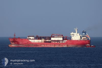
KAMILLA KOSAN
Not available
Current Trip
BRFOR
| Time Travelled | 14 days |
|---|---|
| Remaining Time | --- |
| Distance Travelled | 450.86 nm |
| Remaining Distance | --- |
| AVG Speed | 12.2 Knopen |
| MAX Speed | 13.7 Knopen |
| AVG Wind | 13.9 knots |
| MAX Wind | 25 knots |
| MIN Temp | 24.9°C / 76.82°F |
| MAX Temp | 29.6°C / 85.28°F |
| Diepgang | 6 M |
| Positie ontvangen | 17 h, 41 m geleden |
Current Position
| Lengtegraad | --- |
|---|---|
| Breedtegraat | --- |
| Status | At anchor |
| Snelheid | 0.1 Knopen |
| Koers | 75° |
| Gebied | South Atlantic Ocean |
| Station | T-AIS |
| Positie ontvangen | 17 h, 41 m geleden |
Info
Information
The current position of KAMILLA KOSAN is in South Atlantic Ocean with coordinates -3.64569° / -38.42073° as reported on 2026-01-05 07:50 by AIS to our vessel tracker app. The vessel's current speed is 0.1 Knopen
The vessel KAMILLA KOSAN (MMSI: 563135600) is a Not available It's sailing under the flag of [SG] Singapore.
In this page you can find informations about the vessels current position, last detected port calls, and current voyage information. If the vessels is not in coverage by AIS you will find the latest position.
The current position of KAMILLA KOSAN is detected by our AIS receivers and we are not responsible for the reliability of the data. The last position was recorded while the vessel was in Coverage by the Ais receivers of our vessel tracking app.
The current draught of KAMILLA KOSAN as reported by AIS is 6 meters
Weather
| Temperature | 26.8°C / 80.24°F |
|---|---|
| Wind Speed | 11 knots |
| Direction | 73° ENE |
| Pressure | 1013 hPa |
| Humidity | 70.9 % |
| Cloud Coverage | 10 % |
Featured Company
Last Port Calls
| Port | Arrival | Departure | Time In Port |
|---|---|---|---|
| 2025-12-22 01:19 | 2025-12-22 20:31 | 19 h | |
| 2025-12-16 03:58 | 2025-12-20 14:48 | 4 d | |
| 2025-12-12 13:06 | 2025-12-13 10:34 | 21 h | |
| 2025-12-04 05:40 | 2025-12-10 05:32 | 5 d | |
| 2025-12-01 14:26 | 2025-12-02 12:54 | 22 h | |
| 2025-11-28 22:50 | 2025-11-30 02:08 | 1 d | |
| 2025-11-24 20:34 | 2025-11-28 10:23 | 3 d | |
| 2025-11-22 01:21 | 2025-11-22 23:17 | 21 h | |
| 2025-11-16 03:45 | 2025-11-20 08:08 | 4 d | |
| 2025-11-12 08:41 | 2025-11-13 01:41 | 16 h |
Last Trips
| Origin | Departure | Destination | Arrival | Distance | |
|---|---|---|---|---|---|
| 2025-12-20 14:48 | 2025-12-22 01:19 | 441.59 nm | |||
| 2025-12-13 10:34 | 2025-12-16 03:58 | 445.34 nm | |||
| 2025-12-10 05:32 | 2025-12-12 13:06 | 508.50 nm | |||
| 2025-12-02 12:54 | 2025-12-04 05:40 | 451.22 nm | |||
| 2025-11-30 02:08 | 2025-12-01 14:26 | 462.03 nm | |||
| 2025-11-28 10:23 | 2025-11-28 22:50 | 39.26 nm | |||
| 2025-11-22 23:17 | 2025-11-24 20:34 | 470.07 nm | |||
| 2025-11-20 08:08 | 2025-11-22 01:21 | 526.43 nm | |||
| 2025-11-13 01:41 | 2025-11-16 03:45 | 465.99 nm | |||
| 2025-11-08 16:04 | 2025-11-12 08:41 | 482.64 nm |
Events
| Tijd | Evenement | Details | Positie / Bestemming | Info |
|---|---|---|---|---|
| 2026-01-05 07:56 | Status Changed | Default At anchor |
-3.64551 / -38.42070
BRFOR
|
Snelheid: 0.1 kn Koers: 75° |
| 2026-01-05 07:50 | Status Changed | At anchor Default |
-3.64569 / -38.42073
BRFOR
|
Snelheid: 0.2 kn Koers: 85° |
| 2026-01-05 07:50 | Buitenbereik |
-3.64569 / -38.42073
South Atlantic Ocean
|
Snelheid: 0.1 kn Koers: 286.3° |
|
| 2026-01-05 07:38 | Binnenbereik |
-3.64569 / -38.42073
South Atlantic Ocean
|
Snelheid: 0.1 kn Koers: 286.3° |
|
| 2026-01-05 06:37 | Status Changed | Default At anchor |
-3.64573 / -38.42073
BRFOR
|
Snelheid: 0.1 kn Koers: 79° |
| 2026-01-05 06:32 | Status Changed | At anchor Default |
-3.64563 / -38.42069
BRFOR
|
Snelheid: 0.1 kn Koers: 76° |
| 2026-01-05 06:32 | Buitenbereik |
-3.64563 / -38.42069
South Atlantic Ocean
|
Snelheid: 0.1 kn Koers: 39.6° |
|
| 2026-01-05 06:26 | Binnenbereik |
-3.64563 / -38.42069
South Atlantic Ocean
|
Snelheid: 0.1 kn Koers: 39.6° |
|
| 2026-01-04 13:07 | Status Changed | Default At anchor |
-3.64530 / -38.42065
BRFOR
|
Snelheid: 0.3 kn Koers: 91° |
| 2026-01-04 13:05 | Buitenbereik |
-3.64529 / -38.42065
South Atlantic Ocean
|
Snelheid: 0.3 kn Koers: 266.8° |