
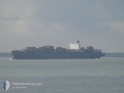
KALAHARI EXPRESS
Container Ship
Current Trip
| Time Travelled | 5 days |
|---|---|
| Remaining Time | 7 days |
| Distance Travelled | 2329.69 nm |
| Remaining Distance | 3336.13 nm |
| AVG Speed | 18.9 Knopen |
| MAX Speed | 21.7 Knopen |
| AVG Wind | 14.6 knots |
| MAX Wind | 31.4 knots |
| MIN Temp | 18.1°C / 64.58°F |
| MAX Temp | 29°C / 84.2°F |
| Diepgang | 13.5 M |
| Positie ontvangen | 3 d geleden |
Current Position
| Lengtegraad | -13.86948° |
|---|---|
| Breedtegraat | 27.64215° |
| Status | Under way using engine |
| Snelheid | 20.2 Knopen |
| Koers | 219° |
| Gebied | North Atlantic Ocean |
| Station | T-AIS |
| Positie ontvangen | 3 d geleden |
Info
Information
The current position of KALAHARI EXPRESS is in North Atlantic Ocean with coordinates 27.64215° / -13.86948° as reported on 2024-05-11 03:05 by AIS to our vessel tracker app. The vessel's current speed is 20.2 Knopen and is heading at the port of COEGA. The estimated time of arrival as calculated by MyShipTracking vessel tracking app is 2024-05-21 18:17 LT
The vessel KALAHARI EXPRESS (IMO: 9400095, MMSI: 636093117) is a Container Ship that was built in 2010 ( 14 Jaar oud ). It's sailing under the flag of [LR] Liberia.
In this page you can find informations about the vessels current position, last detected port calls, and current voyage information. If the vessels is not in coverage by AIS you will find the latest position.
The current position of KALAHARI EXPRESS is detected by our AIS receivers and we are not responsible for the reliability of the data. The last position was recorded while the vessel was in Coverage by the Ais receivers of our vessel tracking app.
The current draught of KALAHARI EXPRESS as reported by AIS is 13.5 meters
Weather
| Temperature | 28.9°C / 84.02°F |
|---|---|
| Wind Speed | 10 knots |
| Direction | 158° SSE |
| Pressure | 1011 hPa |
| Humidity | 74.1 % |
| Cloud Coverage | 89 % |
Featured Company
Last Port Calls
| Port | Arrival | Departure | Time In Port |
|---|---|---|---|
| 2024-05-09 01:26 | 2024-05-09 11:06 | 9 h | |
| 2024-05-06 16:59 | 2024-05-07 07:40 | 14 h | |
| 2024-04-29 11:53 | 2024-05-02 12:55 | 3 d | |
| 2024-04-27 14:30 | 2024-04-28 15:20 | 1 d | |
| 2024-04-25 04:32 | 2024-04-26 17:10 | 1 d | |
| 2024-04-03 13:44 | 2024-04-08 15:13 | 5 d | |
| 2024-03-25 06:00 | 2024-03-27 08:55 | 2 d | |
| 2024-03-05 17:45 | 2024-03-06 01:42 | 7 h | |
| 2024-03-04 16:46 | 2024-03-05 07:50 | 15 h |
Most Visited Ports (Last year)
| Port | Arrivals | |
|---|---|---|
| 11 | ||
| 6 | ||
| 5 | ||
| 5 | ||
| 5 | ||
| 4 |
Last Trips
| Origin | Departure | Destination | Arrival | Distance | |
|---|---|---|---|---|---|
| 2024-05-07 09:40 | 2024-05-09 03:26 | 8.75 nm | |||
| 2024-05-02 14:55 | 2024-05-06 18:59 | 1671.41 nm | |||
| 2024-04-28 16:20 | 2024-04-29 13:53 | 358.84 nm | |||
| 2024-04-26 19:10 | 2024-04-27 15:30 | 171.96 nm | |||
| 2024-04-08 17:13 | 2024-04-25 06:32 | 7033.16 nm | |||
| 2024-03-27 10:55 | 2024-04-03 15:44 | 665.58 nm | |||
| 2024-03-06 02:42 | 2024-03-25 08:00 | 5931.53 nm | |||
| 2024-03-05 08:50 | 2024-03-05 18:45 | 3.15 nm | |||
| 2024-02-28 06:15 | 2024-03-04 17:46 | 1745.50 nm |
Events
| Tijd | Evenement | Details | Positie / Bestemming | Info |
|---|---|---|---|---|
| 2024-05-11 03:08 | Status Changed | Default Under way using engine |
27.62911 / -13.88152
ZAZBA
|
Snelheid: 20.2 kn Koers: 219° |
| 2024-05-11 03:05 | Buitenbereik |
27.64215 / -13.86948
North Atlantic Ocean
ZAZBA
|
Snelheid: 20.2 kn Koers: 219° |
|
| 2024-05-11 03:05 | Wijzig zee gebeid | Spanish (Canary Islands) part of the North Atlantic Ocean Western Saharan part of the North Atlantic Ocean |
27.64215 / -13.86948
North Atlantic Ocean
ZAZBA
|
Snelheid: 20.2 kn Koers: 219° |
| 2024-05-11 03:03 | Wijzig zee gebeid | Western Saharan part of the North Atlantic Ocean Moroccan part of the North Atlantic Ocean |
27.65344 / -13.85904
North Atlantic Ocean
ZAZBA
|
Snelheid: 20.3 kn Koers: 219.9° |
| 2024-05-11 02:59 | Wijzig zee gebeid | Moroccan part of the North Atlantic Ocean Spanish (Canary Islands) part of the North Atlantic Ocean |
27.67002 / -13.84364
North Atlantic Ocean
ZAZBA
|
Snelheid: 20.2 kn Koers: 220° |
| 2024-05-11 01:17 | Wijzig zee gebeid | Spanish (Canary Islands) part of the North Atlantic Ocean Moroccan part of the North Atlantic Ocean |
28.10679 / -13.43101
North Atlantic Ocean
ZAZBA
|
Snelheid: 19.9 kn Koers: 218.9° |
| 2024-05-11 01:08 | Status Changed | Under way using engine Default |
28.14540 / -13.39527
ZAZBA
|
Snelheid: 20 kn Koers: 220° |
| 2024-05-11 01:02 | Status Changed | Default Under way using engine |
28.17120 / -13.37128
ZAZBA
|
Snelheid: 20.1 kn Koers: 219.2° |
| 2024-05-11 00:53 | Status Changed | Under way using engine Default |
28.20947 / -13.33575
ZAZBA
|
Snelheid: 20.2 kn Koers: 220° |
| 2024-05-11 00:50 | Status Changed | Default Under way using engine |
28.22467 / -13.32162
ZAZBA
|
Snelheid: 20.2 kn Koers: 219° |