
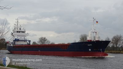
KAATA
General Cargo
Current Trip
| Time Travelled | 13 h, 2 mins |
|---|---|
| Remaining Time | 23 h, 15 mins |
| Distance Travelled | 128.09 nm |
| Remaining Distance | 317.37 nm |
| AVG Speed | 11.6 Knopen |
| MAX Speed | 12.9 Knopen |
| AVG Wind | 9.3 knots |
| MAX Wind | 19.2 knots |
| MIN Temp | 0.4°C / 32.72°F |
| MAX Temp | 3.8°C / 38.84°F |
| Diepgang | 3.4 M |
| Positie ontvangen | 5 h, 39 m geleden |
Current Position
| Lengtegraad | 19.08772° |
|---|---|
| Breedtegraat | 58.73420° |
| Status | Under way using engine |
| Snelheid | 11.7 Knopen |
| Koers | 76.9° |
| Gebied | Baltic Sea |
| Station | T-AIS |
| Positie ontvangen | 5 h, 39 m geleden |
Info
Information
The current position of KAATA is in Baltic Sea with coordinates 58.73420° / 19.08772° as reported on 2024-04-19 20:18 by AIS to our vessel tracker app. The vessel's current speed is 11.7 Knopen and is heading at the port of ST PETERSBURG. The estimated time of arrival as calculated by MyShipTracking vessel tracking app is 2024-04-21 01:12 LT
The vessel KAATA (IMO: 9184823, MMSI: 215908000) is a General Cargo that was built in 1999 ( 25 Jaar oud ). It's sailing under the flag of [MT] Malta.
In this page you can find informations about the vessels current position, last detected port calls, and current voyage information. If the vessels is not in coverage by AIS you will find the latest position.
The current position of KAATA is detected by our AIS receivers and we are not responsible for the reliability of the data. The last position was recorded while the vessel was in Coverage by the Ais receivers of our vessel tracking app.
The current draught of KAATA as reported by AIS is 3.4 meters
Weather
| Temperature | 1.1°C / 33.98°F |
|---|---|
| Wind Speed | 18 knots |
| Direction | 327° NNW |
| Pressure | 1005.4 hPa |
| Humidity | 77.7 % |
| Cloud Coverage | 100 % |
Featured Company
Last Port Calls
| Port | Arrival | Departure | Time In Port |
|---|---|---|---|
| 2024-04-16 22:36 | 2024-04-19 12:55 | 2 d | |
| 2024-04-10 11:56 | 2024-04-10 11:59 | 2 m | |
| 2024-04-08 17:59 | 2024-04-08 19:42 | 1 h | |
| 2024-04-06 11:06 | 2024-04-08 17:34 | 2 d | |
| 2024-04-06 10:38 | 2024-04-06 10:51 | 12 m | |
| 2024-04-01 20:54 | 2024-04-02 19:16 | 22 h | |
| 2024-03-27 11:57 | 2024-03-29 21:28 | 2 d | |
| 2024-03-24 12:19 | 2024-03-26 14:29 | 2 d | |
| 2024-03-19 17:12 | 2024-03-21 09:09 | 1 d | |
| 2024-03-07 20:21 | 2024-03-09 10:30 | 1 d |
Last Trips
| Origin | Departure | Destination | Arrival | Distance | |
|---|---|---|---|---|---|
| 2024-04-10 13:59 | 2024-04-17 00:36 | 469.01 nm | |||
| 2024-04-08 21:42 | 2024-04-10 13:56 | 367.18 nm | |||
| 2024-04-08 19:34 | 2024-04-08 19:59 | 1.72 nm | |||
| 2024-04-06 12:51 | 2024-04-06 13:06 | 1.22 nm | |||
| 2024-04-02 21:16 | 2024-04-06 12:38 | 108.33 nm | |||
| 2024-03-29 22:28 | 2024-04-01 22:54 | 694.66 nm | |||
| 2024-03-26 15:29 | 2024-03-27 12:57 | 229.82 nm | |||
| 2024-03-21 12:09 | 2024-03-24 13:19 | 703.34 nm | |||
| 2024-03-09 11:30 | 2024-03-19 20:12 | 1560.17 nm | |||
| 2024-03-07 19:39 | 2024-03-07 21:21 | 1.67 nm |
Events
| Tijd | Evenement | Details | Positie / Bestemming | Info |
|---|---|---|---|---|
| 2024-04-19 20:24 | Status Changed | Default Under way using engine |
58.73864 / 19.12973
RULED
|
Snelheid: 11.7 kn Koers: 76.9° |
| 2024-04-19 20:18 | Status Changed | Under way using engine Default |
58.73420 / 19.08772
RULED
|
Snelheid: 12 kn Koers: 77° |
| 2024-04-19 20:18 | Buitenbereik |
58.73420 / 19.08772
Baltic Sea
RULED
|
Snelheid: 11.7 kn Koers: 76.9° |
|
| 2024-04-19 20:12 | Status Changed | Default Under way using engine |
58.73061 / 19.05527
RULED
|
Snelheid: 11.9 kn Koers: 79.5° |
| 2024-04-19 12:55 | Vertrekhaven |
|
58.62000 / 16.26043
RULED
|
Snelheid: 7.8 kn Koers: 66° |
| 2024-04-19 12:15 | Start beweging |
58.61028 / 16.18975
[SE] NORRKOPING
|
Snelheid: 3.1 kn Koers: 347° |
|
| 2024-04-19 12:12 | Status Changed | Under way using engine Moored |
58.60827 / 16.19128
[SE] NORRKOPING
|
Snelheid: 1.5 kn Koers: 332° |
| 2024-04-19 11:19 | Draught Changed | 3.4 3.3 |
58.60762 / 16.19160
[SE] NORRKOPING
|
Snelheid: Koers: 323° |
| 2024-04-19 05:22 | Draught Changed | 3.3 5.9 |
58.60757 / 16.19166
[SE] NORRKOPING
|
Snelheid: Koers: 324° |
| 2024-04-19 05:22 | Destination Changed | RULED SENRK |
58.60757 / 16.19166
[SE] NORRKOPING
|
Snelheid: Koers: 324° |