
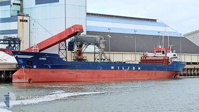
JUMBO
General Cargo
Current Trip
| Time Travelled | 5 days |
|---|---|
| Remaining Time | 29 mins |
| Distance Travelled | 358.76 nm |
| Remaining Distance | 6.36 nm |
| AVG Speed | 7.9 Knopen |
| MAX Speed | 10.8 Knopen |
| AVG Wind | 9.9 knots |
| MAX Wind | 30.6 knots |
| MIN Temp | 9.6°C / 49.28°F |
| MAX Temp | 24.4°C / 75.92°F |
| Diepgang | 5.4 M |
| Positie ontvangen | Nu |
Current Position
| Lengtegraad | 8.52648° |
|---|---|
| Breedtegraat | 53.57944° |
| Status | Under way using engine |
| Snelheid | 9.3 Knopen |
| Koers | 147.6° |
| Gebied | North Sea |
| Station | T-AIS |
| Positie ontvangen | Nu |
Info
Information
The current position of JUMBO is in North Sea with coordinates 53.57944° / 8.52648° as reported on 2024-05-07 06:34 by AIS to our vessel tracker app. The vessel's current speed is 9.3 Knopen and is heading at the port of NORDENHAM. The estimated time of arrival as calculated by MyShipTracking vessel tracking app is 2024-05-07 07:04 LT
The vessel JUMBO (IMO: 8518297, MMSI: 314416000) is a General Cargo that was built in 1987 ( 37 Jaar oud ). It's sailing under the flag of [BB] Barbados.
In this page you can find informations about the vessels current position, last detected port calls, and current voyage information. If the vessels is not in coverage by AIS you will find the latest position.
The current position of JUMBO is detected by our AIS receivers and we are not responsible for the reliability of the data. The last position was recorded while the vessel was in Coverage by the Ais receivers of our vessel tracking app.
The current draught of JUMBO as reported by AIS is 5.4 meters
Weather
| Temperature | 11.1°C / 51.98°F |
|---|---|
| Wind Speed | 4 knots |
| Direction | 81° E |
| Pressure | 1016.7 hPa |
| Humidity | 91.7 % |
| Cloud Coverage | 98 % |
Featured Company
Last Port Calls
| Port | Arrival | Departure | Time In Port |
|---|---|---|---|
| 2024-04-29 21:31 | 2024-05-01 15:57 | 1 d | |
| 2024-04-24 00:10 | 2024-04-25 01:35 | 1 d | |
| 2024-04-18 13:08 | 2024-04-19 16:30 | 1 d | |
| 2024-04-16 19:52 | 2024-04-17 18:30 | 22 h | |
| 2024-04-11 13:30 | 2024-04-12 21:33 | 1 d | |
| 2024-04-08 02:38 | 2024-04-09 09:31 | 1 d | |
| 2024-04-04 20:09 | 2024-04-06 11:55 | 1 d | |
| 2024-04-01 12:51 | 2024-04-02 18:49 | 1 d | |
| 2024-03-28 16:50 | 2024-03-30 11:37 | 1 d | |
| 2024-03-23 15:45 | 2024-03-26 23:14 | 3 d |
Last Trips
| Origin | Departure | Destination | Arrival | Distance | |
|---|---|---|---|---|---|
| 2024-04-25 03:35 | 2024-04-29 23:31 | 256.50 nm | |||
| 2024-04-19 18:30 | 2024-04-24 02:10 | 770.85 nm | |||
| 2024-04-17 20:30 | 2024-04-18 15:08 | 134.54 nm | |||
| 2024-04-12 23:33 | 2024-04-16 21:52 | 699.96 nm | |||
| 2024-04-09 11:31 | 2024-04-11 15:30 | 353.02 nm | |||
| 2024-04-06 13:55 | 2024-04-08 04:38 | 321.36 nm | |||
| 2024-04-02 20:49 | 2024-04-04 22:09 | 434.35 nm | |||
| 2024-03-30 12:37 | 2024-04-01 14:51 | 448.01 nm | |||
| 2024-03-27 00:14 | 2024-03-28 17:50 | 242.44 nm | |||
| 2024-03-23 16:36 | 2024-03-23 16:45 | 0.46 nm |
Events
| Tijd | Evenement | Details | Positie / Bestemming | Info |
|---|---|---|---|---|
| 2024-05-07 03:09 | Status Changed | Under way using engine Default |
53.85742 / 7.93744
DENHA
|
Snelheid: 8.1 kn Koers: 102° |
| 2024-05-07 03:05 | Status Changed | Default Under way using engine |
53.85935 / 7.92235
DENHA
|
Snelheid: 8.2 kn Koers: 102.9° |
| 2024-05-07 02:52 | Status Changed | Under way using engine Default |
53.86579 / 7.87394
DENHA
|
Snelheid: 5.8 kn Koers: 99° |
| 2024-05-07 02:48 | Binnenbereik |
53.86507 / 7.87941
North Sea
DENHA
|
Snelheid: 8 kn Koers: 103.2° |
|
| 2024-05-07 02:23 | Start beweging | 8.68 nm, North of WANGEROOGE |
53.91616 / 7.82509
DENHA
|
Snelheid: 7 kn Koers: 219° |
| 2024-05-06 21:11 | Status Changed | Default At anchor |
53.92049 / 7.83532
DENHA
|
Snelheid: Koers: 288° |
| 2024-05-06 21:05 | Status Changed | At anchor Default |
53.92050 / 7.83531
DENHA
|
Snelheid: Koers: 286° |
| 2024-05-06 21:05 | Buitenbereik |
53.92050 / 7.83531
North Sea
DENHA
|
Snelheid: Koers: 124.9° |
|
| 2024-05-06 20:53 | Binnenbereik |
53.92050 / 7.83531
North Sea
DENHA
|
Snelheid: Koers: 124.9° |
|
| 2024-05-06 15:13 | ETA Changed | 2024/05/07 09:30 2024/05/03 02:00 |
53.92066 / 7.83214
DENHA
|
Snelheid: 0.1 kn Koers: 74° |