
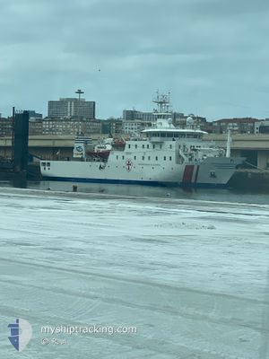
JUAN DE LA COSA
Hospital Ship
Current Trip
MEDICAL CARE
| Time Travelled | 1 day |
|---|---|
| Remaining Time | --- |
| Distance Travelled | 191.65 nm |
| Remaining Distance | --- |
| AVG Speed | 5.3 Knopen |
| MAX Speed | 8.1 Knopen |
| AVG Wind | 15.9 knots |
| MAX Wind | 20.8 knots |
| MIN Temp | 11.4°C / 52.52°F |
| MAX Temp | 12.7°C / 54.86°F |
| Diepgang | 4.7 M |
| Positie ontvangen | 6 h, 13 m geleden |
Current Position
| Lengtegraad | --- |
|---|---|
| Breedtegraat | --- |
| Status | Under way using engine |
| Snelheid | 2.8 Knopen |
| Koers | 345° |
| Gebied | Bay of Biscay |
| Station | T-AIS |
| Positie ontvangen | 6 h, 13 m geleden |
Information
The current position of JUAN DE LA COSA is in Bay of Biscay with coordinates 43.86655° / -2.10023° as reported on 2025-03-29 00:05 by AIS to our vessel tracker app. The vessel's current speed is 2.8 Knopen
The vessel JUAN DE LA COSA (IMO: 9328156, MMSI: 224612000) is a Hospital Ship that was built in 2006 ( 19 Jaar oud ). It's sailing under the flag of [ES] Spain.
In this page you can find informations about the vessels current position, last detected port calls, and current voyage information. If the vessels is not in coverage by AIS you will find the latest position.
The current position of JUAN DE LA COSA is detected by our AIS receivers and we are not responsible for the reliability of the data. The last position was recorded while the vessel was in Coverage by the Ais receivers of our vessel tracking app.
The current draught of JUAN DE LA COSA as reported by AIS is 4.7 meters
Weather
| Temperature | 11.8°C / 53.24°F |
|---|---|
| Wind Speed | 19 knots |
| Direction | 332° NNW |
| Pressure | 1022.8 hPa |
| Humidity | 70.4 % |
| Cloud Coverage | 5 % |
Featured Company
Events
| Tijd | Evenement | Details | Positie / Bestemming | Info |
|---|---|---|---|---|
| 2025-03-29 00:25 | Status Changed | Default Under way using engine |
43.88232 / -2.11770
MEDICAL CARE
|
Snelheid: 2.8 kn Koers: 345° |
| 2025-03-29 00:05 | Buitenbereik |
43.86655 / -2.10023
Bay of Biscay
MEDICAL CARE
|
Snelheid: 2.8 kn Koers: 348.8° |
|
| 2025-03-28 23:58 | Status Changed | Under way using engine Default |
43.85974 / -2.10087
MEDICAL CARE
|
Snelheid: 3.4 kn Koers: 355° |
| 2025-03-28 23:44 | Status Changed | Default Under way using engine |
43.84623 / -2.09552
MEDICAL CARE
|
Snelheid: 3.9 kn Koers: 359° |
| 2025-03-28 23:36 | Status Changed | Under way using engine Default |
43.83800 / -2.09223
MEDICAL CARE
|
Snelheid: 4.1 kn Koers: 339° |
| 2025-03-28 23:32 | Status Changed | Default Under way using engine |
43.83355 / -2.08966
MEDICAL CARE
|
Snelheid: 3.6 kn Koers: 338° |
| 2025-03-28 23:27 | Gevonden in zee | French part of the Bay of Biscay |
43.82897 / -2.08685
Bay of Biscay
MEDICAL CARE
|
Snelheid: 3.6 kn Koers: 334.1° |
| 2025-03-28 21:54 | Status Changed | Under way using engine Default |
43.73077 / -2.03971
MEDICAL CARE
|
Snelheid: 4.3 kn Koers: 342° |
| 2025-03-28 21:52 | Status Changed | Default Under way using engine |
43.72797 / -2.03840
MEDICAL CARE
|
Snelheid: 4.3 kn Koers: 342° |
| 2025-03-28 19:29 | Status Changed | Under way using engine Default |
43.57837 / -2.13563
MEDICAL CARE
|
Snelheid: 5.8 kn Koers: 49° |