
JPO GEMINI
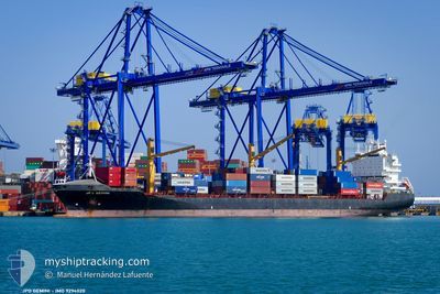
Container Ship
Current Trip
| Time Travelled | 7 days |
|---|---|
| Remaining Time | --- |
| Distance Travelled | 1561.15 nm |
| Remaining Distance | --- |
| AVG Speed | 9.7 Knopen |
| MAX Speed | 11.8 Knopen |
| AVG Wind | 12.8 knots |
| MAX Wind | 26.7 knots |
| MIN Temp | 13.8°C / 56.84°F |
| MAX Temp | 23.9°C / 75.02°F |
| Diepgang | 10.9 M |
| Positie ontvangen | 1 d geleden |
Current Position
| Lengtegraad | -17.73725° |
|---|---|
| Breedtegraat | 19.30465° |
| Status | Under way using engine |
| Snelheid | 10.6 Knopen |
| Koers | 182.8° |
| Gebied | North Atlantic Ocean |
| Station | T-AIS |
| Positie ontvangen | 1 d geleden |
Info
Information
The current position of JPO GEMINI is in North Atlantic Ocean with coordinates 19.30465° / -17.73725° as reported on 2024-04-25 02:00 by AIS to our vessel tracker app. The vessel's current speed is 10.6 Knopen
The vessel JPO GEMINI (IMO: 9294020, MMSI: 636091995) is a Container Ship that was built in 2005 ( 19 Jaar oud ). It's sailing under the flag of [LR] Liberia.
In this page you can find informations about the vessels current position, last detected port calls, and current voyage information. If the vessels is not in coverage by AIS you will find the latest position.
The current position of JPO GEMINI is detected by our AIS receivers and we are not responsible for the reliability of the data. The last position was recorded while the vessel was in Coverage by the Ais receivers of our vessel tracking app.
The current draught of JPO GEMINI as reported by AIS is 10.9 meters
Weather
| Temperature | 22.9°C / 73.22°F |
|---|---|
| Wind Speed | 19 knots |
| Direction | 328° NNW |
| Pressure | 1006.2 hPa |
| Humidity | 82.7 % |
| Cloud Coverage | 2 % |
Featured Company
Last Port Calls
| Port | Arrival | Departure | Time In Port |
|---|---|---|---|
| 2024-04-18 11:21 | 2024-04-18 22:51 | 11 h | |
| 2024-04-15 11:00 | 2024-04-15 23:33 | 12 h | |
| 2024-04-12 18:16 | 2024-04-13 19:28 | 1 d | |
| 2024-04-04 01:33 | 2024-04-06 02:20 | 2 d | |
| 2024-03-28 11:00 | 2024-03-29 08:20 | 21 h | |
| 2024-03-25 16:48 | 2024-03-27 03:32 | 1 d | |
| 2024-03-10 18:00 | 2024-03-11 07:37 | 13 h | |
| 2024-03-07 09:48 | 2024-03-07 18:47 | 8 h | |
| 2024-02-29 04:41 | 2024-03-01 00:02 | 19 h | |
| 2024-02-27 22:08 | 2024-02-29 00:03 | 1 d |
Most Visited Ports (Last year)
| Port | Arrivals | |
|---|---|---|
| 8 | ||
| 6 | ||
| 3 | ||
| 2 | ||
| 2 | ||
| 2 |
Last Trips
| Origin | Departure | Destination | Arrival | Distance | |
|---|---|---|---|---|---|
| 2024-04-16 00:33 | 2024-04-18 13:21 | 741.60 nm | |||
| 2024-04-13 19:28 | 2024-04-15 12:00 | 688.75 nm | |||
| 2024-04-06 03:20 | 2024-04-12 18:16 | 2327.66 nm | |||
| 2024-03-29 09:20 | 2024-04-04 02:33 | 888.35 nm | |||
| 2024-03-27 04:32 | 2024-03-28 12:00 | 298.08 nm | |||
| 2024-03-11 08:37 | 2024-03-25 17:48 | 3716.33 nm | |||
| 2024-03-07 19:47 | 2024-03-10 19:00 | 287.85 nm | |||
| 2024-03-01 03:02 | 2024-03-07 10:48 | 1931.96 nm | |||
| 2024-02-29 03:03 | 2024-02-29 07:41 | 61.24 nm | |||
| 2024-02-18 13:42 | 2024-02-28 01:08 | 2054.93 nm |
Events
| Tijd | Evenement | Details | Positie / Bestemming | Info |
|---|---|---|---|---|
| 2024-04-26 09:29 | Stop beweging | 5.25 nm, South East of GOREE |
14.59167 / -17.35667
DAKAR
|
Snelheid: Koers: -1° |
| 2024-04-25 02:05 | Status Changed | Default Under way using engine |
19.28667 / -17.73833
DAKAR
|
Snelheid: 10.6 kn Koers: 182.8° |
| 2024-04-25 02:00 | Buitenbereik |
19.30465 / -17.73725
North Atlantic Ocean
DAKAR
|
Snelheid: 10.6 kn Koers: 182.8° |
|
| 2024-04-25 01:52 | Status Changed | Under way using engine Default |
19.32827 / -17.73552
DAKAR
|
Snelheid: 10.5 kn Koers: 182° |
| 2024-04-25 01:42 | Status Changed | Default Under way using engine |
19.35553 / -17.73387
DAKAR
|
Snelheid: 10.4 kn Koers: 183.1° |
| 2024-04-25 01:36 | Wijzig zee gebeid | Mauritanian part of the North Atlantic Ocean Western Saharan part of the North Atlantic Ocean |
19.37283 / -17.73273
North Atlantic Ocean
DAKAR
|
Snelheid: 10.2 kn Koers: 184.1° |
| 2024-04-25 01:36 | Status Changed | Under way using engine Default |
19.37283 / -17.73273
DAKAR
|
Snelheid: 10.1 kn Koers: 183° |
| 2024-04-25 01:29 | Binnenbereik |
19.37283 / -17.73273
North Atlantic Ocean
DAKAR
|
Snelheid: 10.2 kn Koers: 184.1° |
|
| 2024-04-24 20:37 | Status Changed | Default Under way using engine |
20.19894 / -17.69631
DAKAR
|
Snelheid: 10.5 kn Koers: 183.5° |
| 2024-04-24 20:33 | Buitenbereik |
20.20869 / -17.69574
North Atlantic Ocean
DAKAR
|
Snelheid: 10.5 kn Koers: 183.5° |