
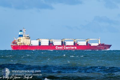
JORGEN REEFER
Not available
Current Trip
| Time Travelled | 22 days |
|---|---|
| Remaining Time | --- |
| Distance Travelled | 2793.70 nm |
| Remaining Distance | --- |
| AVG Speed | 14.7 Knopen |
| MAX Speed | 19.7 Knopen |
| AVG Wind | 10.8 knots |
| MAX Wind | 24 knots |
| MIN Temp | 3°C / 37.4°F |
| MAX Temp | 30.5°C / 86.9°F |
| Diepgang | 7 M |
| Positie ontvangen | 9 d geleden |
Current Position
| Lengtegraad | -79.45052° |
|---|---|
| Breedtegraat | 8.45103° |
| Status | Under way using engine |
| Snelheid | 18.3 Knopen |
| Koers | 178.6° |
| Gebied | North Pacific Ocean |
| Station | T-AIS |
| Positie ontvangen | 9 d geleden |
Info
Information
The current position of JORGEN REEFER is in North Pacific Ocean with coordinates 8.45103° / -79.45052° as reported on 2024-04-16 06:58 by AIS to our vessel tracker app. The vessel's current speed is 18.3 Knopen and is heading at the port of CRISTOBAL.
The vessel JORGEN REEFER (MMSI: 309193000) is a Not available It's sailing under the flag of [BS] Bahamas.
In this page you can find informations about the vessels current position, last detected port calls, and current voyage information. If the vessels is not in coverage by AIS you will find the latest position.
The current position of JORGEN REEFER is detected by our AIS receivers and we are not responsible for the reliability of the data. The last position was recorded while the vessel was in Coverage by the Ais receivers of our vessel tracking app.
The current draught of JORGEN REEFER as reported by AIS is 7 meters
Weather
| Temperature | 23.2°C / 73.76°F |
|---|---|
| Wind Speed | 3 knots |
| Direction | 250° WSW |
| Pressure | 1011.1 hPa |
| Humidity | 87.4 % |
| Cloud Coverage | 73 % |
Featured Company
Last Port Calls
| Port | Arrival | Departure | Time In Port |
|---|---|---|---|
| 2024-04-03 09:11 | 2024-04-03 09:17 | 5 m | |
| 2024-03-28 23:47 | 2024-03-28 23:52 | 4 m | |
| 2024-03-16 23:19 | 2024-03-21 15:42 | 4 d | |
| 2024-02-23 23:01 | 2024-02-23 23:05 | 3 m | |
| 2024-02-13 23:07 | 2024-02-16 10:34 | 2 d | |
| 2024-02-10 00:52 | 2024-02-12 23:58 | 2 d | |
| 2024-02-06 18:28 | 2024-02-08 14:40 | 1 d | |
| 2024-02-01 20:47 | 2024-02-02 19:38 | 22 h |
Most Visited Ports (Last year)
| Port | Arrivals | |
|---|---|---|
| 3 | ||
| 3 | ||
| 2 | ||
| 1 | ||
| 1 | ||
| 1 |
Last Trips
| Origin | Departure | Destination | Arrival | Distance | |
|---|---|---|---|---|---|
| 2024-03-28 18:52 | 2024-04-03 05:11 | 1984.60 nm | |||
| 2024-03-21 12:42 | 2024-03-28 18:47 | 2636.12 nm | |||
| 2024-02-23 18:05 | 2024-03-16 20:19 | 6718.21 nm | |||
| 2024-02-16 07:34 | 2024-02-23 18:01 | 2641.91 nm | |||
| 2024-02-12 20:58 | 2024-02-13 20:07 | 376.17 nm | |||
| 2024-02-08 09:40 | 2024-02-09 21:52 | 609.69 nm | |||
| 2024-02-02 14:38 | 2024-02-06 13:28 | 732.54 nm | |||
| 2024-01-22 11:59 | 2024-02-01 15:47 | 1192.02 nm |
Events
| Tijd | Evenement | Details | Positie / Bestemming | Info |
|---|---|---|---|---|
| 2024-04-18 06:09 | Stop beweging | 6.13 nm, South of GUAYAQUIL |
-2.28149 / -79.90794
PACTB
|
Snelheid: Koers: 304° |
| 2024-04-16 07:04 | Status Changed | Default Under way using engine |
8.41672 / -79.44984
PACTB
|
Snelheid: 18.3 kn Koers: 178.6° |
| 2024-04-16 06:58 | Buitenbereik |
8.45103 / -79.45052
North Pacific Ocean
|
Snelheid: 18.3 kn Koers: 178.6° |
|
| 2024-04-16 06:40 | Status Changed | Under way using engine Default |
8.54328 / -79.45199
PACTB
|
Snelheid: 18.7 kn Koers: 180° |