
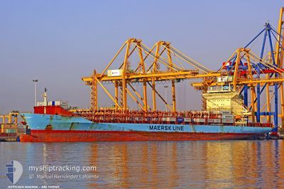
JEPPESEN MAERSK
Container Ship
Current Trip
| Time Travelled | 9 days |
|---|---|
| Remaining Time | --- |
| Distance Travelled | 2641.53 nm |
| Remaining Distance | --- |
| AVG Speed | 12.8 Knopen |
| MAX Speed | 15.1 Knopen |
| AVG Wind | 12 knots |
| MAX Wind | 19.9 knots |
| MIN Temp | 21°C / 69.8°F |
| MAX Temp | 29.5°C / 85.1°F |
| Diepgang | 12 M |
| Positie ontvangen | 4 d geleden |
Current Position
| Lengtegraad | -62.26953° |
|---|---|
| Breedtegraat | 16.48042° |
| Status | Under way using engine |
| Snelheid | 13.2 Knopen |
| Koers | 67° |
| Gebied | Caribbean Sea |
| Station | T-AIS |
| Positie ontvangen | 4 d geleden |
Info
Information
The current position of JEPPESEN MAERSK is in Caribbean Sea with coordinates 16.48042° / -62.26953° as reported on 2024-05-02 10:26 by AIS to our vessel tracker app. The vessel's current speed is 13.2 Knopen and is heading at the port of PORT SAID. The estimated time of arrival as calculated by MyShipTracking vessel tracking app is 2024-05-21 14:00 LT
The vessel JEPPESEN MAERSK (IMO: 9215165, MMSI: 219953000) is a Container Ship that was built in 2001 ( 23 Jaar oud ). It's sailing under the flag of [DK] Denmark.
In this page you can find informations about the vessels current position, last detected port calls, and current voyage information. If the vessels is not in coverage by AIS you will find the latest position.
The current position of JEPPESEN MAERSK is detected by our AIS receivers and we are not responsible for the reliability of the data. The last position was recorded while the vessel was in Coverage by the Ais receivers of our vessel tracking app.
The current draught of JEPPESEN MAERSK as reported by AIS is 12 meters
Weather
| Temperature | 21.2°C / 70.16°F |
|---|---|
| Wind Speed | 13 knots |
| Direction | 268° W |
| Pressure | 1010.9 hPa |
| Humidity | 67.8 % |
| Cloud Coverage | --- |
Featured Company
Last Port Calls
| Port | Arrival | Departure | Time In Port |
|---|---|---|---|
| 2024-04-26 11:23 | 2024-04-27 19:50 | 1 d | |
| 2024-04-24 03:26 | 2024-04-24 20:06 | 16 h | |
| 2024-04-22 22:32 | 2024-04-22 22:46 | 14 m | |
| 2024-04-22 16:01 | 2024-04-22 22:18 | 6 h | |
| 2024-04-19 04:56 | 2024-04-19 20:43 | 15 h | |
| 2024-04-17 02:56 | 2024-04-17 17:21 | 14 h | |
| 2024-04-09 15:35 | 2024-04-11 05:38 | 1 d | |
| 2024-04-05 02:58 | 2024-04-05 19:03 | 16 h | |
| 2024-04-02 03:18 | 2024-04-02 23:02 | 19 h | |
| 2024-03-26 08:58 | 2024-03-27 16:53 | 1 d |
Most Visited Ports (Last year)
| Port | Arrivals | |
|---|---|---|
| 28 | ||
| 25 | ||
| 24 | ||
| 24 | ||
| 16 |
Last Trips
| Origin | Departure | Destination | Arrival | Distance | |
|---|---|---|---|---|---|
| 2024-04-24 15:06 | 2024-04-26 06:23 | 14.53 nm | |||
| 2024-04-22 17:46 | 2024-04-23 22:26 | 14.04 nm | |||
| 2024-04-22 17:18 | 2024-04-22 17:32 | 0.26 nm | |||
| 2024-04-19 15:43 | 2024-04-22 11:01 | 864.01 nm | |||
| 2024-04-17 12:21 | 2024-04-18 23:56 | 514.46 nm | |||
| 2024-04-11 00:38 | 2024-04-16 21:56 | 1648.98 nm | |||
| 2024-04-05 14:03 | 2024-04-09 10:35 | 866.76 nm | |||
| 2024-04-02 18:02 | 2024-04-04 21:58 | 523.18 nm | |||
| 2024-03-27 11:53 | 2024-04-01 22:18 | 1368.03 nm | |||
| 2024-03-26 03:37 | 2024-03-26 03:58 | 0.39 nm |
Events
| Tijd | Evenement | Details | Positie / Bestemming | Info |
|---|---|---|---|---|
| 2024-05-02 10:34 | Status Changed | Default Under way using engine |
16.49095 / -62.24322
PABLB>EGPSD
|
Snelheid: 13.2 kn Koers: 67° |
| 2024-05-02 10:26 | Buitenbereik |
16.48042 / -62.26953
Caribbean Sea
PABLB>EGPSD
|
Snelheid: 13.2 kn Koers: 67° |
|
| 2024-05-02 10:20 | Status Changed | Under way using engine Default |
16.47207 / -62.29240
PABLB>EGPSD
|
Snelheid: 13.3 kn Koers: 70° |
| 2024-05-02 10:17 | Status Changed | Default Under way using engine |
16.46798 / -62.30397
PABLB>EGPSD
|
Snelheid: 13.1 kn Koers: 70.7° |
| 2024-05-02 09:51 | Wijzig zee gebeid | Montserrat part of the Caribbean Sea Colombian part of the Caribbean Sea |
16.42443 / -62.42515
Caribbean Sea
PABLB>EGPSD
|
Snelheid: 13.1 kn Koers: 70.7° |
| 2024-05-02 09:51 | Status Changed | Under way using engine Default |
16.42443 / -62.42515
PABLB>EGPSD
|
Snelheid: 13.1 kn Koers: 70° |
| 2024-05-02 09:51 | Binnenbereik |
16.42443 / -62.42515
Caribbean Sea
PABLB>EGPSD
|
Snelheid: 13.1 kn Koers: 70.7° |
|
| 2024-04-29 21:06 | Status Changed | Default Under way using engine |
11.74859 / -74.51490
PABLB>EGPSD
|
Snelheid: 12.4 kn Koers: 68.6° |
| 2024-04-29 20:59 | Buitenbereik |
11.74107 / -74.53509
Caribbean Sea
PABLB>EGPSD
|
Snelheid: 12.4 kn Koers: 68.6° |
|
| 2024-04-29 20:56 | Status Changed | Under way using engine Default |
11.73644 / -74.54752
PABLB>EGPSD
|
Snelheid: 12.2 kn Koers: 69° |