
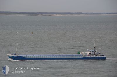
JEKERBORG
General Cargo
Current Trip
| Time Travelled | 22 h, 23 mins |
|---|---|
| Remaining Time | 9 h, 9 mins |
| Distance Travelled | 198.24 nm |
| Remaining Distance | 64.77 nm |
| AVG Speed | 9.1 Knopen |
| MAX Speed | 13.4 Knopen |
| AVG Wind | 7.8 knots |
| MAX Wind | 21.6 knots |
| MIN Temp | 7.5°C / 45.5°F |
| MAX Temp | 13.5°C / 56.3°F |
| Diepgang | 3.3 M |
| Positie ontvangen | 1 m geleden |
Current Position
| Lengtegraad | 3.14187° |
|---|---|
| Breedtegraat | 51.81330° |
| Status | Under way using engine |
| Snelheid | 6.3 Knopen |
| Koers | 142.8° |
| Gebied | North Sea |
| Station | T-AIS |
| Positie ontvangen | 1 m geleden |
Info
Information
The current position of JEKERBORG is in North Sea with coordinates 51.81330° / 3.14187° as reported on 2024-05-04 11:02 by AIS to our vessel tracker app. The vessel's current speed is 6.3 Knopen and is heading at the port of ANTWERP. The estimated time of arrival as calculated by MyShipTracking vessel tracking app is 2024-05-04 20:13 LT
The vessel JEKERBORG (IMO: 9201944, MMSI: 244580000) is a General Cargo that was built in 2000 ( 24 Jaar oud ). It's sailing under the flag of [NL] Netherlands.
In this page you can find informations about the vessels current position, last detected port calls, and current voyage information. If the vessels is not in coverage by AIS you will find the latest position.
The current position of JEKERBORG is detected by our AIS receivers and we are not responsible for the reliability of the data. The last position was recorded while the vessel was in Coverage by the Ais receivers of our vessel tracking app.
The current draught of JEKERBORG as reported by AIS is 3.3 meters
Weather
| Temperature | 11.9°C / 53.42°F |
|---|---|
| Wind Speed | 4 knots |
| Direction | 139° SE |
| Pressure | 1013.2 hPa |
| Humidity | 82.2 % |
| Cloud Coverage | 87 % |
Featured Company
Last Port Calls
| Port | Arrival | Departure | Time In Port |
|---|---|---|---|
| 2024-04-30 10:39 | 2024-05-03 12:41 | 3 d | |
| 2024-04-23 15:30 | 2024-04-26 13:19 | 2 d | |
| 2024-04-16 19:55 | 2024-04-17 22:02 | 1 d | |
| 2024-04-12 21:58 | 2024-04-13 21:15 | 23 h | |
| 2024-04-05 01:47 | 2024-04-06 00:39 | 22 h | |
| 2024-03-31 11:16 | 2024-04-03 15:41 | 3 d | |
| 2024-03-29 02:49 | 2024-03-29 04:43 | 1 h | |
| 2024-03-27 23:54 | 2024-03-28 18:14 | 18 h | |
| 2024-03-26 05:05 | 2024-03-26 18:38 | 13 h | |
| 2024-03-23 08:42 | 2024-03-23 08:50 | 8 m |
Last Trips
| Origin | Departure | Destination | Arrival | Distance | |
|---|---|---|---|---|---|
| 2024-04-26 15:19 | 2024-04-30 11:39 | 642.89 nm | |||
| 2024-04-18 00:02 | 2024-04-23 17:30 | 807.76 nm | |||
| 2024-04-13 22:15 | 2024-04-16 21:55 | 634.84 nm | |||
| 2024-04-06 02:39 | 2024-04-12 22:58 | 906.59 nm | |||
| 2024-04-03 17:41 | 2024-04-05 03:47 | 278.73 nm | |||
| 2024-03-29 05:43 | 2024-03-31 13:16 | 542.11 nm | |||
| 2024-03-28 19:14 | 2024-03-29 03:49 | 82.13 nm | |||
| 2024-03-26 19:38 | 2024-03-28 00:54 | 96.94 nm | |||
| 2024-03-23 08:50 | 2024-03-26 06:05 | 381.59 nm | |||
| 2024-03-21 21:06 | 2024-03-23 08:42 | 338.07 nm |
Events
| Tijd | Evenement | Details | Positie / Bestemming | Info |
|---|---|---|---|---|
| 2024-05-04 07:56 | Wijzig zee gebeid | Dutch part of the North Sea United Kingdom part of the North Sea |
51.98861 / 2.64027
North Sea
KRUIBEKE
|
Snelheid: 7.2 kn Koers: 122.2° |
| 2024-05-04 06:53 | Status Changed | Under way using engine Default |
52.05698 / 2.47146
KRUIBEKE
|
Snelheid: 7.1 kn Koers: 133° |
| 2024-05-04 06:52 | Status Changed | Default Under way using engine |
52.05815 / 2.46944
KRUIBEKE
|
Snelheid: 7.1 kn Koers: 132.3° |
| 2024-05-04 04:26 | Status Changed | Under way using engine Default |
52.37014 / 2.12358
KRUIBEKE
|
Snelheid: 10.2 kn Koers: 148° |
| 2024-05-04 04:24 | Status Changed | Default Under way using engine |
52.37332 / 2.12025
KRUIBEKE
|
Snelheid: 10 kn Koers: 149.9° |
| 2024-05-04 03:46 | Status Changed | Under way using engine Default |
52.46539 / 2.03069
KRUIBEKE
|
Snelheid: 10 kn Koers: 148° |
| 2024-05-04 03:28 | Status Changed | Default Under way using engine |
52.50773 / 1.98835
KRUIBEKE
|
Snelheid: 10 kn Koers: 147.9° |
| 2024-05-04 03:22 | Status Changed | Under way using engine Default |
52.52392 / 1.97193
KRUIBEKE
|
Snelheid: 10.1 kn Koers: 148° |
| 2024-05-04 03:09 | Binnenbereik |
52.52077 / 1.97516
North Sea
KRUIBEKE
|
Snelheid: 10 kn Koers: 148.4° |
|
| 2024-05-04 01:26 | Buitenbereik |
52.79622 / 1.68909
North Sea
KRUIBEKE
|
Snelheid: 9.3 kn Koers: 130.7° |