
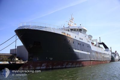
JAWHART AL WUSTA
Factory Trawler
Current Trip
ESLPA
| Time Travelled | 7 days |
|---|---|
| Remaining Time | --- |
| Distance Travelled | 29.13 nm |
| Remaining Distance | --- |
| AVG Speed | 10.3 Knopen |
| MAX Speed | 11 Knopen |
| AVG Wind | 18.8 knots |
| MAX Wind | 24 knots |
| MIN Temp | 19.9°C / 67.82°F |
| MAX Temp | 20.3°C / 68.54°F |
| Diepgang | 7 M |
| Positie ontvangen | 7 d geleden |
Current Position
| Lengtegraad | -15.32742° |
|---|---|
| Breedtegraat | 27.68545° |
| Status | Under way using engine |
| Snelheid | 10.1 Knopen |
| Koers | 197.6° |
| Gebied | North Atlantic Ocean |
| Station | T-AIS |
| Positie ontvangen | 7 d geleden |
Info
Information
The current position of JAWHART AL WUSTA is in North Atlantic Ocean with coordinates 27.68545° / -15.32742° as reported on 2024-06-19 14:41 by AIS to our vessel tracker app. The vessel's current speed is 10.1 Knopen
The vessel JAWHART AL WUSTA (IMO: 9256664, MMSI: 461000003) is a Factory Trawler that was built in 2003 ( 21 Jaar oud ). It's sailing under the flag of [OM] Oman.
In this page you can find informations about the vessels current position, last detected port calls, and current voyage information. If the vessels is not in coverage by AIS you will find the latest position.
The current position of JAWHART AL WUSTA is detected by our AIS receivers and we are not responsible for the reliability of the data. The last position was recorded while the vessel was in Coverage by the Ais receivers of our vessel tracking app.
The current draught of JAWHART AL WUSTA as reported by AIS is 7 meters
Weather
| Temperature | 20.2°C / 68.36°F |
|---|---|
| Wind Speed | 24 knots |
| Direction | 18° NNE |
| Pressure | 1020.8 hPa |
| Humidity | 74.5 % |
| Cloud Coverage | --- |
Featured Company
Last Port Calls
| Port | Arrival | Departure | Time In Port |
|---|---|---|---|
| 2024-06-18 17:18 | 2024-06-19 11:45 | 18 h | |
| 2024-06-16 13:58 | 2024-06-18 17:09 | 2 d | |
| 2024-06-07 03:57 | 2024-06-07 12:56 | 8 h |
Most Visited Ports (Last year)
| Port | Arrivals | |
|---|---|---|
| 2 | ||
| 1 |
Last Trips
| Origin | Departure | Destination | Arrival | Distance | |
|---|---|---|---|---|---|
| 2024-06-18 18:09 | 2024-06-18 18:18 | 0.90 nm |
Events
| Tijd | Evenement | Details | Positie / Bestemming | Info |
|---|---|---|---|---|
| 2024-06-19 14:41 | Buitenbereik |
27.68545 / -15.32742
North Atlantic Ocean
|
Snelheid: 10.1 kn Koers: 197.6° |
|
| 2024-06-19 11:45 | Vertrekhaven |
|
28.14465 / -15.39546
ESLPA
|
Snelheid: 8.9 kn Koers: 117° |
| 2024-06-19 11:39 | Start beweging |
28.15520 / -15.40013
[ES] LAS PALMAS
|
Snelheid: 3.6 kn Koers: 186° |
|
| 2024-06-19 11:29 | Status Changed | Under way using engine Moored |
28.15869 / -15.39892
[ES] LAS PALMAS
|
Snelheid: 0.1 kn Koers: 0° |
| 2024-06-18 19:32 | Status Changed | Moored Under way using engine |
28.15864 / -15.39859
[ES] LAS PALMAS
|
Snelheid: Koers: 0° |
| 2024-06-18 18:03 | Stop beweging |
28.15876 / -15.39875
[ES] LAS PALMAS
|
Snelheid: 0.3 kn Koers: 1° |
|
| 2024-06-18 17:18 | Aankomsthaven |
|
28.12843 / -15.40114
[ES] LAS PALMAS
|
Snelheid: 6.4 kn Koers: 358.2° |
| 2024-06-18 17:09 | Vertrekhaven |
|
28.11571 / -15.40574
ESLPA
|
Snelheid: 5 kn Koers: 110° |
| 2024-06-18 16:46 | Start beweging |
28.14308 / -15.41899
[ES] LAS PALMAS
|
Snelheid: 4.6 kn Koers: 182° |
|
| 2024-06-18 16:41 | Status Changed | Under way using engine Moored |
28.14631 / -15.41876
[ES] LAS PALMAS
|
Snelheid: 0.7 kn Koers: 270° |