
BERNINA
Cargo
Current Trip
ONDERWEG
| Time Travelled | 10 h, 54 mins |
|---|---|
| Remaining Time | --- |
| Distance Travelled | 51.28 nm |
| Remaining Distance | --- |
| AVG Speed | 7.3 Knopen |
| MAX Speed | 8.7 Knopen |
| AVG Wind | 8.5 knots |
| MAX Wind | 10 knots |
| MIN Temp | 15.8°C / 60.44°F |
| MAX Temp | 23.6°C / 74.48°F |
| Diepgang | 2.2 M |
| Positie ontvangen | 2 m geleden |
Current Position
| Lengtegraad | 4.95575° |
|---|---|
| Breedtegraat | 52.38370° |
| Status | Moored |
| Snelheid | |
| Koers | --- |
| Gebied | North Sea |
| Station | T-AIS |
| Positie ontvangen | 2 m geleden |
Info
Information
The current position of BERNINA is in North Sea with coordinates 52.38370° / 4.95575° as reported on 2024-05-13 22:33 by AIS to our vessel tracker app. The vessel's current speed is 0 Knopen
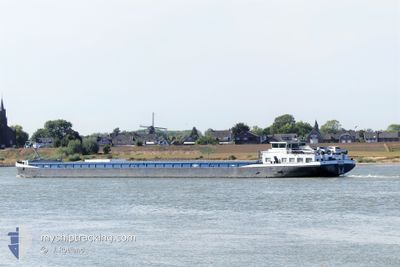
The vessel BERNINA (MMSI: 244660400) is a Cargo It's sailing under the flag of [NL] Netherlands.
In this page you can find informations about the vessels current position, last detected port calls, and current voyage information. If the vessels is not in coverage by AIS you will find the latest position.
The current position of BERNINA is detected by our AIS receivers and we are not responsible for the reliability of the data. The last position was recorded while the vessel was in Coverage by the Ais receivers of our vessel tracking app.
The current draught of BERNINA as reported by AIS is 2.2 meters
Weather
| Temperature | 15.3°C / 59.54°F |
|---|---|
| Wind Speed | 4 knots |
| Direction | 153° SSE |
| Pressure | 1008.1 hPa |
| Humidity | 91.8 % |
| Cloud Coverage | 10 % |
Featured Company
Last Port Calls
| Port | Arrival | Departure | Time In Port |
|---|---|---|---|
| 2024-05-11 11:19 | 2024-05-13 11:41 | 2 d | |
| 2024-05-10 13:24 | 2024-05-10 14:21 | 57 m | |
| 2024-05-09 18:51 | 2024-05-10 07:42 | 12 h | |
| 2024-05-09 14:39 | 2024-05-09 15:08 | 28 m | |
| 2024-05-08 04:27 | 2024-05-08 15:10 | 10 h | |
| 2024-05-06 18:35 | 2024-05-06 18:44 | 9 m | |
| 2024-05-06 08:36 | 2024-05-06 08:56 | 20 m | |
| 2024-05-05 14:37 | 2024-05-06 05:36 | 14 h | |
| 2024-05-02 20:48 | 2024-05-03 12:00 | 15 h | |
| 2024-05-02 07:02 | 2024-05-02 07:34 | 31 m |
Most Visited Ports (Last year)
| Port | Arrivals | |
|---|---|---|
| 68 | ||
| 33 | ||
| 20 | ||
| 17 | ||
| 12 | ||
| 11 |
Last Trips
| Origin | Departure | Destination | Arrival | Distance | |
|---|---|---|---|---|---|
| 2024-05-10 16:21 | 2024-05-11 13:19 | 75.68 nm | |||
| 2024-05-10 09:42 | 2024-05-10 15:24 | 31.57 nm | |||
| 2024-05-09 17:08 | 2024-05-09 20:51 | 33.69 nm | |||
| 2024-05-08 17:10 | 2024-05-09 16:39 | 87.84 nm | |||
| 2024-05-06 20:44 | 2024-05-08 06:27 | 100.55 nm | |||
| 2024-05-06 10:56 | 2024-05-06 20:35 | 30.52 nm | |||
| 2024-05-06 07:36 | 2024-05-06 10:36 | 18.14 nm | |||
| 2024-05-03 14:00 | 2024-05-05 16:37 | 45.42 nm | |||
| 2024-05-02 09:34 | 2024-05-02 22:48 | 75.40 nm | |||
| 2024-05-01 15:53 | 2024-05-02 09:02 | 32.99 nm |
Events
| Tijd | Evenement | Details | Positie / Bestemming | Info |
|---|---|---|---|---|
| 2024-05-13 19:08 | Status Changed | Moored Under way using engine |
52.38368 / 4.95573
ONDERWEG
|
Snelheid: Koers: 511° |
| 2024-05-13 18:49 | Stop beweging | 0.36 nm, North West of SCHELLINGWOUDE |
52.38363 / 4.95578
ONDERWEG
|
Snelheid: 0.2 kn Koers: 511° |
| 2024-05-13 18:44 | Start beweging | 0.26 nm, West of SCHELLINGWOUDE |
52.38059 / 4.95765
ONDERWEG
|
Snelheid: 5.7 kn Koers: 292.5° |
| 2024-05-13 18:34 | Stop beweging | 0.17 nm, South West of SCHELLINGWOUDE |
52.37976 / 4.96048
ONDERWEG
|
Snelheid: 0.3 kn Koers: 511° |
| 2024-05-13 18:32 | Start beweging | 0.14 nm, South West of SCHELLINGWOUDE |
52.37947 / 4.96197
ONDERWEG
|
Snelheid: 3.1 kn Koers: 291° |
| 2024-05-13 18:18 | Stop beweging | 0.16 nm, South of SCHELLINGWOUDE |
52.37837 / 4.96435
ONDERWEG
|
Snelheid: 0.3 kn Koers: 511° |
| 2024-05-13 15:45 | Start beweging | 0.16 nm, West of LELYSTAD |
52.52584 / 5.43452
ONDERWEG
|
Snelheid: 6.2 kn Koers: 182.3° |
| 2024-05-13 15:36 | Stop beweging | 0.17 nm, North West of LELYSTAD |
52.52766 / 5.43470
ONDERWEG
|
Snelheid: 0.1 kn Koers: 511° |
| 2024-05-13 11:41 | Vertrekhaven |
|
52.67802 / 6.13877
ONDERWEG
|
Snelheid: 6.6 kn Koers: 200.4° |
| 2024-05-13 11:32 | Binnenbereik |
52.68905 / 6.15667
North Sea
[NL] MEPPEL
|
Snelheid: 6.4 kn Koers: 232.4° |