
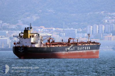
JAG LALIT
Crude Oil Tanker
Current Trip
| Time Travelled | --- |
|---|---|
| Remaining Time | --- |
| Distance Travelled | 8936.37 nm |
| Remaining Distance | --- |
| AVG Speed | 12.2 Knopen |
| MAX Speed | 16.7 Knopen |
| AVG Wind | 9.8 knots |
| MAX Wind | 27.2 knots |
| MIN Temp | 23°C / 73.4°F |
| MAX Temp | 37.1°C / 98.78°F |
| Diepgang | 16.2 M |
| Positie ontvangen | 15 h, 58 m geleden |
Current Position
| Lengtegraad | 76.04393° |
|---|---|
| Breedtegraat | 9.99532° |
| Status | Under way using engine |
| Snelheid | |
| Koers | 312° |
| Gebied | Laccadive Sea |
| Station | T-AIS |
| Positie ontvangen | 15 h, 58 m geleden |
Info
Information
The current position of JAG LALIT is in Laccadive Sea with coordinates 9.99532° / 76.04393° as reported on 2024-06-23 03:25 by AIS to our vessel tracker app. The vessel's current speed is 0 Knopen
The vessel JAG LALIT (IMO: 9297905, MMSI: 419555000) is a Crude Oil Tanker that was built in 2005 ( 19 Jaar oud ). It's sailing under the flag of [IN] India.
In this page you can find informations about the vessels current position, last detected port calls, and current voyage information. If the vessels is not in coverage by AIS you will find the latest position.
The current position of JAG LALIT is detected by our AIS receivers and we are not responsible for the reliability of the data. The last position was recorded while the vessel was in Coverage by the Ais receivers of our vessel tracking app.
The current draught of JAG LALIT as reported by AIS is 16.2 meters
Weather
| Temperature | 27.7°C / 81.86°F |
|---|---|
| Wind Speed | 17 knots |
| Direction | 303° WNW |
| Pressure | 1008.4 hPa |
| Humidity | 79.2 % |
| Cloud Coverage | 100 % |
Featured Company
Last Port Calls
| Port | Arrival | Departure | Time In Port |
|---|---|---|---|
| 2024-04-14 08:58 | 2024-04-16 09:55 | 2 d | |
| 2024-04-02 01:28 | 2024-04-03 06:39 | 1 d |
Most Visited Ports (Last year)
| Port | Arrivals | |
|---|---|---|
| 2 | ||
| 1 | ||
| 1 | ||
| 1 | ||
| 1 | ||
| 1 |
Last Trips
| Origin | Departure | Destination | Arrival | Distance | |
|---|---|---|---|---|---|
| 2024-04-03 09:39 | 2024-04-14 14:28 | 2976.17 nm |
Events
| Tijd | Evenement | Details | Positie / Bestemming | Info |
|---|---|---|---|---|
| 2024-06-23 03:32 | Status Changed | Default Under way using engine |
9.99532 / 76.04387
KOCHI
|
Snelheid: Koers: 312° |
| 2024-06-23 03:25 | Status Changed | Under way using engine Default |
9.99532 / 76.04393
KOCHI
|
Snelheid: 0.1 kn Koers: 314° |
| 2024-06-23 03:25 | Buitenbereik |
9.99532 / 76.04393
Laccadive Sea
|
Snelheid: Koers: 92° |
|
| 2024-06-23 03:18 | Status Changed | Default Under way using engine |
9.99535 / 76.04400
KOCHI
|
Snelheid: 0.3 kn Koers: 315° |
| 2024-06-23 03:04 | Stop beweging | 11.32 nm, West of KOCHI |
9.99453 / 76.04488
KOCHI
|
Snelheid: 0.3 kn Koers: 316° |
| 2024-06-23 02:57 | Status Changed | Under way using engine Default |
9.99362 / 76.04592
KOCHI
|
Snelheid: 0.6 kn Koers: 315° |
| 2024-06-23 02:38 | Status Changed | Default Under way using engine |
9.99153 / 76.04780
KOCHI
|
Snelheid: 0.8 kn Koers: 319° |
| 2024-06-23 02:33 | Status Changed | Under way using engine Default |
9.99052 / 76.04888
KOCHI
|
Snelheid: 1 kn Koers: 310° |
| 2024-06-23 02:22 | Binnenbereik |
9.99077 / 76.04858
Laccadive Sea
|
Snelheid: 1.1 kn Koers: 309° |
|
| 2024-06-23 01:24 | Buitenbereik |
9.96543 / 76.06833
Laccadive Sea
|
Snelheid: 1.3 kn Koers: 357° |