

IANA
Cargo

Current Trip
| Time Travelled | 9 days |
|---|---|
| Remaining Time | --- |
| Distance Travelled | 2017.15 nm |
| Remaining Distance | --- |
| AVG Speed | 9.3 Knopen |
| MAX Speed | 13.3 Knopen |
| AVG Wind | 14.5 knots |
| MAX Wind | 35 knots |
| MIN Temp | 9.5°C / 49.1°F |
| MAX Temp | 21.1°C / 69.98°F |
| Diepgang | 6.5 M |
| Positie ontvangen | 3 m geleden |
Current Position
| Lengtegraad | --- |
|---|---|
| Breedtegraat | --- |
| Status | At anchor |
| Snelheid | |
| Koers | 331° |
| Gebied | Mediterranean Sea - Western Basin |
| Station | T-AIS |
| Positie ontvangen | 3 m geleden |
Information
The current position of IANA is in Mediterranean Sea - Western Basin with coordinates 42.20334° / 3.17558° as reported on 2025-03-30 23:00 by AIS to our vessel tracker app. The vessel's current speed is 0 Knopen
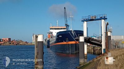
The vessel IANA (IMO: 1030375, MMSI: 255915901) is a Cargo It's sailing under the flag of [PT] Portugal.
In this page you can find informations about the vessels current position, last detected port calls, and current voyage information. If the vessels is not in coverage by AIS you will find the latest position.
The current position of IANA is detected by our AIS receivers and we are not responsible for the reliability of the data. The last position was recorded while the vessel was in Coverage by the Ais receivers of our vessel tracking app.
The current draught of IANA as reported by AIS is 6.5 meters
Weather
| Temperature | 14.7°C / 58.46°F |
|---|---|
| Wind Speed | 17 knots |
| Direction | 325° NW |
| Pressure | 1018 hPa |
| Humidity | 55.9 % |
| Cloud Coverage | --- |


Featured Company
Last Port Calls
| Port | Arrival | Departure | Time In Port |
|---|---|---|---|
| 2025-03-19 12:46 | 2025-03-21 19:28 | 2 d | |
| 2025-03-17 05:41 | 2025-03-18 06:35 | 1 d | |
| 2025-03-13 20:02 | 2025-03-13 21:25 | 1 h | |
| 2025-03-06 12:49 | 2025-03-09 08:20 | 2 d | |
| 2025-02-21 06:36 | 2025-02-24 17:36 | 3 d | |
| 2025-02-13 22:00 | 2025-02-15 18:15 | 1 d | |
| 2025-02-12 18:57 |
Most Visited Ports (Last year)
| Port | Arrivals | |
|---|---|---|
| 2 | ||
| 1 | ||
| 1 | ||
| 1 | ||
| 1 |
Last Trips
| Origin | Departure | Destination | Arrival | Distance | |
|---|---|---|---|---|---|
| 2025-03-18 06:35 | 2025-03-19 12:46 | 317.72 nm | |||
| 2025-03-13 21:25 | 2025-03-17 05:41 | 329.93 nm | |||
| 2025-03-09 08:20 | 2025-03-13 20:02 | 15.06 nm | |||
| 2025-02-24 17:36 | 2025-03-06 12:49 | 1090.17 nm | |||
| 2025-02-15 18:15 | 2025-02-21 06:36 | 1140.74 nm | |||
| 2025-02-12 18:57 | 2025-02-13 22:00 | 212.33 nm |
Events
| Tijd | Evenement | Details | Positie / Bestemming | Info |
|---|---|---|---|---|
| 2025-03-30 19:21 | Status Changed | At anchor Under way using engine |
42.20424 / 3.17445
FRCOZ
|
Snelheid: 0.3 kn Koers: 325° |
| 2025-03-30 19:19 | Stop beweging | 2.96 nm, South of ROSES |
42.20437 / 3.17457
FRCOZ
|
Snelheid: 0.2 kn Koers: 333° |
| 2025-03-30 19:07 | Start beweging | 3.36 nm, South of ROSES |
42.19855 / 3.19184
FRCOZ
|
Snelheid: 4.5 kn Koers: 294° |
| 2025-03-30 18:39 | Status Changed | Under way using engine At anchor |
42.19659 / 3.19490
FRCOZ
|
Snelheid: 0.5 kn Koers: 329° |
| 2025-03-30 18:33 | Status Changed | At anchor Under way using engine |
42.19708 / 3.19463
FRCOZ
|
Snelheid: 0.3 kn Koers: 331° |
| 2025-03-30 18:28 | Stop beweging | 3.42 nm, South of ROSES |
42.19801 / 3.19415
FRCOZ
|
Snelheid: 0.2 kn Koers: 349° |
| 2025-03-30 15:40 | Wijzig zee gebeid | Spanish part of the Mediterranean Sea - Western Basin Spanish part of the Balearic Sea |
41.89720 / 3.24626
Mediterranean Sea - Western Basin
FRCOZ
|
Snelheid: 8.2 kn Koers: 15.8° |
| 2025-03-30 05:17 | ETA Changed | 2025/03/31 09:00 2025/03/31 10:00 |
40.86326 / 1.48026
FRCOZ
|
Snelheid: 8.8 kn Koers: 56.6° |
| 2025-03-29 22:44 | Binnenbereik |
40.23686 / .53894
Balearic Sea
FRCOZ
|
Snelheid: 8.5 kn Koers: 28.5° |
|
| 2025-03-29 20:47 | Buitenbereik |
40.00825 / .35061
Balearic Sea
FRCOZ
|
Snelheid: 8 kn Koers: 30° |