
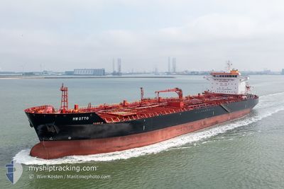
HW OTTO
Oil/Chemical Tanker
Current Trip
SEA FOR ORDERS
| Time Travelled | 9 days |
|---|---|
| Remaining Time | --- |
| Distance Travelled | 2905.54 nm |
| Remaining Distance | --- |
| AVG Speed | 12.4 Knopen |
| MAX Speed | 17.1 Knopen |
| AVG Wind | 9.6 knots |
| MAX Wind | 18.8 knots |
| MIN Temp | 4.4°C / 39.92°F |
| MAX Temp | 14.6°C / 58.28°F |
| Diepgang | 7.5 M |
| Positie ontvangen | 9 d geleden |
Current Position
| Lengtegraad | -70.47995° |
|---|---|
| Breedtegraat | 47.35547° |
| Status | Under way using engine |
| Snelheid | 9.5 Knopen |
| Koers | 20.9° |
| Gebied | Gulf of St-Lawrence |
| Station | T-AIS |
| Positie ontvangen | 9 d geleden |
Info
Information
The current position of HW OTTO is in Gulf of St-Lawrence with coordinates 47.35547° / -70.47995° as reported on 2024-05-14 13:40 by AIS to our vessel tracker app. The vessel's current speed is 9.5 Knopen
The vessel HW OTTO (IMO: 9394040, MMSI: 636023011) is a Oil/Chemical Tanker that was built in 2007 ( 17 Jaar oud ). It's sailing under the flag of [LR] Liberia.
In this page you can find informations about the vessels current position, last detected port calls, and current voyage information. If the vessels is not in coverage by AIS you will find the latest position.
The current position of HW OTTO is detected by our AIS receivers and we are not responsible for the reliability of the data. The last position was recorded while the vessel was in Coverage by the Ais receivers of our vessel tracking app.
The current draught of HW OTTO as reported by AIS is 7.5 meters
Weather
| Temperature | 10°C / 50°F |
|---|---|
| Wind Speed | 12 knots |
| Direction | 2° N |
| Pressure | 1022 hPa |
| Humidity | 71.2 % |
| Cloud Coverage | 100 % |
Featured Company
Last Port Calls
| Port | Arrival | Departure | Time In Port |
|---|---|---|---|
| 2024-05-12 04:58 | 2024-05-13 20:13 | 1 d | |
| 2024-05-10 11:49 | 2024-05-11 12:19 | 1 d | |
| 2024-04-18 19:41 | 2024-04-18 19:44 | 3 m | |
| 2024-03-12 08:16 | 2024-03-13 23:03 | 1 d |
Last Trips
| Origin | Departure | Destination | Arrival | Distance | |
|---|---|---|---|---|---|
| 2024-05-11 12:19 | 2024-05-12 04:58 | 130.79 nm | |||
| 2024-04-18 19:44 | 2024-05-10 11:49 | 5114.90 nm | |||
| 2024-03-13 23:03 | 2024-04-18 19:41 | 6960.91 nm | |||
| 2024-02-17 16:26 | 2024-03-12 08:16 | 3644.03 nm |
Events
| Tijd | Evenement | Details | Positie / Bestemming | Info |
|---|---|---|---|---|
| 2024-05-14 13:40 | Buitenbereik |
47.35547 / -70.47995
Gulf of St-Lawrence
SEA FOR ORDERS
|
Snelheid: 9.5 kn Koers: 20.9° |
|
| 2024-05-14 13:40 | Status Changed | Under way using engine Default |
47.35547 / -70.47995
SEA FOR ORDERS
|
Snelheid: 10 kn Koers: 36° |
| 2024-05-14 13:40 | Binnenbereik |
47.35547 / -70.47995
Gulf of St-Lawrence
SEA FOR ORDERS
|
Snelheid: 9.5 kn Koers: 20.9° |
|
| 2024-05-14 12:33 | Status Changed | Default Under way using engine |
47.18500 / -70.62167
SEA FOR ORDERS
|
Snelheid: 10.7 kn Koers: 43.1° |
| 2024-05-14 12:26 | Buitenbereik |
47.16892 / -70.64423
Gulf of St-Lawrence
SEA FOR ORDERS
|
Snelheid: 10.7 kn Koers: 43.1° |
|
| 2024-05-14 12:19 | Status Changed | Under way using engine Default |
47.15539 / -70.66208
SEA FOR ORDERS
|
Snelheid: 10 kn Koers: 34° |
| 2024-05-14 12:12 | Status Changed | Default Under way using engine |
47.13667 / -70.67834
SEA FOR ORDERS
|
Snelheid: 10.4 kn Koers: 32.8° |
| 2024-05-14 09:09 | Status Changed | Under way using engine Default |
46.74483 / -71.29060
SEA FOR ORDERS
|
Snelheid: 15 kn Koers: 72° |
| 2024-05-14 09:07 | Status Changed | Default Under way using engine |
46.74145 / -71.30640
SEA FOR ORDERS
|
Snelheid: 14.6 kn Koers: 66.1° |
| 2024-05-14 08:55 | Status Changed | Under way using engine Default |
46.72376 / -71.36808
SEA FOR ORDERS
|
Snelheid: 15.1 kn Koers: 76° |