
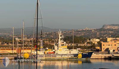
HUMANITY 1
Fishery Research Vessel
Current Trip
FOR ORDERS
| Time Travelled | 6 h, 36 mins |
|---|---|
| Remaining Time | --- |
| Distance Travelled | 31.15 nm |
| Remaining Distance | --- |
| AVG Speed | 5.7 Knopen |
| MAX Speed | 6.5 Knopen |
| AVG Wind | 8.9 knots |
| MAX Wind | 12.3 knots |
| MIN Temp | 12.1°C / 53.78°F |
| MAX Temp | 16.1°C / 60.98°F |
| Diepgang | 4.1 M |
| Positie ontvangen | 1 h, 9 m geleden |
Current Position
| Lengtegraad | --- |
|---|---|
| Breedtegraat | --- |
| Status | Under way using engine |
| Snelheid | 5.1 Knopen |
| Koers | 176.2° |
| Gebied | Ionian Sea |
| Station | T-AIS |
| Positie ontvangen | 1 h, 9 m geleden |
Info
Information
The current position of HUMANITY 1 is in Ionian Sea with coordinates 37.63944° / 15.57281° as reported on 2024-11-23 19:00 by AIS to our vessel tracker app. The vessel's current speed is 5.1 Knopen
The vessel HUMANITY 1 (IMO: 7427518, MMSI: 211300760) is a Fishery Research Vessel that was built in 1976 ( 48 Jaar oud ). It's sailing under the flag of [DE] Germany.
In this page you can find informations about the vessels current position, last detected port calls, and current voyage information. If the vessels is not in coverage by AIS you will find the latest position.
The current position of HUMANITY 1 is detected by our AIS receivers and we are not responsible for the reliability of the data. The last position was recorded while the vessel was in Coverage by the Ais receivers of our vessel tracking app.
The current draught of HUMANITY 1 as reported by AIS is 4.1 meters
Weather
| Temperature | 15.7°C / 60.26°F |
|---|---|
| Wind Speed | 8 knots |
| Direction | 97° E |
| Pressure | 1032.1 hPa |
| Humidity | 46.2 % |
| Cloud Coverage | 3 % |
Featured Company
Last Port Calls
| Port | Arrival | Departure | Time In Port |
|---|---|---|---|
| 2024-11-23 08:30 | 2024-11-23 13:33 | 5 h | |
| 2024-11-23 07:22 | 2024-11-23 07:44 | 21 m | |
| 2024-10-29 15:56 | 2024-11-15 14:55 | 16 d | |
| 2024-10-28 08:08 | 2024-10-28 16:07 | 7 h | |
| 2024-10-11 10:19 | 2024-10-11 19:01 | 8 h | |
| 2024-10-04 06:25 | 2024-10-07 17:18 | 3 d | |
| 2024-09-26 05:40 | 2024-09-28 17:10 | 2 d | |
| 2024-09-21 06:11 | 2024-09-23 04:14 | 1 d | |
| 2024-09-17 05:38 | 2024-09-19 17:08 | 2 d | |
| 2024-09-13 06:18 | 2024-09-16 05:38 | 2 d |
Last Trips
| Origin | Departure | Destination | Arrival | Distance | |
|---|---|---|---|---|---|
| 2024-11-23 08:44 | 2024-11-23 09:30 | 2.50 nm | |||
| 2024-11-15 15:55 | 2024-11-23 08:22 | 886.47 nm | |||
| 2024-10-28 17:07 | 2024-10-29 16:56 | 126.33 nm | |||
| 2024-10-11 21:01 | 2024-10-28 09:08 | 1513.12 nm | |||
| 2024-10-07 19:18 | 2024-10-11 12:19 | 273.68 nm | |||
| 2024-09-28 19:10 | 2024-10-04 08:25 | 5.36 nm | |||
| 2024-09-23 06:14 | 2024-09-26 07:40 | 2.65 nm | |||
| 2024-09-19 19:08 | 2024-09-21 08:11 | 1.30 nm | |||
| 2024-09-16 07:38 | 2024-09-17 07:38 | 2.47 nm | |||
| 2024-09-11 19:14 | 2024-09-13 08:18 | 2.29 nm |
Events
| Tijd | Evenement | Details | Positie / Bestemming | Info |
|---|---|---|---|---|
| 2024-11-23 19:06 | Status Changed | Default Under way using engine |
37.63093 / 15.57426
FOR ORDERS
|
Snelheid: 5.1 kn Koers: 176.2° |
| 2024-11-23 19:00 | Status Changed | Under way using engine Default |
37.63944 / 15.57281
FOR ORDERS
|
Snelheid: 5.4 kn Koers: 185° |
| 2024-11-23 19:00 | Buitenbereik |
37.63944 / 15.57281
Ionian Sea
FOR ORDERS
|
Snelheid: 5.1 kn Koers: 176.2° |
|
| 2024-11-23 18:49 | Status Changed | Default Under way using engine |
37.65396 / 15.57255
FOR ORDERS
|
Snelheid: 5.5 kn Koers: 180.9° |
| 2024-11-23 18:32 | Status Changed | Under way using engine Default |
37.68168 / 15.57293
FOR ORDERS
|
Snelheid: 5.7 kn Koers: 178° |
| 2024-11-23 18:22 | Status Changed | Default Under way using engine |
37.69657 / 15.57311
FOR ORDERS
|
Snelheid: 5.7 kn Koers: 177.9° |
| 2024-11-23 18:14 | Status Changed | Under way using engine Default |
37.71011 / 15.57309
FOR ORDERS
|
Snelheid: 5.7 kn Koers: 178° |
| 2024-11-23 18:11 | Status Changed | Default Under way using engine |
37.71439 / 15.57301
FOR ORDERS
|
Snelheid: 5.7 kn Koers: 178.3° |
| 2024-11-23 17:58 | Status Changed | Under way using engine Default |
37.73552 / 15.57200
FOR ORDERS
|
Snelheid: 5.4 kn Koers: 178° |
| 2024-11-23 17:52 | Status Changed | Default Under way using engine |
37.74406 / 15.57203
FOR ORDERS
|
Snelheid: 5.3 kn Koers: 181.4° |