
HULDER
Other Type
Current Trip
HEEREWAARDEN
| Time Travelled | 12 days |
|---|---|
| Remaining Time | --- |
| Distance Travelled | 14.27 nm |
| Remaining Distance | --- |
| AVG Speed | 5.3 Knopen |
| MAX Speed | 11.9 Knopen |
| AVG Wind | 7.8 knots |
| MAX Wind | 13.8 knots |
| MIN Temp | -3.2°C / 26.24°F |
| MAX Temp | 14.3°C / 57.74°F |
| Diepgang | 1.6 M |
| Positie ontvangen | Nu |
Current Position
| Lengtegraad | --- |
|---|---|
| Breedtegraat | --- |
| Status | Under way using engine |
| Snelheid | |
| Koers | --- |
| Gebied | North Sea |
| Station | T-AIS |
| Positie ontvangen | Nu |
Info
Information
The current position of HULDER is in North Sea with coordinates 51.89081° / 5.68863° as reported on 2025-03-02 09:42 by AIS to our vessel tracker app. The vessel's current speed is 0 Knopen
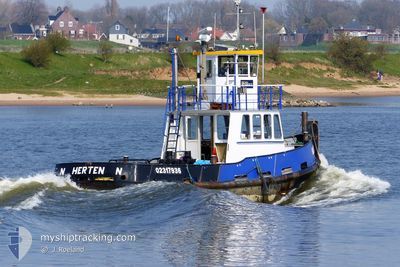
The vessel HULDER (MMSI: 244700789) is a Other Type It's sailing under the flag of [NL] Netherlands.
In this page you can find informations about the vessels current position, last detected port calls, and current voyage information. If the vessels is not in coverage by AIS you will find the latest position.
The current position of HULDER is detected by our AIS receivers and we are not responsible for the reliability of the data. The last position was recorded while the vessel was in Coverage by the Ais receivers of our vessel tracking app.
The current draught of HULDER as reported by AIS is 1.6 meters
Weather
| Temperature | 4.7°C / 40.46°F |
|---|---|
| Wind Speed | 2 knots |
| Direction | 57° ENE |
| Pressure | 1036.1 hPa |
| Humidity | 74.3 % |
| Cloud Coverage | --- |
Featured Company
Most Visited Ports (Last year)
| Port | Arrivals | |
|---|---|---|
| 3 | ||
| 2 | ||
| 1 |
Events
| Tijd | Evenement | Details | Positie / Bestemming | Info |
|---|---|---|---|---|
| 2025-02-27 15:38 | Stop beweging | 0.63 nm, East of DEEST |
51.89078 / 5.68855
HEEREWAARDEN
|
Snelheid: 0.1 kn Koers: 511° |
| 2025-02-27 15:35 | Start beweging | 0.58 nm, East of DEEST |
51.89182 / 5.68774
HEEREWAARDEN
|
Snelheid: 4.2 kn Koers: 294.1° |
| 2025-02-26 12:57 | Stop beweging | 0.69 nm, East of DEEST |
51.89213 / 5.69074
HEEREWAARDEN
|
Snelheid: 0.1 kn Koers: 511° |
| 2025-02-26 12:56 | Start beweging | 0.66 nm, East of DEEST |
51.89185 / 5.68975
HEEREWAARDEN
|
Snelheid: 4.9 kn Koers: 82.9° |
| 2025-02-26 12:22 | Stop beweging | 0.55 nm, East of DEEST |
51.89148 / 5.68667
HEEREWAARDEN
|
Snelheid: 0.2 kn Koers: 511° |
| 2025-02-26 12:20 | Start beweging | 0.55 nm, East of DEEST |
51.89213 / 5.68682
HEEREWAARDEN
|
Snelheid: 3.1 kn Koers: 292.6° |
| 2025-02-25 10:02 | Stop beweging | 0.64 nm, East of DEEST |
51.89076 / 5.68879
HEEREWAARDEN
|
Snelheid: 0.2 kn Koers: 511° |
| 2025-02-25 10:00 | Start beweging | 0.42 nm, East of DEEST |
51.89259 / 5.68362
HEEREWAARDEN
|
Snelheid: 6.4 kn Koers: 123.5° |
| 2025-02-25 08:08 | Stop beweging | 0.31 nm, East of DEEST |
51.89313 / 5.68063
HEEREWAARDEN
|
Snelheid: 0.2 kn Koers: 511° |
| 2025-02-25 08:03 | Start beweging | 0.47 nm, East of DEEST |
51.89262 / 5.68497
HEEREWAARDEN
|
Snelheid: 3.2 kn Koers: 318.9° |