
HUIGANGTONG139
Cargo
Current Trip
| Trip Time | 5 days |
|---|---|
| Trip Distance | 140.91 nm |
| AVG Speed | 5.5 Knopen |
| MAX Speed | 8 Knopen |
| Diepgang | 2.8 M |
| AVG Wind | 10.3 knots |
| MAX Wind | 16 knots |
| MIN Temp | 12.7°C / 54.86°F |
| MAX Temp | 26.2°C / 79.16°F |
| Positie ontvangen | 1 d geleden |
Current Position
| Lengtegraad | --- |
|---|---|
| Breedtegraat | --- |
| Status | Under way using engine |
| Snelheid | 5.8 Knopen |
| Koers | 166.3° |
| Gebied | South China Sea |
| Station | T-AIS |
| Positie ontvangen | 1 d geleden |
Info
Information
The current position of HUIGANGTONG139 is in South China Sea with coordinates 22.30510° / 113.79547° as reported on 2025-03-05 19:22 by AIS to our vessel tracker app. The vessel's current speed is 5.8 Knopen and is currently inside the port of HUIZHOU.
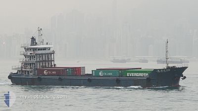
The vessel HUIGANGTONG139 (MMSI: 412469340) is a Cargo It's sailing under the flag of [CN] China.
In this page you can find informations about the vessels current position, last detected port calls, and current voyage information. If the vessels is not in coverage by AIS you will find the latest position.
The current position of HUIGANGTONG139 is detected by our AIS receivers and we are not responsible for the reliability of the data. The last position was recorded while the vessel was in Coverage by the Ais receivers of our vessel tracking app.
The current draught of HUIGANGTONG139 as reported by AIS is 2.8 meters
Weather
| Temperature | 12.3°C / 54.14°F |
|---|---|
| Wind Speed | 7 knots |
| Direction | 356° N |
| Pressure | 1023.8 hPa |
| Humidity | 70.5 % |
| Cloud Coverage | 95 % |
Featured Company
Last Port Calls
| Port | Arrival | Departure | Time In Port |
|---|---|---|---|
| 2025-03-06 13:02 | |||
| 2025-03-01 00:13 | 2025-03-01 03:41 | 3 h | |
| 2025-02-28 07:45 | 2025-02-28 08:29 | 43 m | |
| 2025-02-27 18:49 | 2025-02-28 01:29 | 6 h | |
| 2025-02-27 04:41 | 2025-02-27 12:53 | 8 h | |
| 2025-02-26 18:13 | 2025-02-26 23:49 | 5 h | |
| 2025-02-26 00:25 | 2025-02-26 10:57 | 10 h | |
| 2025-02-25 20:37 | 2025-02-25 22:11 | 1 h | |
| 2025-02-24 15:37 | 2025-02-25 15:33 | 23 h | |
| 2025-02-23 15:34 | 2025-02-24 08:12 | 16 h |
Last Trips
| Origin | Departure | Destination | Arrival | Distance | |
|---|---|---|---|---|---|
| 2025-03-01 11:41 | 2025-03-06 21:02 | 140.91 nm | |||
| 2025-02-28 16:29 | 2025-03-01 08:13 | 34.91 nm | |||
| 2025-02-28 09:29 | 2025-02-28 15:45 | 36.58 nm | |||
| 2025-02-27 20:53 | 2025-02-28 02:49 | 31.80 nm | |||
| 2025-02-27 07:49 | 2025-02-27 12:41 | 26.53 nm | |||
| 2025-02-26 18:57 | 2025-02-27 02:13 | 32.00 nm | |||
| 2025-02-26 06:11 | 2025-02-26 08:25 | 2.04 nm | |||
| 2025-02-25 23:33 | 2025-02-26 04:37 | 28.27 nm | |||
| 2025-02-24 16:12 | 2025-02-24 23:37 | 31.90 nm | |||
| 2025-02-23 17:21 | 2025-02-23 23:34 | 36.39 nm |
Events
| Tijd | Evenement | Details | Positie / Bestemming | Info |
|---|---|---|---|---|
| 2025-03-07 03:32 | Stop beweging |
22.69584 / 114.56342
[CN] HUIZHOU
|
Snelheid: 0.1 kn Koers: -1° |
|
| 2025-03-07 03:17 | Start beweging |
22.68910 / 114.56318
[CN] HUIZHOU
|
Snelheid: 4.4 kn Koers: -1° |
|
| 2025-03-06 13:26 | Stop beweging |
22.67635 / 114.55699
[CN] HUIZHOU
|
Snelheid: 0.1 kn Koers: -1° |
|
| 2025-03-06 13:02 | Aankomsthaven |
|
22.67003 / 114.58433
[CN] HUIZHOU
|
Snelheid: 6 kn Koers: 316° |
| 2025-03-06 02:40 | Start beweging | 0.61 nm, West of WAILINGDING ISLAND |
22.10243 / 114.01228
MANSHA
|
Snelheid: 5.1 kn Koers: 23° |
| 2025-03-05 22:47 | Stop beweging | 0.74 nm, West of WAILINGDING ISLAND |
22.09789 / 114.01047
MANSHA
|
Snelheid: 0.1 kn Koers: -1° |
| 2025-03-05 19:30 | Status Changed | Default Under way using engine |
22.29363 / 113.79872
MANSHA
|
Snelheid: 5.8 kn Koers: 166.3° |
| 2025-03-05 19:22 | Buitenbereik |
22.30510 / 113.79547
South China Sea
|
Snelheid: 5.8 kn Koers: 166.3° |
|
| 2025-03-05 19:15 | Status Changed | Under way using engine Default |
22.31719 / 113.79162
MANSHA
|
Snelheid: 6.1 kn Koers: 163° |
| 2025-03-05 19:14 | Status Changed | Default Under way using engine |
22.31945 / 113.79094
MANSHA
|
Snelheid: 6.1 kn Koers: 146.7° |