
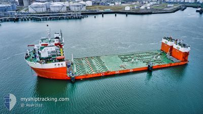
HUA HAI LONG
Heavy Lift Vessel
Current Trip
| Time Travelled | 3 days |
|---|---|
| Remaining Time | 3 days |
| Distance Travelled | 545.12 nm |
| Remaining Distance | 1090.65 nm |
| AVG Speed | 7.6 Knopen |
| MAX Speed | 11.1 Knopen |
| AVG Wind | 7.5 knots |
| MAX Wind | 11.8 knots |
| MIN Temp | 29.2°C / 84.56°F |
| MAX Temp | 31°C / 87.8°F |
| Diepgang | 6.1 M |
| Positie ontvangen | 3 d geleden |
Current Position
| Lengtegraad | 104.46313° |
|---|---|
| Breedtegraat | 1.40130° |
| Status | Under way sailing |
| Snelheid | 9.8 Knopen |
| Koers | 51.3° |
| Gebied | South China Sea |
| Station | T-AIS |
| Positie ontvangen | 3 d geleden |
Info
Information
The current position of HUA HAI LONG is in South China Sea with coordinates 1.40130° / 104.46313° as reported on 2024-05-10 10:04 by AIS to our vessel tracker app. The vessel's current speed is 9.8 Knopen and is heading at the port of NANSHA. The estimated time of arrival as calculated by MyShipTracking vessel tracking app is 2024-05-16 14:53 LT
The vessel HUA HAI LONG (IMO: 9560144, MMSI: 412036000) is a Heavy Lift Vessel that was built in 2012 ( 12 Jaar oud ). It's sailing under the flag of [CN] China.
In this page you can find informations about the vessels current position, last detected port calls, and current voyage information. If the vessels is not in coverage by AIS you will find the latest position.
The current position of HUA HAI LONG is detected by our AIS receivers and we are not responsible for the reliability of the data. The last position was recorded while the vessel was in Coverage by the Ais receivers of our vessel tracking app.
The current draught of HUA HAI LONG as reported by AIS is 6.1 meters
Weather
| Temperature | 30.2°C / 86.36°F |
|---|---|
| Wind Speed | 6 knots |
| Direction | 64° ENE |
| Pressure | 1007.3 hPa |
| Humidity | 70.4 % |
| Cloud Coverage | 14 % |
Featured Company
Events
| Tijd | Evenement | Details | Positie / Bestemming | Info |
|---|---|---|---|---|
| 2024-05-10 10:12 | Status Changed | Default Under way sailing |
1.41528 / 104.48066
GUANG ZHOU
|
Snelheid: 9.8 kn Koers: 51.3° |
| 2024-05-10 10:04 | Buitenbereik |
1.40130 / 104.46313
South China Sea
GUANG ZHOU
|
Snelheid: 9.8 kn Koers: 51.3° |
|
| 2024-05-10 10:02 | Status Changed | Under way sailing Default |
1.39761 / 104.45855
GUANG ZHOU
|
Snelheid: 9.8 kn Koers: 50° |
| 2024-05-10 09:45 | Status Changed | Default Under way sailing |
1.36721 / 104.42215
GUANG ZHOU
|
Snelheid: 9.6 kn Koers: 49.3° |
| 2024-05-10 09:35 | Gevonden in zee | Malaysian part of the South China Sea |
1.35022 / 104.40254
South China Sea
GUANG ZHOU
|
Snelheid: 9.5 kn Koers: 47.5° |
| 2024-05-10 09:33 | Status Changed | Under way sailing Default |
1.34662 / 104.39857
GUANG ZHOU
|
Snelheid: 9.5 kn Koers: 49° |
| 2024-05-10 09:05 | Status Changed | Default Under way sailing |
1.29775 / 104.34380
GUANG ZHOU
|
Snelheid: 8.6 kn Koers: 59.6° |
| 2024-05-10 07:47 | Wijzig zee gebeid | Malaysian part of the Singapore Strait Indonesian part of the Singapore Strait |
1.25934 / 104.15515
Singapore Strait
GUANG ZHOU
|
Snelheid: 9.4 kn Koers: 83.5° |
| 2024-05-10 02:07 | Wijzig zee gebeid | Indonesian part of the Singapore Strait Singaporean part of the Singapore Strait |
1.20306 / 103.63433
Singapore Strait
GUANG ZHOU
|
Snelheid: 7.8 kn Koers: 259.4° |
| 2024-05-10 01:06 | Status Changed | Under way sailing Moored |
1.28221 / 103.66322
GUANG ZHOU
|
Snelheid: 6.3 kn Koers: 237.8° |