
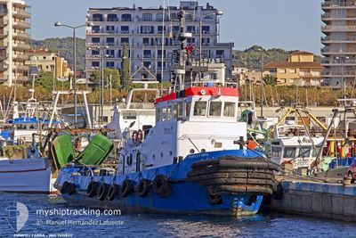
HOROZ
Tug
Current Trip
| Trip Time | --- |
|---|---|
| Trip Distance | --- |
| AVG Speed | --- |
| MAX Speed | --- |
| Diepgang | --- |
| AVG Wind | --- |
| MAX Wind | --- |
| MIN Temp | --- |
| MAX Temp | --- |
| Positie ontvangen | 29 d geleden |
Current Position
| Lengtegraad | --- |
|---|---|
| Breedtegraat | --- |
| Status | Under way using engine |
| Snelheid | 6.9 Knopen |
| Koers | 304.4° |
| Gebied | Black Sea |
| Station | T-AIS |
| Positie ontvangen | 29 d geleden |
Info
Information
The current position of HOROZ is in Black Sea with coordinates 41.33606° / 29.20838° as reported on 2024-09-08 19:43 by AIS to our vessel tracker app. The vessel's current speed is 6.9 Knopen and is currently inside the port of CAMBURNU.
The vessel HOROZ (IMO: 7610830, MMSI: 351235000) is a Tug that was built in 1978 ( 46 Jaar oud ). It's sailing under the flag of [PA] Panama.
In this page you can find informations about the vessels current position, last detected port calls, and current voyage information. If the vessels is not in coverage by AIS you will find the latest position.
The current position of HOROZ is detected by our AIS receivers and we are not responsible for the reliability of the data. The last position was recorded while the vessel was in Coverage by the Ais receivers of our vessel tracking app.
The current draught of HOROZ as reported by AIS is 3.6 meters
Weather
| Temperature | 17.2°C / 62.96°F |
|---|---|
| Wind Speed | 5 knots |
| Direction | 202° SSW |
| Pressure | 1011.9 hPa |
| Humidity | 47.4 % |
| Cloud Coverage | --- |
Featured Company
Last Trips
| Origin | Departure | Destination | Arrival | Distance | |
|---|---|---|---|---|---|
| 2024-10-05 21:06 | 2024-10-06 00:26 | 29.17 nm | |||
| 2024-09-08 13:21 | 2024-10-05 10:25 | 1077.82 nm | |||
| 2024-08-20 08:45 | 2024-08-29 15:59 | 1183.44 nm | |||
| 2024-08-10 15:21 | 2024-08-19 07:13 | 1352.78 nm |
Events
| Tijd | Evenement | Details | Positie / Bestemming | Info |
|---|---|---|---|---|
| 2024-10-05 21:26 | Aankomsthaven |
|
41.11223 / 37.34403
[TR] UNYE
|
Snelheid: 17.4 kn Koers: -1° |
| 2024-10-05 18:06 | Vertrekhaven |
|
41.36811 / 36.79599
RO SUL
|
Snelheid: 0.6 kn Koers: -1° |
| 2024-10-05 07:33 | Stop beweging |
41.11610 / 37.34167
[TR] UNYE
|
Snelheid: 0.3 kn Koers: -1° |
|
| 2024-10-05 07:25 | Aankomsthaven |
|
41.11601 / 37.34332
[TR] UNYE
|
Snelheid: 2.4 kn Koers: -1° |
| 2024-10-05 06:09 | Start beweging | 0.71 nm, North of UNYE |
41.12669 / 37.33944
RO SUL
|
Snelheid: 5 kn Koers: 9° |
| 2024-10-04 09:25 | Stop beweging | 0.53 nm, North of UNYE |
41.12399 / 37.34195
RO SUL
|
Snelheid: 0.2 kn Koers: -1° |
| 2024-10-04 08:49 | Start beweging | 0.52 nm, North of UNYE |
41.12315 / 37.34791
RO SUL
|
Snelheid: 5 kn Koers: 22° |
| 2024-10-04 05:05 | Stop beweging | 0.71 nm, North East of UNYE |
41.12434 / 37.35366
RO SUL
|
Snelheid: 0.1 kn Koers: -1° |
| 2024-10-02 18:09 | Start beweging | 4.85 nm, South of SINOP |
41.94207 / 35.12877
RO SUL
|
Snelheid: 3.1 kn Koers: -1° |
| 2024-10-02 05:41 | Stop beweging | 5.42 nm, South East of SINOP |
41.96969 / 35.24000
RO SUL
|
Snelheid: 0.3 kn Koers: -1° |