
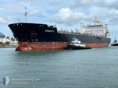
HONESTY
Oil/Chemical Tanker
Current Trip
| Time Travelled | 1 day |
|---|---|
| Remaining Time | --- |
| Distance Travelled | 320.33 nm |
| Remaining Distance | --- |
| AVG Speed | 14.7 Knopen |
| MAX Speed | 17.3 Knopen |
| AVG Wind | 4.3 knots |
| MAX Wind | 10.7 knots |
| MIN Temp | 22.2°C / 71.96°F |
| MAX Temp | 29.9°C / 85.82°F |
| Diepgang | 8.4 M |
| Positie ontvangen | 23 d geleden |
Current Position
| Lengtegraad | --- |
|---|---|
| Breedtegraat | --- |
| Status | Under way using engine |
| Snelheid | 1.6 Knopen |
| Koers | 208° |
| Gebied | South Atlantic Ocean |
| Station | T-AIS |
| Positie ontvangen | 23 d geleden |
Information
The current position of HONESTY is in South Atlantic Ocean with coordinates -8.37566° / -34.73200° as reported on 2025-03-06 23:37 by AIS to our vessel tracker app. The vessel's current speed is 1.6 Knopen
The vessel HONESTY (IMO: 9416393, MMSI: 636014864) is a Oil/Chemical Tanker that was built in 2011 ( 14 Jaar oud ). It's sailing under the flag of [LR] Liberia.
In this page you can find informations about the vessels current position, last detected port calls, and current voyage information. If the vessels is not in coverage by AIS you will find the latest position.
The current position of HONESTY is detected by our AIS receivers and we are not responsible for the reliability of the data. The last position was recorded while the vessel was in Coverage by the Ais receivers of our vessel tracking app.
The current draught of HONESTY as reported by AIS is 8.4 meters
Weather
| Temperature | 24.1°C / 75.38°F |
|---|---|
| Wind Speed | 5 knots |
| Direction | 2° N |
| Pressure | 1009 hPa |
| Humidity | 93.1 % |
| Cloud Coverage | 100 % |
Featured Company
Last Port Calls
| Port | Arrival | Departure | Time In Port |
|---|---|---|---|
| 2025-03-26 01:57 | 2025-03-28 13:27 | 2 d | |
| 2025-03-08 18:20 | 2025-03-10 01:46 | 1 d | |
| 2025-02-24 14:33 | 2025-02-24 15:15 | 41 m | |
| 2025-02-14 23:56 | 2025-02-16 10:51 | 1 d | |
| 2025-02-11 03:08 | 2025-02-11 03:25 | 17 m | |
| 2025-01-20 11:04 | 2025-01-23 01:19 | 2 d | |
| 2025-01-11 12:05 | 2025-01-13 18:06 | 2 d | |
| 2025-01-01 19:12 |
Last Trips
| Origin | Departure | Destination | Arrival | Distance | |
|---|---|---|---|---|---|
| 2025-03-09 22:46 | 2025-03-25 22:57 | 1728.82 nm | |||
| 2025-02-24 12:15 | 2025-03-08 15:20 | 1588.23 nm | |||
| 2025-02-16 07:51 | 2025-02-24 11:33 | 180.48 nm | |||
| 2025-02-11 00:25 | 2025-02-14 20:56 | 182.66 nm | |||
| 2025-01-22 21:19 | 2025-02-11 00:08 | 3261.64 nm | |||
| 2025-01-13 14:06 | 2025-01-20 07:04 | 6.75 nm | |||
| 2025-01-01 16:12 | 2025-01-11 08:05 | 1992.25 nm |
Events
| Tijd | Evenement | Details | Positie / Bestemming | Info |
|---|---|---|---|---|
| 2025-03-29 13:05 | Stop beweging | 6.35 nm, North East of MACAPA |
.08950 / -50.96600
BRSTM
|
Snelheid: 0.3 kn Koers: 201° |
| 2025-03-28 13:42 | Start beweging | 2.28 nm, East of SANTAREM |
-2.42600 / -54.67517
BRSTM
|
Snelheid: 16 kn Koers: 119° |
| 2025-03-28 13:27 | Vertrekhaven |
|
-2.42600 / -54.67517
BRSTM
|
Snelheid: 2.9 kn Koers: 23° |
| 2025-03-26 02:12 | Stop beweging |
-2.41317 / -54.73883
[BR] SANTAREM
|
Snelheid: 0.3 kn Koers: 288° |
|
| 2025-03-26 01:57 | Aankomsthaven |
|
-2.41233 / -54.73883
[BR] SANTAREM
|
Snelheid: 0.5 kn Koers: 291° |
| 2025-03-26 00:53 | Start beweging | 5.96 nm, West of SANTAREM |
-2.39317 / -54.80833
BRSTM
|
Snelheid: 3.4 kn Koers: 168° |
| 2025-03-24 06:38 | Stop beweging | 5.87 nm, West of SANTAREM |
-2.39250 / -54.80667
BRSTM
|
Snelheid: 0.3 kn Koers: 309° |
| 2025-03-22 20:05 | Start beweging | 7.5 nm, North East of MACAPA |
.11050 / -50.95883
BRSTM
|
Snelheid: 3.4 kn Koers: 240° |