
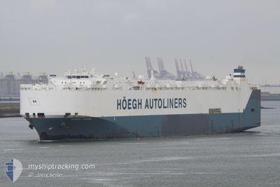
HOEGH TRADER
Vehicles Carrier
Current Trip
| Time Travelled | 7 h, 27 mins |
|---|---|
| Remaining Time | 2 days |
| Distance Travelled | 100.99 nm |
| Remaining Distance | 850.94 nm |
| AVG Speed | 14 Knopen |
| MAX Speed | 16.1 Knopen |
| AVG Wind | 15.3 knots |
| MAX Wind | 19 knots |
| MIN Temp | 10.5°C / 50.9°F |
| MAX Temp | 14.2°C / 57.56°F |
| Diepgang | 8.8 M |
| Positie ontvangen | 1 h, 3 m geleden |
Current Position
| Lengtegraad | --- |
|---|---|
| Breedtegraat | --- |
| Status | Under way using engine |
| Snelheid | 14.6 Knopen |
| Koers | 355.4° |
| Gebied | North Atlantic Ocean |
| Station | T-AIS |
| Positie ontvangen | 1 h, 3 m geleden |
Info
Information
The current position of HOEGH TRADER is in North Atlantic Ocean with coordinates 39.33480° / -9.88410° as reported on 2025-12-24 03:08 by AIS to our vessel tracker app. The vessel's current speed is 14.6 Knopen and is heading at the port of SOUTHAMPTON. The estimated time of arrival as calculated by MyShipTracking vessel tracking app is 2025-12-26 13:39 LT
The vessel HOEGH TRADER (IMO: 9171280, MMSI: 258882000) is a Vehicles Carrier that was built in 1998 ( 27 Jaar oud ). It's sailing under the flag of [NO] Norway.
In this page you can find informations about the vessels current position, last detected port calls, and current voyage information. If the vessels is not in coverage by AIS you will find the latest position.
The current position of HOEGH TRADER is detected by our AIS receivers and we are not responsible for the reliability of the data. The last position was recorded while the vessel was in Coverage by the Ais receivers of our vessel tracking app.
The current draught of HOEGH TRADER as reported by AIS is 8.8 meters
Weather
| Temperature | 12.9°C / 55.22°F |
|---|---|
| Wind Speed | 11 knots |
| Direction | 357° N |
| Pressure | 1009.6 hPa |
| Humidity | 72.5 % |
| Cloud Coverage | 59 % |
Featured Company
Last Port Calls
| Port | Arrival | Departure | Time In Port |
|---|---|---|---|
| 2025-12-23 00:24 | 2025-12-23 20:44 | 20 h | |
| 2025-11-09 13:00 | 2025-11-10 12:24 | 23 h | |
| 2025-11-05 07:40 | 2025-11-06 15:36 | 1 d | |
| 2025-10-06 05:48 | 2025-10-06 19:15 | 13 h | |
| 2025-10-04 18:34 | 2025-10-05 01:29 | 6 h | |
| 2025-10-04 07:34 | 2025-10-04 18:17 | 10 h | |
| 2025-10-01 16:39 | 2025-10-02 00:16 | 7 h |
Most Visited Ports (Last year)
| Port | Arrivals | |
|---|---|---|
| 3 | ||
| 3 | ||
| 3 | ||
| 2 | ||
| 2 | ||
| 2 |
Last Trips
| Origin | Departure | Destination | Arrival | Distance | |
|---|---|---|---|---|---|
| 2025-11-10 12:24 | 2025-12-23 00:24 | 14154.73 nm | |||
| 2025-11-06 15:36 | 2025-11-09 13:00 | 959.79 nm | |||
| 2025-10-06 19:15 | 2025-11-05 07:40 | 10123.33 nm | |||
| 2025-10-05 01:29 | 2025-10-06 05:48 | 411.10 nm | |||
| 2025-10-04 18:17 | 2025-10-04 18:34 | 0.77 nm | |||
| 2025-10-02 00:16 | 2025-10-04 07:34 | 699.48 nm | |||
| 2025-09-26 01:00 | 2025-10-01 16:39 | 1482.31 nm |
Events
| Tijd | Evenement | Details | Positie / Bestemming | Info |
|---|---|---|---|---|
| 2025-12-24 03:16 | Status Changed | Default Under way using engine |
39.36608 / -9.88645
PTSET>GBSOU
|
Snelheid: 14.6 kn Koers: 355.4° |
| 2025-12-24 03:08 | Buitenbereik |
39.33480 / -9.88410
North Atlantic Ocean
PTSET>GBSOU
|
Snelheid: 14.6 kn Koers: 355.4° |
|
| 2025-12-24 02:45 | Status Changed | Under way using engine Default |
39.24092 / -9.88004
PTSET>GBSOU
|
Snelheid: 14.7 kn Koers: 358° |
| 2025-12-24 02:44 | Status Changed | Default Under way using engine |
39.23640 / -9.87991
PTSET>GBSOU
|
Snelheid: 15 kn Koers: 358.1° |
| 2025-12-23 21:25 | Draught Changed | 8.8 9.2 |
38.41112 / -9.02533
PTSET>GBSOU
|
Snelheid: 13.8 kn Koers: 244° |
| 2025-12-23 21:25 | Destination Changed | PTSET>GBSOU CNXMP>PTSET |
38.41112 / -9.02533
PTSET>GBSOU
|
Snelheid: 13.8 kn Koers: 244° |
| 2025-12-23 21:25 | ETA Changed | 2025/12/26 11:00 2025/12/22 23:00 |
38.41112 / -9.02533
PTSET>GBSOU
|
Snelheid: 13.8 kn Koers: 244° |
| 2025-12-23 21:15 | Status Changed | Under way using engine Default |
38.42691 / -8.99120
CNXMP>PTSET
|
Snelheid: 7.2 kn Koers: 188° |
| 2025-12-23 21:04 | Status Changed | Default Under way using engine |
38.45021 / -8.97186
CNXMP>PTSET
|
Snelheid: 14 kn Koers: 218.5° |
| 2025-12-23 20:57 | Status Changed | Under way using engine Default |
38.47050 / -8.95065
CNXMP>PTSET
|
Snelheid: 14.8 kn Koers: 221° |