
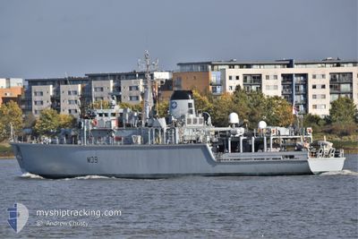
HMS HURWORTH
Tug
Current Trip
MARITIME SECURITY
| Time Travelled | 3 days |
|---|---|
| Remaining Time | --- |
| Distance Travelled | 76.49 nm |
| Remaining Distance | --- |
| AVG Speed | 9.6 Knopen |
| MAX Speed | 13.2 Knopen |
| AVG Wind | 4.7 knots |
| MAX Wind | 11.8 knots |
| MIN Temp | 10.6°C / 51.08°F |
| MAX Temp | 15.3°C / 59.54°F |
| Diepgang | 3.2 M |
| Positie ontvangen | 1 d geleden |
Current Position
| Lengtegraad | -5.42648° |
|---|---|
| Breedtegraat | 55.36312° |
| Status | Restricted manoeuverability |
| Snelheid | 1.9 Knopen |
| Koers | 181° |
| Gebied | Inner Seas off the West Coast of Scotland |
| Station | T-AIS |
| Positie ontvangen | 1 d geleden |
Info
Information
The current position of HMS HURWORTH is in Inner Seas off the West Coast of Scotland with coordinates 55.36312° / -5.42648° as reported on 2024-05-16 17:20 by AIS to our vessel tracker app. The vessel's current speed is 1.9 Knopen
The vessel HMS HURWORTH (IMO: 8401509, MMSI: 234600000) is a Tug that was built in 1986 ( 38 Jaar oud ). It's sailing under the flag of [GB] United Kingdom.
In this page you can find informations about the vessels current position, last detected port calls, and current voyage information. If the vessels is not in coverage by AIS you will find the latest position.
The current position of HMS HURWORTH is detected by our AIS receivers and we are not responsible for the reliability of the data. The last position was recorded while the vessel was in Coverage by the Ais receivers of our vessel tracking app.
The current draught of HMS HURWORTH as reported by AIS is 3.2 meters
Weather
| Temperature | 14.1°C / 57.38°F |
|---|---|
| Wind Speed | 8 knots |
| Direction | 313° NW |
| Pressure | 1007.2 hPa |
| Humidity | 85.1 % |
| Cloud Coverage | 95 % |
Featured Company
Last Port Calls
| Port | Arrival | Departure | Time In Port |
|---|---|---|---|
| 2024-05-09 16:50 | 2024-05-14 14:59 | 4 d | |
| 2024-05-07 17:02 | 2024-05-08 07:06 | 14 h | |
| 2024-05-06 14:49 | 2024-05-07 07:21 | 16 h | |
| 2024-05-03 13:11 | 2024-05-06 12:31 | 2 d | |
| 2024-05-02 15:24 | 2024-05-03 06:59 | 15 h | |
| 2024-04-30 17:07 | 2024-05-01 06:59 | 13 h | |
| 2024-04-29 15:47 | 2024-04-30 08:57 | 17 h | |
| 2024-04-25 15:28 | 2024-04-29 08:48 | 3 d | |
| 2024-04-15 07:58 | 2024-04-25 08:04 | 10 d | |
| 2024-04-10 10:32 | 2024-04-10 11:04 | 32 m |
Most Visited Ports (Last year)
| Port | Arrivals | |
|---|---|---|
| 22 | ||
| 17 | ||
| 12 | ||
| 1 | ||
| 1 | ||
| 1 |
Last Trips
| Origin | Departure | Destination | Arrival | Distance | |
|---|---|---|---|---|---|
| 2024-05-08 08:06 | 2024-05-09 17:50 | 169.23 nm | |||
| 2024-05-07 08:21 | 2024-05-07 18:02 | 36.19 nm | |||
| 2024-05-06 13:31 | 2024-05-06 15:49 | 1.58 nm | |||
| 2024-05-03 07:59 | 2024-05-03 14:11 | 29.76 nm | |||
| 2024-05-01 07:59 | 2024-05-02 16:24 | 89.09 nm | |||
| 2024-04-30 09:57 | 2024-04-30 18:07 | 41.57 nm | |||
| 2024-04-29 09:48 | 2024-04-29 16:47 | 41.96 nm | |||
| 2024-04-25 09:04 | 2024-04-25 16:28 | 19.63 nm | |||
| 2024-04-10 08:23 | 2024-04-15 08:58 | 667.59 nm | |||
| 2024-04-10 08:23 | 2024-04-10 11:32 | 33.06 nm |
Events
| Tijd | Evenement | Details | Positie / Bestemming | Info |
|---|---|---|---|---|
| 2024-05-16 17:20 | Buitenbereik |
55.36312 / -5.42648
Inner Seas off the West Coast of Scotland
|
Snelheid: 1.9 kn Koers: 179.6° |
|
| 2024-05-16 17:19 | Binnenbereik |
55.36364 / -5.42651
Inner Seas off the West Coast of Scotland
|
Snelheid: 1.9 kn Koers: 179.4° |
|
| 2024-05-16 07:57 | Buitenbereik |
55.53275 / -4.90232
Inner Seas off the West Coast of Scotland
|
Snelheid: 11.8 kn Koers: 154.4° |
|
| 2024-05-16 07:50 | Binnenbereik |
55.54293 / -4.93690
Inner Seas off the West Coast of Scotland
|
Snelheid: 12.1 kn Koers: 114.6° |
|
| 2024-05-16 03:53 | Buitenbereik |
55.58772 / -5.13061
Inner Seas off the West Coast of Scotland
|
Snelheid: 2.7 kn Koers: 114.5° |
|
| 2024-05-16 00:17 | Binnenbereik |
55.58681 / -5.13765
Inner Seas off the West Coast of Scotland
|
Snelheid: 0.9 kn Koers: 99° |
|
| 2024-05-15 21:46 | Buitenbereik |
55.58524 / -5.14371
Inner Seas off the West Coast of Scotland
|
Snelheid: 2 kn Koers: 94.2° |
|
| 2024-05-15 19:45 | Stop beweging | 0.7 nm, North of BRODICK |
55.58895 / -5.13285
MARITIME SECURITY
|
Snelheid: Koers: 258° |
| 2024-05-15 19:28 | Start beweging | 1.26 nm, North East of BRODICK |
55.59232 / -5.11043
MARITIME SECURITY
|
Snelheid: 4.8 kn Koers: 274° |
| 2024-05-15 17:42 | Stop beweging | 0.72 nm, North of BRODICK |
55.58908 / -5.13235
MARITIME SECURITY
|
Snelheid: Koers: 293° |