
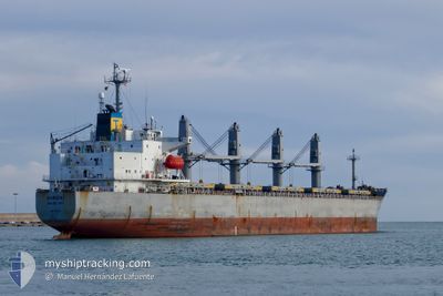
HIROKI
Bulk Carrier
Current Trip
| Time Travelled | --- |
|---|---|
| Remaining Time | --- |
| Distance Travelled | 7806.69 nm |
| Remaining Distance | --- |
| AVG Speed | 10.9 Knopen |
| MAX Speed | 10.9 Knopen |
| AVG Wind | 8.7 knots |
| MAX Wind | 30.8 knots |
| MIN Temp | 10.3°C / 50.54°F |
| MAX Temp | 32.5°C / 90.5°F |
| Diepgang | 11.6 M |
| Positie ontvangen | 19 m geleden |
Current Position
| Lengtegraad | 29.08706° |
|---|---|
| Breedtegraat | 40.45043° |
| Status | At anchor |
| Snelheid | |
| Koers | 121° |
| Gebied | Sea of Marmara |
| Station | T-AIS |
| Positie ontvangen | 19 m geleden |
Info
Information
The current position of HIROKI is in Sea of Marmara with coordinates 40.45043° / 29.08706° as reported on 2024-04-28 16:33 by AIS to our vessel tracker app. The vessel's current speed is 0 Knopen
The vessel HIROKI (IMO: 9181120, MMSI: 312099000) is a Bulk Carrier that was built in 1999 ( 25 Jaar oud ). It's sailing under the flag of [BZ] Belize.
In this page you can find informations about the vessels current position, last detected port calls, and current voyage information. If the vessels is not in coverage by AIS you will find the latest position.
The current position of HIROKI is detected by our AIS receivers and we are not responsible for the reliability of the data. The last position was recorded while the vessel was in Coverage by the Ais receivers of our vessel tracking app.
The current draught of HIROKI as reported by AIS is 11.6 meters
Weather
| Temperature | 15.9°C / 60.62°F |
|---|---|
| Wind Speed | 8 knots |
| Direction | 44° NE |
| Pressure | 1018.7 hPa |
| Humidity | 79.1 % |
| Cloud Coverage | 64 % |
Featured Company
Last Port Calls
| Port | Arrival | Departure | Time In Port |
|---|---|---|---|
| 2024-04-22 04:35 | 2024-04-22 17:54 | 13 h | |
| 2024-02-08 13:38 | 2024-02-11 21:11 | 3 d |
Most Visited Ports (Last year)
| Port | Arrivals | |
|---|---|---|
| 2 | ||
| 2 | ||
| 2 | ||
| 1 | ||
| 1 | ||
| 1 |
Last Trips
| Origin | Departure | Destination | Arrival | Distance | |
|---|---|---|---|---|---|
| 2024-02-12 05:11 | 2024-04-22 06:35 | 6902.44 nm | |||
| 2024-01-17 18:28 | 2024-02-08 21:38 | 1787.22 nm |
Events
| Tijd | Evenement | Details | Positie / Bestemming | Info |
|---|---|---|---|---|
| 2024-04-28 16:42 | Status Changed | Default At anchor |
40.45037 / 29.08695
TR GEM
|
Snelheid: Koers: 121° |
| 2024-04-28 15:51 | Status Changed | At anchor Default |
40.45071 / 29.08948
TR GEM
|
Snelheid: 0.1 kn Koers: 241° |
| 2024-04-28 15:48 | Status Changed | Default At anchor |
40.45062 / 29.08959
TR GEM
|
Snelheid: 0.1 kn Koers: 254° |
| 2024-04-28 15:21 | Status Changed | At anchor Default |
40.44996 / 29.09024
TR GEM
|
Snelheid: 0.1 kn Koers: 272° |
| 2024-04-28 15:18 | Status Changed | Default At anchor |
40.44991 / 29.09026
TR GEM
|
Snelheid: 0.1 kn Koers: 275° |
| 2024-04-28 15:15 | Status Changed | At anchor Default |
40.44977 / 29.09026
TR GEM
|
Snelheid: Koers: 278° |
| 2024-04-28 15:06 | Status Changed | Default At anchor |
40.44952 / 29.09033
TR GEM
|
Snelheid: Koers: 284° |
| 2024-04-28 15:03 | Status Changed | At anchor Default |
40.44945 / 29.09036
TR GEM
|
Snelheid: Koers: 285° |
| 2024-04-28 14:54 | Status Changed | Default At anchor |
40.44935 / 29.09043
TR GEM
|
Snelheid: 0.1 kn Koers: 281° |
| 2024-04-28 14:33 | Status Changed | At anchor Default |
40.44968 / 29.09035
TR GEM
|
Snelheid: 0.1 kn Koers: 278° |