
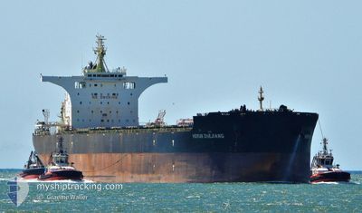
HERUN ZHEJIANG
Cargo
Current Trip
| Trip Time | 23 days |
|---|---|
| Trip Distance | 3494.00 nm |
| AVG Speed | 10.1 Knopen |
| MAX Speed | 14.5 Knopen |
| Diepgang | 17.9 M |
| AVG Wind | 10.6 knots |
| MAX Wind | 30 knots |
| MIN Temp | 20.4°C / 68.72°F |
| MAX Temp | 30.3°C / 86.54°F |
| Positie ontvangen | 15 d geleden |
Current Position
| Lengtegraad | 119.57349° |
|---|---|
| Breedtegraat | 15.01396° |
| Status | Under way using engine |
| Snelheid | 10.5 Knopen |
| Koers | 351.9° |
| Gebied | South China Sea |
| Station | T-AIS |
| Positie ontvangen | 15 d geleden |
Info
Information
The current position of HERUN ZHEJIANG is in South China Sea with coordinates 15.01396° / 119.57349° as reported on 2024-06-10 21:08 by AIS to our vessel tracker app. The vessel's current speed is 10.5 Knopen and is currently inside the port of TAICANG.
The vessel HERUN ZHEJIANG (IMO: 9715488, MMSI: 477439500) is a Cargo It's sailing under the flag of [HK] Hong Kong.
In this page you can find informations about the vessels current position, last detected port calls, and current voyage information. If the vessels is not in coverage by AIS you will find the latest position.
The current position of HERUN ZHEJIANG is detected by our AIS receivers and we are not responsible for the reliability of the data. The last position was recorded while the vessel was in Coverage by the Ais receivers of our vessel tracking app.
The current draught of HERUN ZHEJIANG as reported by AIS is 17.9 meters
Weather
| Temperature | 21.8°C / 71.24°F |
|---|---|
| Wind Speed | 13 knots |
| Direction | 69° ENE |
| Pressure | 1012.8 hPa |
| Humidity | 94.8 % |
| Cloud Coverage | 100 % |
Featured Company
Most Visited Ports (Last year)
| Port | Arrivals | |
|---|---|---|
| 2 | ||
| 2 | ||
| 2 | ||
| 2 | ||
| 2 | ||
| 1 |
Last Trips
| Origin | Departure | Destination | Arrival | Distance | |
|---|---|---|---|---|---|
| 2024-06-02 05:51 | 2024-06-25 17:01 | 3494.00 nm | |||
| 2024-05-13 19:12 | 2024-05-31 16:39 | 3612.43 nm | |||
| 2024-04-23 09:29 | 2024-05-11 07:44 | 3975.90 nm | |||
| 2024-04-07 22:33 | 2024-04-21 12:13 | 3619.75 nm | |||
| 2024-03-20 18:36 | 2024-04-05 00:01 | 3610.78 nm |
Events
| Tijd | Evenement | Details | Positie / Bestemming | Info |
|---|---|---|---|---|
| 2024-06-25 09:01 | Stop beweging |
31.68243 / 121.16671
[CN] TAICANG
|
Snelheid: 0.3 kn Koers: 296° |
|
| 2024-06-25 09:01 | Aankomsthaven |
|
31.68243 / 121.16671
[CN] TAICANG
|
Snelheid: 1.1 kn Koers: 296° |
| 2024-06-24 22:36 | Start beweging |
31.13621 / 122.89128
CN TAO
|
Snelheid: 3.6 kn Koers: 261° |
|
| 2024-06-22 16:27 | Stop beweging |
31.13444 / 122.89374
CN TAO
|
Snelheid: 0.3 kn Koers: 342° |
|
| 2024-06-22 00:41 | Start beweging | 7.72 nm, South West of ZHOUSHAN |
29.89778 / 122.07484
CN TAO
|
Snelheid: 3.3 kn Koers: 1° |
| 2024-06-21 01:45 | Stop beweging | 7.73 nm, South West of ZHOUSHAN |
29.89380 / 122.07766
CN TAO
|
Snelheid: 0.3 kn Koers: 251° |
| 2024-06-20 19:22 | Start beweging |
29.74778 / 122.97195
CN TAO
|
Snelheid: 3.8 kn Koers: 300° |