

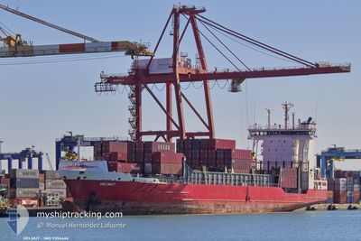
HELMUT
Container Ship

Current Trip
| Trip Time | 8 days |
|---|---|
| Trip Distance | 1009.71 nm |
| AVG Speed | 12.1 Knopen |
| MAX Speed | 15.2 Knopen |
| Diepgang | 8.5 M |
| AVG Wind | 17.1 knots |
| MAX Wind | 30.8 knots |
| MIN Temp | 11.7°C / 53.06°F |
| MAX Temp | 19°C / 66.2°F |
| Positie ontvangen | 3 m geleden |
Current Position
| Lengtegraad | --- |
|---|---|
| Breedtegraat | --- |
| Status | Moored |
| Snelheid | |
| Koers | 333° |
| Gebied | North Atlantic Ocean |
| Station | T-AIS |
| Positie ontvangen | 3 m geleden |
Information
The current position of HELMUT is in North Atlantic Ocean with coordinates 33.61241° / -7.59786° as reported on 2025-03-29 02:16 by AIS to our vessel tracker app. The vessel's current speed is 0 Knopen and is currently inside the port of CASABLANCA.
The vessel HELMUT (IMO: 9354466, MMSI: 255806016) is a Container Ship that was built in 2006 ( 19 Jaar oud ). It's sailing under the flag of [PT] Portugal.
In this page you can find informations about the vessels current position, last detected port calls, and current voyage information. If the vessels is not in coverage by AIS you will find the latest position.
The current position of HELMUT is detected by our AIS receivers and we are not responsible for the reliability of the data. The last position was recorded while the vessel was in Coverage by the Ais receivers of our vessel tracking app.
The current draught of HELMUT as reported by AIS is 8.5 meters
Weather
| Temperature | 12.1°C / 53.78°F |
|---|---|
| Wind Speed | 5 knots |
| Direction | 60° ENE |
| Pressure | 1017.2 hPa |
| Humidity | 70.4 % |
| Cloud Coverage | 100 % |


Featured Company
Last Port Calls
| Port | Arrival | Departure | Time In Port |
|---|---|---|---|
| 2025-03-29 01:20 | |||
| 2025-03-19 06:28 | 2025-03-20 12:00 | 1 d | |
| 2025-03-16 10:12 | 2025-03-17 00:07 | 13 h | |
| 2025-03-12 20:50 | 2025-03-13 16:47 | 19 h | |
| 2025-03-10 08:31 | 2025-03-11 02:00 | 17 h | |
| 2025-03-08 03:21 | |||
| 2025-03-02 10:08 | 2025-03-04 14:46 | 2 d | |
| 2025-02-27 12:20 | 2025-02-28 14:52 | 1 d | |
| 2025-02-25 14:26 | 2025-02-26 09:22 | 18 h | |
| 2025-02-23 10:26 | 2025-02-24 04:18 | 17 h |
Most Visited Ports (Last year)
| Port | Arrivals | |
|---|---|---|
| 33 | ||
| 19 | ||
| 12 | ||
| 12 | ||
| 7 | ||
| 4 |
Last Trips
| Origin | Departure | Destination | Arrival | Distance | |
|---|---|---|---|---|---|
| 2025-03-20 12:00 | 2025-03-29 01:20 | 1009.71 nm | |||
| 2025-03-17 00:07 | 2025-03-19 06:28 | 314.68 nm | |||
| 2025-03-13 16:47 | 2025-03-16 10:12 | 968.80 nm | |||
| 2025-03-11 02:00 | 2025-03-12 20:50 | 323.98 nm | |||
| 2025-03-08 03:21 | 2025-03-10 08:31 | 786.82 nm | |||
| 2025-02-28 14:52 | 2025-03-02 10:08 | 507.94 nm | |||
| 2025-02-26 09:22 | 2025-02-27 12:20 | 373.95 nm | |||
| 2025-02-24 04:18 | 2025-02-25 14:26 | 487.55 nm | |||
| 2025-02-23 06:07 | 2025-02-23 10:26 | 42.27 nm | |||
| 2025-02-20 21:22 | 2025-02-22 15:28 | 594.49 nm |
Events
| Tijd | Evenement | Details | Positie / Bestemming | Info |
|---|---|---|---|---|
| 2025-03-29 02:10 | Status Changed | Moored Default |
33.61241 / -7.59786
[MA] CASABLANCA
|
Snelheid: Koers: 333° |
| 2025-03-29 01:49 | Status Changed | Default Moored |
33.61241 / -7.59786
[MA] CASABLANCA
|
Snelheid: Koers: 332° |
| 2025-03-29 01:43 | Status Changed | Moored Under way using engine |
33.61240 / -7.59787
[MA] CASABLANCA
|
Snelheid: 0.1 kn Koers: 332° |
| 2025-03-29 01:36 | Stop beweging |
33.61220 / -7.59795
[MA] CASABLANCA
|
Snelheid: 0.3 kn Koers: 328° |
|
| 2025-03-29 01:20 | Aankomsthaven |
|
33.61896 / -7.58806
[MA] CASABLANCA
|
Snelheid: 6.4 kn Koers: 235.2° |
| 2025-03-29 00:55 | Start beweging | 1.56 nm, North of CASABLANCA |
33.64048 / -7.59997
MACAS
|
Snelheid: 3.9 kn Koers: 99° |
| 2025-03-29 00:40 | Status Changed | Under way using engine Default |
33.64130 / -7.60277
MACAS
|
Snelheid: 0.3 kn Koers: 48° |
| 2025-03-29 00:38 | Status Changed | Default At anchor |
33.64131 / -7.60224
MACAS
|
Snelheid: Koers: 78° |
| 2025-03-28 23:32 | Status Changed | At anchor Default |
33.64059 / -7.60235
MACAS
|
Snelheid: 0.1 kn Koers: 51° |
| 2025-03-28 23:26 | Status Changed | Default At anchor |
33.64045 / -7.60238
MACAS
|
Snelheid: 0.1 kn Koers: 49° |