
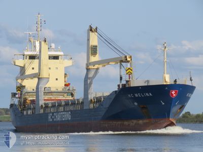
HC MELINA
General Cargo
Current Trip
| Time Travelled | 10 days |
|---|---|
| Remaining Time | 4 days |
| Distance Travelled | 2612.74 nm |
| Remaining Distance | 1177.10 nm |
| AVG Speed | 11.2 Knopen |
| MAX Speed | 13 Knopen |
| AVG Wind | 6.7 knots |
| MAX Wind | 20.3 knots |
| MIN Temp | 24.9°C / 76.82°F |
| MAX Temp | 30.6°C / 87.08°F |
| Diepgang | 6 M |
| Positie ontvangen | 7 d geleden |
Current Position
| Lengtegraad | 57.29971° |
|---|---|
| Breedtegraat | 24.91356° |
| Status | Under way using engine |
| Snelheid | 11.9 Knopen |
| Koers | 123.8° |
| Gebied | Gulf of Oman |
| Station | T-AIS |
| Positie ontvangen | 7 d geleden |
Info
Information
The current position of HC MELINA is in Gulf of Oman with coordinates 24.91356° / 57.29971° as reported on 2024-04-23 19:40 by AIS to our vessel tracker app. The vessel's current speed is 11.9 Knopen and is heading at the port of SINGAPORE. The estimated time of arrival as calculated by MyShipTracking vessel tracking app is 2024-05-05 13:14 LT
The vessel HC MELINA (IMO: 9415052, MMSI: 305767000) is a General Cargo that was built in 2011 ( 13 Jaar oud ). It's sailing under the flag of [AG] Antigua Barbuda.
In this page you can find informations about the vessels current position, last detected port calls, and current voyage information. If the vessels is not in coverage by AIS you will find the latest position.
The current position of HC MELINA is detected by our AIS receivers and we are not responsible for the reliability of the data. The last position was recorded while the vessel was in Coverage by the Ais receivers of our vessel tracking app.
The current draught of HC MELINA as reported by AIS is 6 meters
Weather
| Temperature | 29.9°C / 85.82°F |
|---|---|
| Wind Speed | 7 knots |
| Direction | 215° SW |
| Pressure | 1006.2 hPa |
| Humidity | 74.5 % |
| Cloud Coverage | 100 % |
Featured Company
Last Port Calls
| Port | Arrival | Departure | Time In Port |
|---|---|---|---|
| 2024-04-16 20:39 | 2024-04-20 22:00 | 4 d | |
| 2024-03-25 11:46 | 2024-03-25 19:25 | 7 h |
Most Visited Ports (Last year)
| Port | Arrivals | |
|---|---|---|
| 5 | ||
| 3 | ||
| 2 | ||
| 2 | ||
| 2 | ||
| 2 |
Last Trips
| Origin | Departure | Destination | Arrival | Distance | |
|---|---|---|---|---|---|
| 2024-03-25 23:25 | 2024-04-16 23:39 | 1257.42 nm | |||
| 2024-02-24 20:54 | 2024-03-25 15:46 | 8565.16 nm |
Events
| Tijd | Evenement | Details | Positie / Bestemming | Info |
|---|---|---|---|---|
| 2024-04-23 19:47 | Status Changed | Default Under way using engine |
24.90186 / 57.31831
SG SIN
|
Snelheid: 11.9 kn Koers: 123.8° |
| 2024-04-23 19:40 | Buitenbereik |
24.91356 / 57.29971
Gulf of Oman
SG SIN
|
Snelheid: 11.9 kn Koers: 123.8° |
|
| 2024-04-23 18:07 | Wijzig zee gebeid | Omani part of the Gulf of Oman United Arab Emirates part of the Gulf of Oman |
25.08029 / 57.01143
Gulf of Oman
SG SIN
|
Snelheid: 11.8 kn Koers: 120.7° |
| 2024-04-23 15:02 | Start beweging | 8.64 nm, North East of FUJAIRAH |
25.22648 / 56.49819
SG SIN
|
Snelheid: 3.1 kn Koers: 139° |
| 2024-04-23 14:59 | Status Changed | Under way using engine At anchor |
25.22809 / 56.49657
SG SIN
|
Snelheid: 2 kn Koers: 140° |
| 2024-04-23 14:32 | ETA Changed | 2024/05/05 04:00 2024/05/05 07:00 |
25.23103 / 56.49450
SG SIN
|
Snelheid: Koers: 151° |
| 2024-04-23 14:22 | Draught Changed | 6 5.9 |
25.23114 / 56.49448
SG SIN
|
Snelheid: Koers: 155° |
| 2024-04-23 14:16 | Destination Changed | SG SIN AE FJR |
25.23106 / 56.49452
SG SIN
|
Snelheid: Koers: 158° |
| 2024-04-23 14:16 | ETA Changed | 2024/05/05 07:00 2024/05/05 11:30 |
25.23106 / 56.49452
SG SIN
|
Snelheid: Koers: 158° |
| 2024-04-23 14:14 | ETA Changed | 2024/05/05 11:30 2024/04/22 11:30 |
25.23111 / 56.49448
AE FJR
|
Snelheid: 0.1 kn Koers: 159° |