
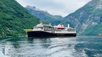
HAVILA POLARIS
Passenger
Current Trip
| Time Travelled | 59 mins |
|---|---|
| Remaining Time | 1 day |
| Distance Travelled | 12.44 nm |
| Remaining Distance | 459.04 nm |
| AVG Speed | 14.7 Knopen |
| MAX Speed | 15.2 Knopen |
| AVG Wind | 4.3 knots |
| MAX Wind | 5.4 knots |
| MIN Temp | 4°C / 39.2°F |
| MAX Temp | 4.6°C / 40.28°F |
| Diepgang | 5.3 M |
| Positie ontvangen | 1 m geleden |
Current Position
| Lengtegraad | --- |
|---|---|
| Breedtegraat | --- |
| Status | Under way using engine |
| Snelheid | 10.9 Knopen |
| Koers | 167.2° |
| Gebied | Norwegian Sea |
| Station | T-AIS |
| Positie ontvangen | 1 m geleden |
Info
Information
The current position of HAVILA POLARIS is in Norwegian Sea with coordinates 66.03052° / 12.64416° as reported on 2024-10-06 09:47 by AIS to our vessel tracker app. The vessel's current speed is 10.9 Knopen and is heading at the port of BERGEN. The estimated time of arrival as calculated by MyShipTracking vessel tracking app is 2024-10-07 20:57 LT
The vessel HAVILA POLARIS (IMO: 9946910, MMSI: 258094000) is a Passenger It's sailing under the flag of [NO] Norway.
In this page you can find informations about the vessels current position, last detected port calls, and current voyage information. If the vessels is not in coverage by AIS you will find the latest position.
The current position of HAVILA POLARIS is detected by our AIS receivers and we are not responsible for the reliability of the data. The last position was recorded while the vessel was in Coverage by the Ais receivers of our vessel tracking app.
The current draught of HAVILA POLARIS as reported by AIS is 5.3 meters
Weather
| Temperature | 4.5°C / 40.1°F |
|---|---|
| Wind Speed | 3 knots |
| Direction | 46° NE |
| Pressure | 1010 hPa |
| Humidity | 64.1 % |
| Cloud Coverage | 8 % |
Featured Company
Last Port Calls
| Port | Arrival | Departure | Time In Port |
|---|---|---|---|
| 2024-10-06 10:37 | 2024-10-06 10:50 | 12 m | |
| 2024-10-06 06:20 | 2024-10-06 06:36 | 16 m | |
| 2024-10-06 02:17 | 2024-10-06 03:33 | 1 h | |
| 2024-10-05 22:01 | 2024-10-05 22:22 | 20 m | |
| 2024-10-05 18:35 | 2024-10-05 20:29 | 1 h | |
| 2024-10-05 14:15 | 2024-10-05 15:14 | 58 m | |
| 2024-10-05 12:33 | 2024-10-05 13:03 | 30 m | |
| 2024-10-05 07:54 | 2024-10-05 08:32 | 37 m | |
| 2024-10-05 04:19 | 2024-10-05 04:30 | 10 m | |
| 2024-10-04 23:58 | 2024-10-05 01:33 | 1 h |
Last Trips
| Origin | Departure | Destination | Arrival | Distance | |
|---|---|---|---|---|---|
| 2024-10-06 06:36 | 2024-10-06 10:37 | 54.70 nm | |||
| 2024-10-06 03:33 | 2024-10-06 06:20 | 37.81 nm | |||
| 2024-10-05 22:22 | 2024-10-06 02:17 | 53.02 nm | |||
| 2024-10-05 20:29 | 2024-10-05 22:01 | 19.35 nm | |||
| 2024-10-05 15:14 | 2024-10-05 18:35 | 38.96 nm | |||
| 2024-10-05 13:03 | 2024-10-05 14:15 | 15.13 nm | |||
| 2024-10-05 08:32 | 2024-10-05 12:33 | 43.67 nm | |||
| 2024-10-05 04:30 | 2024-10-05 07:54 | 42.97 nm | |||
| 2024-10-05 01:33 | 2024-10-05 04:19 | 36.82 nm | |||
| 2024-10-04 12:53 | 2024-10-04 23:58 | 139.98 nm |
Events
| Tijd | Evenement | Details | Positie / Bestemming | Info |
|---|---|---|---|---|
| 2024-10-06 08:50 | Start beweging | 0.42 nm, South West of NESNA |
66.19522 / 13.00099
NO BGO
|
Snelheid: 10.1 kn Koers: 194° |
| 2024-10-06 08:50 | Vertrekhaven |
|
66.19522 / 13.00099
NO BGO
|
Snelheid: 5.1 kn Koers: 216° |
| 2024-10-06 08:40 | Stop beweging |
66.20015 / 13.00757
[NO] NESNA
|
Snelheid: 0.1 kn Koers: 202° |
|
| 2024-10-06 08:37 | Aankomsthaven |
|
66.20031 / 13.00752
[NO] NESNA
|
Snelheid: 5.6 kn Koers: 149.6° |
| 2024-10-06 04:36 | Vertrekhaven |
|
66.86300 / 13.69266
NO BGO
|
Snelheid: 7.4 kn Koers: 225° |
| 2024-10-06 04:35 | Start beweging |
66.86782 / 13.69677
[NO] ORNES
|
Snelheid: 7.4 kn Koers: 225° |
|
| 2024-10-06 04:23 | Stop beweging |
66.86883 / 13.70226
[NO] ORNES
|
Snelheid: Koers: 227° |
|
| 2024-10-06 04:20 | Aankomsthaven |
|
66.86954 / 13.70239
[NO] ORNES
|
Snelheid: 5.2 kn Koers: 136.5° |
| 2024-10-06 01:33 | Vertrekhaven |
|
67.28437 / 14.35986
NO BGO
|
Snelheid: 11.2 kn Koers: 238° |
| 2024-10-06 01:28 | Start beweging |
67.28968 / 14.39046
[NO] BODOE
|
Snelheid: 5.6 kn Koers: 246° |