

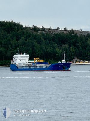
HAV SUND
General Cargo

Current Trip
TOVIK
| Time Travelled | 1 day |
|---|---|
| Remaining Time | --- |
| Distance Travelled | 374.28 nm |
| Remaining Distance | --- |
| AVG Speed | 8.8 Knopen |
| MAX Speed | 12 Knopen |
| AVG Wind | 13 knots |
| MAX Wind | 22.5 knots |
| MIN Temp | 5.2°C / 41.36°F |
| MAX Temp | 8.3°C / 46.94°F |
| Diepgang | 5 M |
| Positie ontvangen | Nu |
Current Position
| Lengtegraad | --- |
|---|---|
| Breedtegraat | --- |
| Status | Under way using engine |
| Snelheid | 10 Knopen |
| Koers | 339.9° |
| Gebied | North Sea |
| Station | T-AIS |
| Positie ontvangen | Nu |
Information
The current position of HAV SUND is in North Sea with coordinates 59.99430° / 5.35325° as reported on 2025-03-29 16:05 by AIS to our vessel tracker app. The vessel's current speed is 10 Knopen
The vessel HAV SUND (IMO: 9361768, MMSI: 231075000) is a General Cargo that was built in 2008 ( 17 Jaar oud ). It's sailing under the flag of [FO] Faroe Is.
In this page you can find informations about the vessels current position, last detected port calls, and current voyage information. If the vessels is not in coverage by AIS you will find the latest position.
The current position of HAV SUND is detected by our AIS receivers and we are not responsible for the reliability of the data. The last position was recorded while the vessel was in Coverage by the Ais receivers of our vessel tracking app.
The current draught of HAV SUND as reported by AIS is 5 meters
Weather
| Temperature | 5.7°C / 42.26°F |
|---|---|
| Wind Speed | 11 knots |
| Direction | 200° SSW |
| Pressure | 1008.5 hPa |
| Humidity | 77.4 % |
| Cloud Coverage | 93 % |


Featured Company
Last Port Calls
| Port | Arrival | Departure | Time In Port |
|---|---|---|---|
| 2025-03-27 06:29 | 2025-03-27 21:07 | 14 h | |
| 2025-03-24 21:03 | 2025-03-26 14:29 | 1 d | |
| 2025-03-16 17:56 | 2025-03-17 19:04 | 1 d | |
| 2025-03-15 14:38 | 2025-03-16 05:50 | 15 h | |
| 2025-03-10 19:30 | 2025-03-11 03:21 | 7 h | |
| 2025-03-08 05:53 | 2025-03-08 20:26 | 14 h | |
| 2025-03-05 08:24 | 2025-03-05 15:45 | 7 h | |
| 2025-03-02 12:58 | 2025-03-03 11:32 | 22 h | |
| 2025-02-25 06:51 | 2025-02-26 05:13 | 22 h | |
| 2025-02-20 00:34 | 2025-02-20 16:48 | 16 h |
Last Trips
| Origin | Departure | Destination | Arrival | Distance | |
|---|---|---|---|---|---|
| 2025-03-26 14:29 | 2025-03-27 06:29 | 136.84 nm | |||
| 2025-03-17 19:04 | 2025-03-24 21:03 | 1181.37 nm | |||
| 2025-03-16 05:50 | 2025-03-16 17:56 | 98.13 nm | |||
| 2025-03-11 03:21 | 2025-03-15 14:38 | 861.02 nm | |||
| 2025-03-08 20:26 | 2025-03-10 19:30 | 352.36 nm | |||
| 2025-03-05 15:45 | 2025-03-08 05:53 | 434.58 nm | |||
| 2025-03-03 11:32 | 2025-03-05 08:24 | 438.10 nm | |||
| 2025-02-26 05:13 | 2025-03-02 12:58 | 655.24 nm | |||
| 2025-02-20 16:48 | 2025-02-25 06:51 | 1044.71 nm | |||
| 2025-02-18 23:11 | 2025-02-20 00:34 | 199.33 nm |
Events
| Tijd | Evenement | Details | Positie / Bestemming | Info |
|---|---|---|---|---|
| 2025-03-29 06:02 | ETA Changed | 2025/04/01 12:00 2025/04/01 06:00 |
58.55674 / 5.60093
TOVIK
|
Snelheid: 9.2 kn Koers: 323.5° |
| 2025-03-28 22:30 | Wijzig zee gebeid | Norwegian part of the North Sea Norwegian part of the Skaggerak |
57.93234 / 7.10623
North Sea
TOVIK
|
Snelheid: 8.1 kn Koers: 281° |
| 2025-03-28 13:41 | Wijzig zee gebeid | Norwegian part of the Skaggerak Danish part of the Skaggerak |
57.91444 / 9.25352
Skaggerak
TOVIK
|
Snelheid: 7.6 kn Koers: 283.1° |
| 2025-03-28 12:06 | Destination Changed | TOVIK NOSKL |
57.89259 / 9.61040
TOVIK
|
Snelheid: 7.5 kn Koers: 274.8° |
| 2025-03-28 06:46 | Wijzig zee gebeid | Danish part of the Skaggerak Danish part of the Kattegat |
57.77781 / 10.81648
Skaggerak
NOSKL
|
Snelheid: 11.7 kn Koers: 5.5° |
| 2025-03-28 05:48 | ETA Changed | 2025/04/01 06:00 2025/03/31 20:00 |
57.61125 / 10.79178
NOSKL
|
Snelheid: 10 kn Koers: 6.1° |
| 2025-03-28 05:31 | Draught Changed | 5 4.8 |
57.56513 / 10.78202
NOSKL
|
Snelheid: 9.9 kn Koers: 7.3° |
| 2025-03-27 22:37 | Start beweging | 12.37 nm, North East of RANDERS |
56.60547 / 10.31798
NOSKL
|
Snelheid: 6.1 kn Koers: 108.4° |
| 2025-03-27 22:35 | Stop beweging | 12.32 nm, North East of RANDERS |
56.60625 / 10.31462
NOSKL
|
Snelheid: Koers: 116° |
| 2025-03-27 20:12 | Draught Changed | 4.8 4.7 |
56.46417 / 10.09835
NOSKL
|
Snelheid: 6 kn Koers: 104.1° |