
HARVEST RAIN
Cargo
Current Trip
KAOSHIUNG
| Time Travelled | 2 days |
|---|---|
| Remaining Time | --- |
| Distance Travelled | 538.74 nm |
| Remaining Distance | --- |
| AVG Speed | 10.3 Knopen |
| MAX Speed | 12.1 Knopen |
| AVG Wind | 14.2 knots |
| MAX Wind | 19.7 knots |
| MIN Temp | 24.1°C / 75.38°F |
| MAX Temp | 26.6°C / 79.88°F |
| Diepgang | 13.4 M |
| Positie ontvangen | 2 d geleden |
Current Position
| Lengtegraad | --- |
|---|---|
| Breedtegraat | --- |
| Status | Under way using engine |
| Snelheid | 10.5 Knopen |
| Koers | 223.3° |
| Gebied | South China Sea |
| Station | T-AIS |
| Positie ontvangen | 2 d geleden |
Info
Information
The current position of HARVEST RAIN is in South China Sea with coordinates 22.53712° / 120.21673° as reported on 2025-03-01 22:51 by AIS to our vessel tracker app. The vessel's current speed is 10.5 Knopen
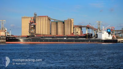
The vessel HARVEST RAIN (IMO: 9643893, MMSI: 538006315) is a Cargo It's sailing under the flag of [MH] Marshall Is.
In this page you can find informations about the vessels current position, last detected port calls, and current voyage information. If the vessels is not in coverage by AIS you will find the latest position.
The current position of HARVEST RAIN is detected by our AIS receivers and we are not responsible for the reliability of the data. The last position was recorded while the vessel was in Coverage by the Ais receivers of our vessel tracking app.
The current draught of HARVEST RAIN as reported by AIS is 13.4 meters
Weather
| Temperature | 27.2°C / 80.96°F |
|---|---|
| Wind Speed | 8 knots |
| Direction | 102° ESE |
| Pressure | 1009.6 hPa |
| Humidity | 84 % |
| Cloud Coverage | 44 % |
Featured Company
Last Trips
Events
| Tijd | Evenement | Details | Positie / Bestemming | Info |
|---|---|---|---|---|
| 2025-03-01 22:57 | Status Changed | Default Under way using engine |
22.51955 / 120.21138
KAOSHIUNG
|
Snelheid: 10.5 kn Koers: 223.3° |
| 2025-03-01 22:51 | Buitenbereik |
22.53712 / 120.21673
South China Sea
|
Snelheid: 10.5 kn Koers: 223.3° |
|
| 2025-03-01 22:40 | Status Changed | Under way using engine Default |
22.54569 / 120.25296
KAOSHIUNG
|
Snelheid: 11 kn Koers: 262° |
| 2025-03-01 22:34 | Binnenbereik |
22.54569 / 120.25296
South China Sea
|
Snelheid: 11.1 kn Koers: 258.6° |
|
| 2025-03-01 22:33 | Vertrekhaven |
|
22.54750 / 120.27340
KAOSHIUNG
|
Snelheid: 10.7 kn Koers: 267° |
| 2025-03-01 22:02 | Start beweging |
22.54349 / 120.33410
[TW] KAOHSIUNG
|
Snelheid: 3.1 kn Koers: 327° |
|
| 2025-02-28 00:30 | Stop beweging |
22.54000 / 120.33233
[TW] KAOHSIUNG
|
Snelheid: 0.1 kn Koers: 100° |
|
| 2025-02-27 23:49 | Aankomsthaven |
|
22.54737 / 120.28848
[TW] KAOHSIUNG
|
Snelheid: 7.6 kn Koers: 61° |
| 2025-02-27 23:46 | Status Changed | Default Under way using engine |
22.54487 / 120.27972
KAOSHIUNG
|
Snelheid: 5.1 kn Koers: 57.3° |
| 2025-02-27 23:39 | Buitenbereik |
22.53811 / 120.26935
South China Sea
[TW] KAOHSIUNG
|
Snelheid: 5.1 kn Koers: 57.3° |