

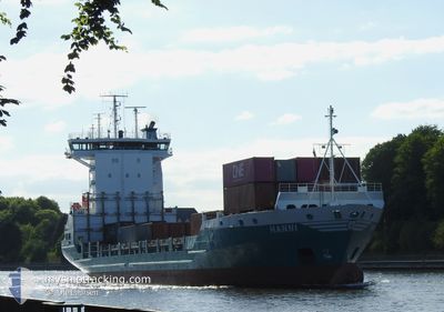
HANNI
Container Ship

Current Trip
| Time Travelled | 2 days |
|---|---|
| Remaining Time | 5 h, 17 mins |
| Distance Travelled | 592.97 nm |
| Remaining Distance | 55.88 nm |
| AVG Speed | 11.6 Knopen |
| MAX Speed | 16.9 Knopen |
| AVG Wind | 13.7 knots |
| MAX Wind | 28.8 knots |
| MIN Temp | 7.7°C / 45.86°F |
| MAX Temp | 11.7°C / 53.06°F |
| Diepgang | 6.3 M |
| Positie ontvangen | 14 h, 30 m geleden |
Current Position
| Lengtegraad | --- |
|---|---|
| Breedtegraat | --- |
| Status | Under way using engine |
| Snelheid | 11.8 Knopen |
| Koers | 318.2° |
| Gebied | Celtic Sea |
| Station | T-AIS |
| Positie ontvangen | 14 h, 30 m geleden |
Information
The current position of HANNI is in Celtic Sea with coordinates 50.43158° / -6.00819° as reported on 2025-03-22 15:15 by AIS to our vessel tracker app. The vessel's current speed is 11.8 Knopen and is heading at the port of DUBLIN. The estimated time of arrival as calculated by MyShipTracking vessel tracking app is 2025-03-23 11:03 LT
The vessel HANNI (IMO: 9188506, MMSI: 211286440) is a Container Ship that was built in 1998 ( 27 Jaar oud ). It's sailing under the flag of [DE] Germany.
In this page you can find informations about the vessels current position, last detected port calls, and current voyage information. If the vessels is not in coverage by AIS you will find the latest position.
The current position of HANNI is detected by our AIS receivers and we are not responsible for the reliability of the data. The last position was recorded while the vessel was in Coverage by the Ais receivers of our vessel tracking app.
The current draught of HANNI as reported by AIS is 6.3 meters
Weather
| Temperature | 7.7°C / 45.86°F |
|---|---|
| Wind Speed | 29 knots |
| Direction | 351° N |
| Pressure | 1005.2 hPa |
| Humidity | 85 % |
| Cloud Coverage | 100 % |


Featured Company
Last Port Calls
| Port | Arrival | Departure | Time In Port |
|---|---|---|---|
| 2025-03-19 19:20 | 2025-03-21 02:50 | 1 d | |
| 2025-03-15 22:42 | 2025-03-16 06:01 | 7 h | |
| 2025-03-15 02:47 | 2025-03-15 10:02 | 7 h | |
| 2025-03-13 07:24 | 2025-03-13 16:09 | 8 h | |
| 2025-03-11 23:41 | 2025-03-12 11:20 | 11 h | |
| 2025-03-10 14:27 | 2025-03-10 14:31 | 3 m | |
| 2025-03-09 06:34 | 2025-03-09 22:08 | 15 h | |
| 2025-03-08 01:56 | 2025-03-08 21:14 | 19 h | |
| 2025-03-06 08:41 | 2025-03-06 18:49 | 10 h | |
| 2025-03-05 06:38 | 2025-03-05 13:16 | 6 h |
Most Visited Ports (Last year)
| Port | Arrivals | |
|---|---|---|
| 45 | ||
| 38 | ||
| 30 | ||
| 26 | ||
| 9 | ||
| 8 |
Last Trips
| Origin | Departure | Destination | Arrival | Distance | |
|---|---|---|---|---|---|
| 2025-03-16 06:01 | 2025-03-19 19:20 | 263.53 nm | |||
| 2025-03-15 10:02 | 2025-03-15 22:42 | 119.25 nm | |||
| 2025-03-13 16:09 | 2025-03-15 02:47 | 307.28 nm | |||
| 2025-03-12 11:20 | 2025-03-13 07:24 | 272.60 nm | |||
| 2025-03-10 14:31 | 2025-03-11 23:41 | 460.93 nm | |||
| 2025-03-08 21:14 | 2025-03-09 06:34 | 114.88 nm | |||
| 2025-03-06 18:49 | 2025-03-08 01:56 | 353.61 nm | |||
| 2025-03-05 13:16 | 2025-03-06 08:41 | 272.43 nm | |||
| 2025-03-03 02:33 | 2025-03-05 06:38 | 548.97 nm | |||
| 2025-02-28 13:47 | 2025-03-01 06:06 | 117.27 nm |
Events
| Tijd | Evenement | Details | Positie / Bestemming | Info |
|---|---|---|---|---|
| 2025-03-22 15:24 | Status Changed | Default Under way using engine |
50.45349 / -6.03557
IEDUB
|
Snelheid: 11.8 kn Koers: 318.2° |
| 2025-03-22 15:15 | Buitenbereik |
50.43158 / -6.00819
Celtic Sea
IEDUB
|
Snelheid: 11.8 kn Koers: 318.2° |
|
| 2025-03-22 15:14 | Status Changed | Under way using engine Default |
50.42748 / -6.00233
IEDUB
|
Snelheid: 11.9 kn Koers: 318° |
| 2025-03-22 15:12 | Status Changed | Default Under way using engine |
50.42303 / -5.99596
IEDUB
|
Snelheid: 12 kn Koers: 326.6° |
| 2025-03-22 12:49 | Status Changed | Under way using engine Default |
50.01515 / -5.88230
IEDUB
|
Snelheid: 10.7 kn Koers: 1° |
| 2025-03-22 12:48 | Status Changed | Default Under way using engine |
50.01167 / -5.88213
IEDUB
|
Snelheid: 10 kn Koers: 332.1° |
| 2025-03-22 12:29 | Gevonden in zee | United Kingdom part of the Celtic Sea |
49.98152 / -5.82771
Celtic Sea
IEDUB
|
Snelheid: 10.7 kn Koers: 281.7° |
| 2025-03-22 12:29 | Status Changed | Under way using engine Default |
49.98152 / -5.82771
IEDUB
|
Snelheid: 10.6 kn Koers: 284° |
| 2025-03-22 11:32 | Status Changed | Default Under way using engine |
49.94246 / -5.56598
IEDUB
|
Snelheid: 11 kn Koers: 284.8° |
| 2025-03-22 11:21 | Status Changed | Under way using engine Default |
49.93461 / -5.51570
IEDUB
|
Snelheid: 10.9 kn Koers: 285° |