

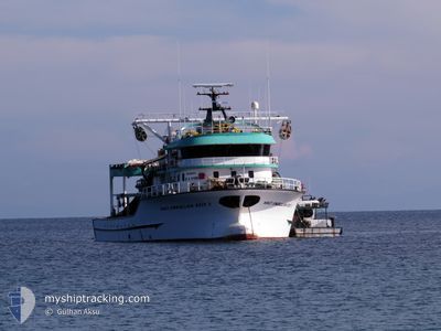
HACI EMRULLAH REIS 3
Fishing

Current Trip
Unknown
| Time Travelled | 15 days |
|---|---|
| Remaining Time | --- |
| Distance Travelled | 334.00 nm |
| Remaining Distance | --- |
| AVG Speed | 7.5 Knopen |
| MAX Speed | 18.3 Knopen |
| AVG Wind | 8.6 knots |
| MAX Wind | 17 knots |
| MIN Temp | 1.2°C / 34.16°F |
| MAX Temp | 14.9°C / 58.82°F |
| Diepgang | --- |
| Positie ontvangen | 45 m geleden |
Current Position
| Lengtegraad | --- |
|---|---|
| Breedtegraat | --- |
| Status | Default |
| Snelheid | 7.5 Knopen |
| Koers | 80° |
| Gebied | Aegean Sea |
| Station | T-AIS |
| Positie ontvangen | 45 m geleden |
Information
The current position of HACI EMRULLAH REIS 3 is in Aegean Sea with coordinates 37.69750° / 27.07311° as reported on 2025-03-05 17:38 by AIS to our vessel tracker app. The vessel's current speed is 7.5 Knopen
The vessel HACI EMRULLAH REIS 3 (MMSI: 271073610) is a Fishing It's sailing under the flag of [TR] Turkey.
In this page you can find informations about the vessels current position, last detected port calls, and current voyage information. If the vessels is not in coverage by AIS you will find the latest position.
The current position of HACI EMRULLAH REIS 3 is detected by our AIS receivers and we are not responsible for the reliability of the data. The last position was recorded while the vessel was in Coverage by the Ais receivers of our vessel tracking app.
Weather
| Temperature | 14.2°C / 57.56°F |
|---|---|
| Wind Speed | 9 knots |
| Direction | 327° NNW |
| Pressure | 1023.5 hPa |
| Humidity | 62.5 % |
| Cloud Coverage | --- |


Featured Company
Most Visited Ports (Last year)
| Port | Arrivals | |
|---|---|---|
| 15 | ||
| 4 |
Events
| Tijd | Evenement | Details | Positie / Bestemming | Info |
|---|---|---|---|---|
| 2025-03-05 16:56 | Start beweging | 3.43 nm, South East of PYTHAGOREIO |
37.64858 / 26.99718
|
Snelheid: 8.2 kn Koers: 322° |
| 2025-03-05 10:02 | Stop beweging | 3.89 nm, South East of PYTHAGOREIO |
37.64926 / 27.01058
|
Snelheid: 0.2 kn Koers: 511° |
| 2025-03-05 08:49 | Gevonden in zee | Greek part of the Aegean Sea |
37.54146 / 27.03195
Aegean Sea
|
Snelheid: 6.9 kn Koers: 344° |
| 2025-03-05 08:49 | Binnenbereik |
37.54146 / 27.03195
Aegean Sea
|
Snelheid: 6.9 kn Koers: 344° |
|
| 2025-03-04 00:41 | Buitenbereik |
36.68550 / 28.32205
Mediterranean Sea - Eastern Basin
|
Snelheid: 7.8 kn Koers: 187° |
|
| 2025-03-03 23:55 | Start beweging | 4.8 nm, South East of MARMARIS |
36.76264 / 28.32261
|
Snelheid: 4.2 kn Koers: 65° |
| 2025-03-03 22:01 | Stop beweging | 4.64 nm, South East of MARMARIS |
36.76347 / 28.31754
|
Snelheid: 0.3 kn Koers: 511° |
| 2025-03-03 20:49 | Binnenbereik |
36.70345 / 28.44589
Mediterranean Sea - Eastern Basin
|
Snelheid: 7.7 kn Koers: 290° |
|
| 2025-03-03 18:40 | Buitenbereik |
36.72432 / 28.47870
Mediterranean Sea - Eastern Basin
|
Snelheid: 8.4 kn Koers: 115° |
|
| 2025-03-03 15:21 | Binnenbereik |
36.80217 / 28.23980
Mediterranean Sea - Eastern Basin
|
Snelheid: Koers: 0° |