

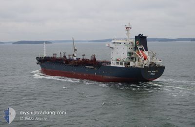
GT VICTORY
Oil/Chemical Tanker

Current Trip
MAPTAPHUT"THAILAND
| Time Travelled | 6 days |
|---|---|
| Remaining Time | --- |
| Distance Travelled | 1612.84 nm |
| Remaining Distance | --- |
| AVG Speed | 10.3 Knopen |
| MAX Speed | 13.6 Knopen |
| AVG Wind | 13.4 knots |
| MAX Wind | 34 knots |
| MIN Temp | 14.8°C / 58.64°F |
| MAX Temp | 28.5°C / 83.3°F |
| Diepgang | 5 M |
| Positie ontvangen | 11 d geleden |
Current Position
| Lengtegraad | --- |
|---|---|
| Breedtegraat | --- |
| Status | Under way sailing |
| Snelheid | 14.7 Knopen |
| Koers | 168° |
| Gebied | South China Sea |
| Station | T-AIS |
| Positie ontvangen | 11 d geleden |
Information
The current position of GT VICTORY is in South China Sea with coordinates 14.61395° / 109.26220° as reported on 2025-03-17 10:52 by AIS to our vessel tracker app. The vessel's current speed is 14.7 Knopen
The vessel GT VICTORY (IMO: 9321641, MMSI: 574003530) is a Oil/Chemical Tanker that was built in 2006 ( 19 Jaar oud ). It's sailing under the flag of [VN] Vietnam.
In this page you can find informations about the vessels current position, last detected port calls, and current voyage information. If the vessels is not in coverage by AIS you will find the latest position.
The current position of GT VICTORY is detected by our AIS receivers and we are not responsible for the reliability of the data. The last position was recorded while the vessel was in Coverage by the Ais receivers of our vessel tracking app.
The current draught of GT VICTORY as reported by AIS is 5 meters
Weather
| Temperature | 15.2°C / 59.36°F |
|---|---|
| Wind Speed | 33 knots |
| Direction | 36° NE |
| Pressure | 1019.6 hPa |
| Humidity | 82.8 % |
| Cloud Coverage | 100 % |


Featured Company
Last Port Calls
| Port | Arrival | Departure | Time In Port |
|---|---|---|---|
| 2025-03-20 15:01 | 2025-03-22 20:18 | 2 d | |
| 2025-02-09 13:59 | 2025-02-11 08:21 | 1 d | |
| 2025-02-04 01:32 | 2025-02-05 22:53 | 1 d | |
| 2025-01-31 00:38 | 2025-01-31 22:07 | 21 h | |
| 2025-01-29 10:34 | 2025-01-30 06:38 | 20 h | |
| 2025-01-21 11:19 | 2025-01-24 06:33 | 2 d | |
| 2025-01-18 00:33 | 2025-01-18 19:29 | 18 h | |
| 2025-01-10 01:05 | 2025-01-11 11:00 | 1 d |
Most Visited Ports (Last year)
| Port | Arrivals | |
|---|---|---|
| 10 | ||
| 5 | ||
| 3 | ||
| 3 | ||
| 3 | ||
| 2 |
Last Trips
| Origin | Departure | Destination | Arrival | Distance | |
|---|---|---|---|---|---|
| 2025-02-11 08:21 | 2025-03-20 15:01 | 2158.93 nm | |||
| 2025-02-05 22:53 | 2025-02-09 13:59 | 671.13 nm | |||
| 2025-01-31 22:07 | 2025-02-04 01:32 | 222.58 nm | |||
| 2025-01-30 06:38 | 2025-01-31 00:38 | 18.16 nm | |||
| 2025-01-24 06:33 | 2025-01-29 10:34 | 796.71 nm | |||
| 2025-01-18 19:29 | 2025-01-21 11:19 | 13.37 nm | |||
| 2025-01-11 11:00 | 2025-01-18 00:33 | 1232.93 nm | |||
| 2024-12-31 23:05 | 2025-01-10 01:05 | 1896.81 nm |
Events
| Tijd | Evenement | Details | Positie / Bestemming | Info |
|---|---|---|---|---|
| 2025-03-22 17:54 | Start beweging | 6.18 nm, South East of MAP TA PHUT |
12.56995 / 101.21239
MAPTAPHUT"THAILAND
|
Snelheid: 5.6 kn Koers: 162° |
| 2025-03-22 14:20 | Stop beweging | 5.96 nm, South East of MAP TA PHUT |
12.57587 / 101.21394
MAPTAPHUT"THAILAND
|
Snelheid: 0.3 kn Koers: 221° |
| 2025-03-22 13:18 | Vertrekhaven |
|
12.62397 / 101.15605
MAPTAPHUT"THAILAND
|
Snelheid: 8.5 kn Koers: 169° |
| 2025-03-22 13:02 | Start beweging |
12.65478 / 101.15078
[TH] MAP TA PHUT
|
Snelheid: 3.7 kn Koers: 220° |
|
| 2025-03-20 08:02 | Stop beweging |
12.65520 / 101.15504
[TH] MAP TA PHUT
|
Snelheid: 0.3 kn Koers: 273° |
|
| 2025-03-20 08:01 | Aankomsthaven |
|
12.65520 / 101.15504
[TH] MAP TA PHUT
|
Snelheid: 1.1 kn Koers: 273° |