
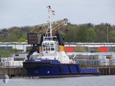
GROSSNORDSEE
Tug
Current Trip
| Time Travelled | 2 h, 52 mins |
|---|---|
| Remaining Time | --- |
| Distance Travelled | 20.56 nm |
| Remaining Distance | --- |
| AVG Speed | 7.7 Knopen |
| MAX Speed | 11.6 Knopen |
| AVG Wind | 6 knots |
| MAX Wind | 9.8 knots |
| MIN Temp | 14.8°C / 58.64°F |
| MAX Temp | 16.1°C / 60.98°F |
| Diepgang | 4.6 M |
| Positie ontvangen | Nu |
Current Position
| Lengtegraad | 8.64268° |
|---|---|
| Breedtegraat | 53.94940° |
| Status | Under way using engine |
| Snelheid | 11.8 Knopen |
| Koers | 310.2° |
| Gebied | North Sea |
| Station | T-AIS |
| Positie ontvangen | Nu |
Info
Information
The current position of GROSSNORDSEE is in North Sea with coordinates 53.94940° / 8.64268° as reported on 2024-05-22 14:37 by AIS to our vessel tracker app. The vessel's current speed is 11.8 Knopen and is heading at the port of LAUENBURG. The estimated time of arrival as calculated by MyShipTracking vessel tracking app is 2024-05-22 16:00 LT
The vessel GROSSNORDSEE (IMO: 9067271, MMSI: 218008130) is a Tug that was built in 1994 ( 30 Jaar oud ). It's sailing under the flag of [DE] Germany.
In this page you can find informations about the vessels current position, last detected port calls, and current voyage information. If the vessels is not in coverage by AIS you will find the latest position.
The current position of GROSSNORDSEE is detected by our AIS receivers and we are not responsible for the reliability of the data. The last position was recorded while the vessel was in Coverage by the Ais receivers of our vessel tracking app.
The current draught of GROSSNORDSEE as reported by AIS is 4.6 meters
Weather
| Temperature | 14.8°C / 58.64°F |
|---|---|
| Wind Speed | 9 knots |
| Direction | 260° W |
| Pressure | 1008.2 hPa |
| Humidity | 96.5 % |
| Cloud Coverage | 100 % |
Featured Company
Last Port Calls
| Port | Arrival | Departure | Time In Port |
|---|---|---|---|
| 2024-05-21 10:14 | 2024-05-22 11:46 | 1 d | |
| 2024-05-20 18:15 | 2024-05-20 18:53 | 38 m | |
| 2024-05-16 07:21 | 2024-05-20 09:06 | 4 d | |
| 2024-05-15 10:13 | 2024-05-15 10:23 | 9 m | |
| 2024-05-13 23:22 | 2024-05-14 19:42 | 20 h | |
| 2024-05-11 10:58 | 2024-05-12 01:21 | 14 h | |
| 2024-04-28 00:40 | 2024-04-29 20:10 | 1 d | |
| 2024-04-26 19:27 | 2024-04-26 21:10 | 1 h | |
| 2024-04-22 05:30 | 2024-04-26 18:45 | 4 d | |
| 2024-04-21 10:32 | 2024-04-21 11:36 | 1 h |
Most Visited Ports (Last year)
| Port | Arrivals | |
|---|---|---|
| 49 | ||
| 30 | ||
| 26 | ||
| 6 | ||
| 4 | ||
| 3 |
Last Trips
| Origin | Departure | Destination | Arrival | Distance | |
|---|---|---|---|---|---|
| 2024-05-20 20:53 | 2024-05-21 12:14 | 57.10 nm | |||
| 2024-05-20 11:06 | 2024-05-20 20:15 | 45.16 nm | |||
| 2024-05-15 12:23 | 2024-05-16 09:21 | 74.09 nm | |||
| 2024-05-14 21:42 | 2024-05-15 12:13 | 76.48 nm | |||
| 2024-05-12 03:21 | 2024-05-14 01:22 | 361.68 nm | |||
| 2024-04-29 22:10 | 2024-05-11 12:58 | 954.91 nm | |||
| 2024-04-26 23:10 | 2024-04-28 02:40 | 242.35 nm | |||
| 2024-04-26 20:45 | 2024-04-26 21:27 | 5.41 nm | |||
| 2024-04-21 13:36 | 2024-04-22 07:30 | 129.92 nm | |||
| 2024-04-18 16:35 | 2024-04-21 12:32 | 74.00 nm |
Events
| Tijd | Evenement | Details | Positie / Bestemming | Info |
|---|---|---|---|---|
| 2024-05-22 13:50 | Status Changed | Under way using engine Moored |
53.85311 / 8.75814
ELBE 1
|
Snelheid: 9.4 kn Koers: 313.2° |
| 2024-05-22 11:51 | Status Changed | Moored Default |
53.89075 / 9.13967
ELBE 1
|
Snelheid: 1.7 kn Koers: 233° |
| 2024-05-22 11:51 | Start beweging | 1.03 nm, South West of BRUNSBUETTEL |
53.89075 / 9.13967
ELBE 1
|
Snelheid: 3.5 kn Koers: 227° |
| 2024-05-22 11:46 | Status Changed | Default Moored |
53.89172 / 9.14180
ELBE 1
|
Snelheid: 2.1 kn Koers: 225° |
| 2024-05-22 11:46 | Vertrekhaven |
|
53.89172 / 9.14180
ELBE 1
|
Snelheid: 2.1 kn Koers: 225° |
| 2024-05-22 11:43 | Wijzig zee gebeid | German part of the North Sea German part of the Baltic Sea |
53.89300 / 9.14409
North Sea
ELBE 1
|
Snelheid: 2.1 kn Koers: 224.9° |
| 2024-05-22 11:25 | Status Changed | Moored Default |
53.89449 / 9.14667
[DE] BRUNSBUETTEL
|
Snelheid: Koers: 223° |
| 2024-05-22 11:19 | Status Changed | Default Moored |
53.89450 / 9.14669
[DE] BRUNSBUETTEL
|
Snelheid: Koers: 223° |
| 2024-05-22 10:55 | Status Changed | Moored Default |
53.89463 / 9.14719
[DE] BRUNSBUETTEL
|
Snelheid: 0.9 kn Koers: 227° |
| 2024-05-22 10:55 | Stop beweging |
53.89463 / 9.14719
[DE] BRUNSBUETTEL
|
Snelheid: 0.3 kn Koers: 233° |