

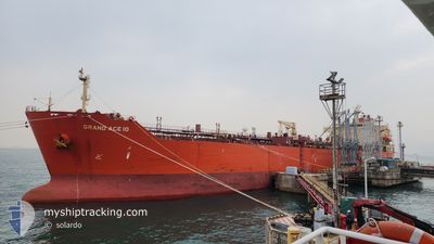
GRAND ACE10
Oil/Chemical Tanker

Current Trip
| Time Travelled | 8 days |
|---|---|
| Remaining Time | 1 day |
| Distance Travelled | 2115.40 nm |
| Remaining Distance | 317.60 nm |
| AVG Speed | 11.2 Knopen |
| MAX Speed | 13.7 Knopen |
| AVG Wind | 8.3 knots |
| MAX Wind | 16 knots |
| MIN Temp | 23.4°C / 74.12°F |
| MAX Temp | 29.3°C / 84.74°F |
| Diepgang | 8 M |
| Positie ontvangen | 3 h, 44 m geleden |
Current Position
| Lengtegraad | --- |
|---|---|
| Breedtegraat | --- |
| Status | Under way using engine |
| Snelheid | 11.5 Knopen |
| Koers | 356.5° |
| Gebied | Gulf of Oman |
| Station | T-AIS |
| Positie ontvangen | 3 h, 44 m geleden |
Information
The current position of GRAND ACE10 is in Gulf of Oman with coordinates 25.92997° / 56.67254° as reported on 2025-03-29 03:00 by AIS to our vessel tracker app. The vessel's current speed is 11.5 Knopen and is heading at the port of RUWAIS. The estimated time of arrival as calculated by MyShipTracking vessel tracking app is 2025-03-30 10:45 LT
The vessel GRAND ACE10 (IMO: 9443877, MMSI: 354252000) is a Oil/Chemical Tanker that was built in 2008 ( 17 Jaar oud ). It's sailing under the flag of [PA] Panama.
In this page you can find informations about the vessels current position, last detected port calls, and current voyage information. If the vessels is not in coverage by AIS you will find the latest position.
The current position of GRAND ACE10 is detected by our AIS receivers and we are not responsible for the reliability of the data. The last position was recorded while the vessel was in Coverage by the Ais receivers of our vessel tracking app.
The current draught of GRAND ACE10 as reported by AIS is 8 meters
Weather
| Temperature | 23.4°C / 74.12°F |
|---|---|
| Wind Speed | 11 knots |
| Direction | 132° SE |
| Pressure | 1015.2 hPa |
| Humidity | 71.3 % |
| Cloud Coverage | 1 % |


Featured Company
Last Port Calls
| Port | Arrival | Departure | Time In Port |
|---|---|---|---|
| 2025-03-19 16:54 | 2025-03-21 09:57 | 1 d | |
| 2025-03-14 20:15 | 2025-03-16 16:07 | 1 d | |
| 2025-03-11 08:55 | 2025-03-13 08:48 | 1 d | |
| 2025-02-22 01:55 | 2025-02-23 13:55 | 1 d | |
| 2025-02-12 23:37 | 2025-02-16 03:48 | 3 d | |
| 2025-02-02 02:15 | 2025-02-05 15:39 | 3 d | |
| 2025-01-30 18:51 | 2025-02-01 11:55 | 1 d | |
| 2025-01-23 09:02 | 2025-01-25 06:23 | 1 d | |
| 2025-01-21 21:53 | 2025-01-22 16:23 | 18 h | |
| 2025-01-07 10:03 | 2025-01-09 03:09 | 1 d |
Most Visited Ports (Last year)
| Port | Arrivals | |
|---|---|---|
| 8 | ||
| 8 | ||
| 4 | ||
| 3 | ||
| 2 | ||
| 2 |
Last Trips
| Origin | Departure | Destination | Arrival | Distance | |
|---|---|---|---|---|---|
| 2025-03-16 16:07 | 2025-03-19 16:54 | 371.32 nm | |||
| 2025-03-13 08:48 | 2025-03-14 20:15 | 21.00 nm | |||
| 2025-02-23 13:55 | 2025-03-11 08:55 | 1633.24 nm | |||
| 2025-02-16 03:48 | 2025-02-22 01:55 | 1580.76 nm | |||
| 2025-02-05 15:39 | 2025-02-12 23:37 | 964.27 nm | |||
| 2025-02-01 11:55 | 2025-02-02 02:15 | 145.78 nm | |||
| 2025-01-25 06:23 | 2025-01-30 18:51 | 1472.81 nm | |||
| 2025-01-22 16:23 | 2025-01-23 09:02 | 126.75 nm | |||
| 2025-01-09 03:09 | 2025-01-21 21:53 | 876.78 nm | |||
| 2025-01-05 22:30 | 2025-01-07 10:03 | 13.57 nm |
Events
| Tijd | Evenement | Details | Positie / Bestemming | Info |
|---|---|---|---|---|
| 2025-03-29 03:04 | Status Changed | Default Under way using engine |
25.94545 / 56.67013
AE RUW
|
Snelheid: 11.5 kn Koers: 356.5° |
| 2025-03-29 03:00 | Buitenbereik |
25.92997 / 56.67254
Gulf of Oman
AE RUW
|
Snelheid: 11.5 kn Koers: 356.5° |
|
| 2025-03-29 01:43 | Wijzig zee gebeid | Omani part of the Gulf of Oman United Arab Emirates part of the Gulf of Oman |
25.67963 / 56.67879
Gulf of Oman
AE RUW
|
Snelheid: 11.5 kn Koers: 357.9° |
| 2025-03-28 22:19 | Wijzig zee gebeid | United Arab Emirates part of the Gulf of Oman Omani part of the Gulf of Oman |
25.04181 / 56.71372
Gulf of Oman
AE RUW
|
Snelheid: 11.3 kn Koers: 358.8° |
| 2025-03-28 19:20 | Wijzig zee gebeid | Omani part of the Gulf of Oman Indian part of the Laccadive Sea |
24.73534 / 57.25298
Gulf of Oman
AE RUW
|
Snelheid: 11.8 kn Koers: 295.1° |
| 2025-03-28 19:19 | Status Changed | Under way using engine Default |
24.73427 / 57.25587
AE RUW
|
Snelheid: 11.7 kn Koers: 292° |
| 2025-03-28 19:14 | Binnenbereik |
24.73534 / 57.25298
Gulf of Oman
AE RUW
|
Snelheid: 11.8 kn Koers: 295.1° |
|
| 2025-03-22 23:58 | Status Changed | Default Under way using engine |
7.55669 / 76.86205
AE RUW
|
Snelheid: 10.4 kn Koers: 294.8° |
| 2025-03-22 23:51 | Status Changed | Under way using engine Default |
7.54871 / 76.88042
AE RUW
|
Snelheid: 10.2 kn Koers: 290° |
| 2025-03-22 23:51 | Buitenbereik |
7.54871 / 76.88042
Laccadive Sea
AE RUW
|
Snelheid: 10.4 kn Koers: 294.8° |