
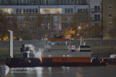
GPS BATTLER
Tug
Current Trip
Current Position
| Lengtegraad | --- |
|---|---|
| Breedtegraat | --- |
| Status | Under way using engine |
| Snelheid | |
| Koers | 258° |
| Gebied | North Sea |
| Station | T-AIS |
| Positie ontvangen | Nu |
Info
Information
The current position of GPS BATTLER is in North Sea with coordinates 51.50182° / 0.48651° as reported on 2024-11-18 16:32 by AIS to our vessel tracker app. The vessel's current speed is 0 Knopen and is currently inside the port of THAMES.
The vessel GPS BATTLER (IMO: 1053729, MMSI: 212160000) is a Tug It's sailing under the flag of [CY] Cyprus.
In this page you can find informations about the vessels current position, last detected port calls, and current voyage information. If the vessels is not in coverage by AIS you will find the latest position.
The current position of GPS BATTLER is detected by our AIS receivers and we are not responsible for the reliability of the data. The last position was recorded while the vessel was in Coverage by the Ais receivers of our vessel tracking app.
The current draught of GPS BATTLER as reported by AIS is 3 meters
Weather
| Temperature | 7.1°C / 44.78°F |
|---|---|
| Wind Speed | 4 knots |
| Direction | 117° ESE |
| Pressure | 1009.6 hPa |
| Humidity | 81.8 % |
| Cloud Coverage | 100 % |
Featured Company
Last Port Calls
| Port | Arrival | Departure | Time In Port |
|---|---|---|---|
| 2024-11-17 14:22 | |||
| 2024-11-15 19:10 | 2024-11-16 08:06 | 12 h | |
| 2024-11-14 00:43 | 2024-11-14 17:58 | 17 h | |
| 2024-11-13 08:25 | 2024-11-13 09:26 | 1 h | |
| 2024-11-12 15:35 | 2024-11-12 15:39 | 3 m | |
| 2024-11-12 13:02 | 2024-11-12 13:07 | 5 m | |
| 2024-11-10 22:55 | 2024-11-12 11:38 | 1 d | |
| 2024-11-09 17:44 | 2024-11-10 12:10 | 18 h | |
| 2024-11-05 17:15 | 2024-11-08 22:38 | 3 d | |
| 2024-11-05 07:56 | 2024-11-05 16:46 | 8 h |
Most Visited Ports (Last year)
| Port | Arrivals | |
|---|---|---|
| 6 | ||
| 4 | ||
| 3 | ||
| 2 | ||
| 2 | ||
| 2 |
Last Trips
| Origin | Departure | Destination | Arrival | Distance | |
|---|---|---|---|---|---|
| 2024-11-16 08:06 | 2024-11-17 14:22 | 72.83 nm | |||
| 2024-11-14 17:58 | 2024-11-15 19:10 | 85.59 nm | |||
| 2024-11-13 09:26 | 2024-11-14 00:43 | 100.34 nm | |||
| 2024-11-12 15:39 | 2024-11-13 08:25 | 53.25 nm | |||
| 2024-11-12 13:07 | 2024-11-12 15:35 | 18.26 nm | |||
| 2024-11-12 11:38 | 2024-11-12 13:02 | 12.75 nm | |||
| 2024-11-10 12:10 | 2024-11-10 22:55 | 21.63 nm | |||
| 2024-11-08 22:38 | 2024-11-09 17:44 | 78.41 nm | |||
| 2024-11-05 16:46 | 2024-11-05 17:15 | 4.50 nm | |||
| 2024-11-05 07:00 | 2024-11-05 07:56 | 5.57 nm |
Events
| Tijd | Evenement | Details | Positie / Bestemming | Info |
|---|---|---|---|---|
| 2024-11-17 14:23 | Stop beweging |
51.50181 / .48647
[GB] THAMES
|
Snelheid: 0.3 kn Koers: 268° |
|
| 2024-11-17 14:22 | Aankomsthaven |
|
51.50165 / .48652
[GB] THAMES
|
Snelheid: 0.7 kn Koers: 278° |
| 2024-11-17 11:34 | Start beweging | 0.64 nm, North West of CHATHAM |
51.41076 / .53352
GBUPR
|
Snelheid: 6.4 kn Koers: 58.1° |
| 2024-11-16 13:49 | Stop beweging | 0.66 nm, North West of CHATHAM |
51.40998 / .53089
GBUPR
|
Snelheid: Koers: 230° |
| 2024-11-16 09:32 | ETA Changed | 2024/11/16 15:00 2025/10/31 09:00 |
51.77299 / 1.21912
GBUPR
|
Snelheid: 9.7 kn Koers: 218.7° |
| 2024-11-16 09:10 | Destination Changed | GBUPR GBHRW |
51.81862 / 1.28064
GBUPR
|
Snelheid: 9.7 kn Koers: 219.2° |
| 2024-11-16 08:06 | Vertrekhaven |
|
51.94976 / 1.26733
GBHRW
|
Snelheid: 7.5 kn Koers: 90° |
| 2024-11-16 08:01 | Start beweging |
51.94952 / 1.25194
[GB] HARWICH
|
Snelheid: 6.8 kn Koers: 81° |
|
| 2024-11-15 19:12 | Stop beweging |
51.94844 / 1.24912
[GB] HARWICH
|
Snelheid: 0.3 kn Koers: 128° |
|
| 2024-11-15 19:10 | Aankomsthaven |
|
51.94888 / 1.24896
[GB] HARWICH
|
Snelheid: 4.6 kn Koers: 171° |