
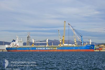
GLORY SEA
Bulk Carrier
Current Trip
IN ORDER
| Time Travelled | 3 days |
|---|---|
| Remaining Time | --- |
| Distance Travelled | 90.60 nm |
| Remaining Distance | --- |
| AVG Speed | 5.5 Knopen |
| MAX Speed | 11.8 Knopen |
| AVG Wind | 6.9 knots |
| MAX Wind | 18 knots |
| MIN Temp | 10.9°C / 51.62°F |
| MAX Temp | 15.1°C / 59.18°F |
| Diepgang | 6.4 M |
| Positie ontvangen | 1 m geleden |
Current Position
| Lengtegraad | --- |
|---|---|
| Breedtegraat | --- |
| Status | Under way using engine |
| Snelheid | 0.6 Knopen |
| Koers | 91° |
| Gebied | Sea of Marmara |
| Station | T-AIS |
| Positie ontvangen | 1 m geleden |
Information
The current position of GLORY SEA is in Sea of Marmara with coordinates 40.68708° / 28.69808° as reported on 2025-03-28 05:29 by AIS to our vessel tracker app. The vessel's current speed is 0.6 Knopen
The vessel GLORY SEA (IMO: 9602980, MMSI: 477353500) is a Bulk Carrier that was built in 2011 ( 14 Jaar oud ). It's sailing under the flag of [HK] Hong Kong.
In this page you can find informations about the vessels current position, last detected port calls, and current voyage information. If the vessels is not in coverage by AIS you will find the latest position.
The current position of GLORY SEA is detected by our AIS receivers and we are not responsible for the reliability of the data. The last position was recorded while the vessel was in Coverage by the Ais receivers of our vessel tracking app.
The current draught of GLORY SEA as reported by AIS is 6.4 meters
Weather
| Temperature | 11.6°C / 52.88°F |
|---|---|
| Wind Speed | 14 knots |
| Direction | 40° NE |
| Pressure | 1002.5 hPa |
| Humidity | 80.7 % |
| Cloud Coverage | 100 % |
Featured Company
Last Port Calls
| Port | Arrival | Departure | Time In Port |
|---|---|---|---|
| 2025-03-18 21:40 | 2025-03-24 20:16 | 5 d | |
| 2025-03-14 06:22 | 2025-03-14 15:20 | 8 h | |
| 2025-02-13 04:23 | 2025-02-20 15:36 | 7 d | |
| 2025-02-05 09:10 | 2025-02-06 22:36 | 1 d | |
| 2025-01-17 12:39 | 2025-01-17 21:48 | 9 h | |
| 2025-01-09 16:35 | |||
| 2025-01-09 16:19 | |||
| 2025-01-09 13:09 | 2025-01-09 13:24 | 14 m | |
| 2025-01-07 05:22 | 2025-01-07 06:54 | 1 h | |
| 2025-01-07 01:59 | 2025-01-07 03:40 | 1 h |
Most Visited Ports (Last year)
| Port | Arrivals | |
|---|---|---|
| 8 | ||
| 5 | ||
| 2 | ||
| 1 | ||
| 1 | ||
| 1 |
Last Trips
| Origin | Departure | Destination | Arrival | Distance | |
|---|---|---|---|---|---|
| 2025-02-20 23:36 | 2025-03-19 00:40 | 6181.12 nm | |||
| 2025-02-20 23:36 | 2025-03-14 08:22 | 5252.81 nm | |||
| 2025-02-07 04:06 | 2025-02-13 12:23 | 1816.50 nm | |||
| 2025-01-09 19:19 | 2025-02-05 14:40 | 5986.19 nm | |||
| 2025-01-09 19:19 | 2025-01-17 14:39 | 1318.00 nm | |||
| 2025-01-09 16:24 | 2025-01-09 19:35 | 38.91 nm | |||
| 2025-01-07 09:54 | 2025-01-09 16:09 | 316.84 nm | |||
| 2025-01-07 06:40 | 2025-01-07 08:22 | 2.67 nm | |||
| 2025-01-07 03:12 | 2025-01-07 04:59 | 13.00 nm | |||
| 2025-01-06 14:36 | 2025-01-07 02:23 | 82.32 nm |
Events
| Tijd | Evenement | Details | Positie / Bestemming | Info |
|---|---|---|---|---|
| 2025-03-27 12:13 | Stop beweging | 11.48 nm, South of YESILKOY |
40.76470 / 28.80475
IN ORDER
|
Snelheid: 0.3 kn Koers: 88° |
| 2025-03-27 11:59 | Start beweging | 11.4 nm, South of YESILKOY |
40.76662 / 28.79710
IN ORDER
|
Snelheid: 3.2 kn Koers: 104° |
| 2025-03-27 08:14 | Stop beweging | 11.08 nm, South of YESILKOY |
40.77238 / 28.85940
IN ORDER
|
Snelheid: 0.3 kn Koers: 113° |
| 2025-03-27 08:14 | Start beweging | 11.05 nm, South of YESILKOY |
40.77290 / 28.85965
IN ORDER
|
Snelheid: 6.5 kn Koers: 198° |
| 2025-03-27 07:02 | Stop beweging | 10.96 nm, South of YESILKOY |
40.77510 / 28.86497
IN ORDER
|
Snelheid: 0.3 kn Koers: 110° |
| 2025-03-27 06:04 | Start beweging | 7.79 nm, South of YESILKOY |
40.82575 / 28.81647
IN ORDER
|
Snelheid: 3.1 kn Koers: 269° |
| 2025-03-25 11:02 | Stop beweging | 12.91 nm, South of YESILKOY |
40.74622 / 28.89243
IN ORDER
|
Snelheid: 0.3 kn Koers: 169° |
| 2025-03-24 22:53 | Destination Changed | IN ORDER DILISKELESI |
40.78137 / 28.96107
IN ORDER
|
Snelheid: 8.4 kn Koers: 273° |
| 2025-03-24 20:16 | Vertrekhaven |
|
40.76083 / 29.53073
DILISKELESI
|
Snelheid: 3.1 kn Koers: 252° |
| 2025-03-24 20:15 | Start beweging |
40.76107 / 29.53123
[TR] DILISKELESI
|
Snelheid: 3.1 kn Koers: 252° |