

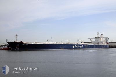
GHAZAL
Crude Oil Tanker

Current Trip
| Time Travelled | --- |
|---|---|
| Remaining Time | --- |
| Distance Travelled | 11020.04 nm |
| Remaining Distance | --- |
| AVG Speed | 10.9 Knopen |
| MAX Speed | 15.7 Knopen |
| AVG Wind | 10.9 knots |
| MAX Wind | 33 knots |
| MIN Temp | -0.6°C / 30.92°F |
| MAX Temp | 30.7°C / 87.26°F |
| Diepgang | 13.7 M |
| Positie ontvangen | 34 m geleden |
Current Position
| Lengtegraad | --- |
|---|---|
| Breedtegraat | --- |
| Status | Moored |
| Snelheid | |
| Koers | 135° |
| Gebied | Persian Gulf |
| Station | T-AIS |
| Positie ontvangen | 34 m geleden |
Information
The current position of GHAZAL is in Persian Gulf with coordinates 26.93152° / 50.03775° as reported on 2025-03-30 03:15 by AIS to our vessel tracker app. The vessel's current speed is 0 Knopen
The vessel GHAZAL (IMO: 9387009, MMSI: 403508000) is a Crude Oil Tanker that was built in 2009 ( 16 Jaar oud ). It's sailing under the flag of [SA] Saudi Arabia.
In this page you can find informations about the vessels current position, last detected port calls, and current voyage information. If the vessels is not in coverage by AIS you will find the latest position.
The current position of GHAZAL is detected by our AIS receivers and we are not responsible for the reliability of the data. The last position was recorded while the vessel was in Coverage by the Ais receivers of our vessel tracking app.
The current draught of GHAZAL as reported by AIS is 13.7 meters
Weather
| Temperature | 21.2°C / 70.16°F |
|---|---|
| Wind Speed | 9 knots |
| Direction | 139° SE |
| Pressure | 1012.6 hPa |
| Humidity | 64.5 % |
| Cloud Coverage | 3 % |


Featured Company
Last Port Calls
| Port | Arrival | Departure | Time In Port |
|---|---|---|---|
| 2025-01-20 08:06 | 2025-01-22 13:12 | 2 d |
Most Visited Ports (Last year)
| Port | Arrivals | |
|---|---|---|
| 1 |
Last Trips
| Origin | Departure | Destination | Arrival | Distance |
|---|
Events
| Tijd | Evenement | Details | Positie / Bestemming | Info |
|---|---|---|---|---|
| 2025-03-30 03:27 | Status Changed | Default Moored |
26.93130 / 50.03752
SA RTA
|
Snelheid: Koers: 135° |
| 2025-03-30 03:15 | Status Changed | Moored Default |
26.93152 / 50.03775
SA RTA
|
Snelheid: Koers: 138° |
| 2025-03-30 02:53 | Status Changed | Default Moored |
26.93175 / 50.03804
SA RTA
|
Snelheid: 0.1 kn Koers: 145° |
| 2025-03-30 02:39 | Status Changed | Moored Default |
26.93201 / 50.03841
SA RTA
|
Snelheid: Koers: 154° |
| 2025-03-30 02:09 | Status Changed | Default Moored |
26.93194 / 50.03833
SA RTA
|
Snelheid: 0.1 kn Koers: 145° |
| 2025-03-30 02:03 | Status Changed | Moored Default |
26.93185 / 50.03825
SA RTA
|
Snelheid: 0.1 kn Koers: 140° |
| 2025-03-30 01:53 | Status Changed | Default Moored |
26.93168 / 50.03794
SA RTA
|
Snelheid: 0.1 kn Koers: 139° |
| 2025-03-30 01:45 | Status Changed | Moored Default |
26.93145 / 50.03766
SA RTA
|
Snelheid: 0.1 kn Koers: 125° |
| 2025-03-30 01:45 | Binnenbereik |
26.93145 / 50.03766
Persian Gulf
|
Snelheid: 0.1 kn Koers: 39.3° |
|
| 2025-03-29 23:00 | Buitenbereik |
26.92733 / 50.03748
Persian Gulf
|
Snelheid: Koers: 152° |