
GEORGE III
Not available
Current Trip
| Time Travelled | 1 day |
|---|---|
| Remaining Time | 3 days |
| Distance Travelled | 540.97 nm |
| Remaining Distance | 1966.77 nm |
| AVG Speed | 19.9 Knopen |
| MAX Speed | 21.4 Knopen |
| AVG Wind | 11.6 knots |
| MAX Wind | 21 knots |
| MIN Temp | 15.5°C / 59.9°F |
| MAX Temp | 17.4°C / 63.32°F |
| Diepgang | 10.7 M |
| Positie ontvangen | 23 h, 16 m geleden |
Current Position
| Lengtegraad | --- |
|---|---|
| Breedtegraat | --- |
| Status | Under way using engine |
| Snelheid | 20 Knopen |
| Koers | 245.4° |
| Gebied | North Pacific Ocean |
| Station | T-AIS |
| Positie ontvangen | 23 h, 16 m geleden |
Info
Information
The current position of GEORGE III is in North Pacific Ocean with coordinates 33.13546° / -119.44820° as reported on 2026-01-03 17:20 by AIS to our vessel tracker app. The vessel's current speed is 20 Knopen and is heading at the port of HONOLULU . The estimated time of arrival as calculated by MyShipTracking vessel tracking app is 2026-01-07 17:27 LT
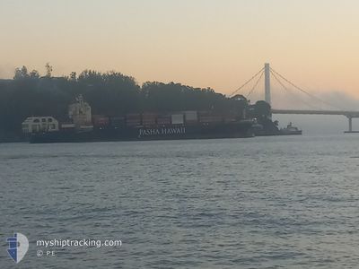
The vessel GEORGE III (IMO: 9837092, MMSI: 369355000) is a Not available It's sailing under the flag of [US] USA.
In this page you can find informations about the vessels current position, last detected port calls, and current voyage information. If the vessels is not in coverage by AIS you will find the latest position.
The current position of GEORGE III is detected by our AIS receivers and we are not responsible for the reliability of the data. The last position was recorded while the vessel was in Coverage by the Ais receivers of our vessel tracking app.
The current draught of GEORGE III as reported by AIS is 10.7 meters
Weather
| Temperature | 16.6°C / 61.88°F |
|---|---|
| Wind Speed | 15 knots |
| Direction | 309° NW |
| Pressure | 1016.4 hPa |
| Humidity | 71.9 % |
| Cloud Coverage | 100 % |
Featured Company
Last Port Calls
| Port | Arrival | Departure | Time In Port |
|---|---|---|---|
| 2026-01-01 10:11 | 2026-01-03 05:16 | 1 d | |
| 2025-12-24 21:13 | 2025-12-27 18:27 | 2 d | |
| 2025-12-18 15:06 | 2025-12-20 05:06 | 1 d | |
| 2025-12-17 06:54 | 2025-12-17 17:49 | 10 h | |
| 2025-12-10 18:23 | 2025-12-12 09:33 | 1 d | |
| 2025-12-04 15:09 | 2025-12-06 05:13 | 1 d | |
| 2025-12-03 06:24 | 2025-12-03 17:50 | 11 h | |
| 2025-11-26 18:08 | 2025-11-28 20:39 | 2 d | |
| 2025-11-20 15:14 | 2025-11-22 04:51 | 1 d | |
| 2025-11-19 05:13 | 2025-11-19 17:51 | 12 h |
Most Visited Ports (Last year)
| Port | Arrivals | |
|---|---|---|
| 26 | ||
| 26 | ||
| 25 |
Last Trips
| Origin | Departure | Destination | Arrival | Distance | |
|---|---|---|---|---|---|
| 2025-12-27 18:27 | 2026-01-01 10:11 | 2245.36 nm | |||
| 2025-12-20 05:06 | 2025-12-24 21:13 | 2248.33 nm | |||
| 2025-12-17 17:49 | 2025-12-18 15:06 | 398.11 nm | |||
| 2025-12-12 09:33 | 2025-12-17 06:54 | 2117.60 nm | |||
| 2025-12-06 05:13 | 2025-12-10 18:23 | 2241.67 nm | |||
| 2025-12-03 17:50 | 2025-12-04 15:09 | 396.62 nm | |||
| 2025-11-28 20:39 | 2025-12-03 06:24 | 2105.78 nm | |||
| 2025-11-22 04:51 | 2025-11-26 18:08 | 2250.85 nm | |||
| 2025-11-19 17:51 | 2025-11-20 15:14 | 398.32 nm | |||
| 2025-11-14 08:42 | 2025-11-19 05:13 | 2118.71 nm |
Events
| Tijd | Evenement | Details | Positie / Bestemming | Info |
|---|---|---|---|---|
| 2026-01-03 17:27 | Status Changed | Default Under way using engine |
33.12374 / -119.49612
USHNL
|
Snelheid: 20 kn Koers: 245.4° |
| 2026-01-03 17:20 | Buitenbereik |
33.13546 / -119.44820
North Pacific Ocean
USHNL
|
Snelheid: 20 kn Koers: 245.4° |
|
| 2026-01-03 16:33 | Status Changed | Under way using engine Default |
33.27174 / -119.16813
USHNL
|
Snelheid: 21.3 kn Koers: 241° |
| 2026-01-03 15:59 | Status Changed | Default Under way using engine |
33.37004 / -118.95761
USHNL
|
Snelheid: 21.3 kn Koers: 240.4° |
| 2026-01-03 15:11 | Status Changed | Under way using engine Default |
33.50811 / -118.66780
USHNL
|
Snelheid: 20.9 kn Koers: 239° |
| 2026-01-03 15:10 | Status Changed | Default Under way using engine |
33.50997 / -118.66413
USHNL
|
Snelheid: 20.7 kn Koers: 248.8° |
| 2026-01-03 14:52 | Status Changed | Under way using engine Default |
33.53955 / -118.54487
USHNL
|
Snelheid: 20.8 kn Koers: 260° |
| 2026-01-03 14:51 | Status Changed | Default Under way using engine |
33.54156 / -118.53245
USHNL
|
Snelheid: 20.4 kn Koers: 258.1° |
| 2026-01-03 14:35 | Status Changed | Under way using engine Default |
33.55873 / -118.43096
USHNL
|
Snelheid: 19.5 kn Koers: 259° |
| 2026-01-03 14:34 | Status Changed | Default Under way using engine |
33.55944 / -118.42652
USHNL
|
Snelheid: 19.4 kn Koers: 258.7° |