
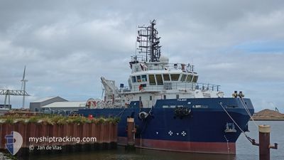
GEO OCEAN IX
Research/Survey Vessel
Current Trip
SHELTER AREA
| Time Travelled | 3 days |
|---|---|
| Remaining Time | --- |
| Distance Travelled | 172.98 nm |
| Remaining Distance | --- |
| AVG Speed | 4.7 Knopen |
| MAX Speed | 8.7 Knopen |
| AVG Wind | 19.8 knots |
| MAX Wind | 29.9 knots |
| MIN Temp | 11.7°C / 53.06°F |
| MAX Temp | 16.6°C / 61.88°F |
| Diepgang | 4 M |
| Positie ontvangen | 13 h, 56 m geleden |
Current Position
| Lengtegraad | -0.90187° |
|---|---|
| Breedtegraat | 55.94397° |
| Status | Restricted manoeuverability |
| Snelheid | 3.8 Knopen |
| Koers | 146° |
| Gebied | North Sea |
| Station | T-AIS |
| Positie ontvangen | 13 h, 56 m geleden |
Info
Information
The current position of GEO OCEAN IX is in North Sea with coordinates 55.94397° / -0.90187° as reported on 2024-06-29 15:25 by AIS to our vessel tracker app. The vessel's current speed is 3.8 Knopen
The vessel GEO OCEAN IX (IMO: 9668518, MMSI: 341182001) is a Research/Survey Vessel that was built in 2013 ( 11 Jaar oud ). It's sailing under the flag of [KN] St Kitts Nevis.
In this page you can find informations about the vessels current position, last detected port calls, and current voyage information. If the vessels is not in coverage by AIS you will find the latest position.
The current position of GEO OCEAN IX is detected by our AIS receivers and we are not responsible for the reliability of the data. The last position was recorded while the vessel was in Coverage by the Ais receivers of our vessel tracking app.
The current draught of GEO OCEAN IX as reported by AIS is 4 meters
Weather
| Temperature | 13.9°C / 57.02°F |
|---|---|
| Wind Speed | 6 knots |
| Direction | 223° SW |
| Pressure | 1011 hPa |
| Humidity | 79.7 % |
| Cloud Coverage | 100 % |
Featured Company
Last Port Calls
| Port | Arrival | Departure | Time In Port |
|---|---|---|---|
| 2024-06-26 04:41 | 2024-06-26 21:31 | 16 h | |
| 2024-06-18 20:53 | 2024-06-19 22:21 | 1 d | |
| 2024-06-14 22:22 | 2024-06-16 04:27 | 1 d | |
| 2024-06-03 03:58 | 2024-06-14 15:06 | 11 d | |
| 2024-05-21 18:13 | 2024-06-03 03:52 | 12 d | |
| 2024-05-21 17:18 | 2024-05-21 18:00 | 42 m | |
| 2024-05-21 05:45 |
Last Trips
| Origin | Departure | Destination | Arrival | Distance | |
|---|---|---|---|---|---|
| 2024-06-19 23:21 | 2024-06-26 05:41 | 197.51 nm | |||
| 2024-06-16 06:27 | 2024-06-18 21:53 | 379.03 nm | |||
| 2024-06-14 17:06 | 2024-06-15 00:22 | 20.95 nm | |||
| 2024-06-03 05:52 | 2024-06-03 05:58 | 0.89 nm | |||
| 2024-05-21 20:00 | 2024-05-21 20:13 | 0.97 nm | |||
| 2024-05-21 07:45 | 2024-05-21 19:18 | 90.78 nm |
Events
| Tijd | Evenement | Details | Positie / Bestemming | Info |
|---|---|---|---|---|
| 2024-06-29 15:25 | Buitenbereik |
55.94397 / -.90187
North Sea
|
Snelheid: 3.8 kn Koers: 146.7° |
|
| 2024-06-29 15:25 | Binnenbereik |
55.94397 / -.90187
North Sea
|
Snelheid: 3.8 kn Koers: 146.7° |
|
| 2024-06-29 11:03 | Buitenbereik |
55.95415 / -1.05390
North Sea
|
Snelheid: 4.1 kn Koers: 351.4° |
|
| 2024-06-29 10:58 | Binnenbereik |
55.95164 / -1.04861
North Sea
|
Snelheid: 1.6 kn Koers: 286.1° |
|
| 2024-06-29 07:27 | Buitenbereik |
55.93275 / -1.11410
North Sea
|
Snelheid: 0.3 kn Koers: 331.2° |
|
| 2024-06-29 06:13 | Binnenbereik |
55.93263 / -1.11504
North Sea
|
Snelheid: 0.2 kn Koers: 275.7° |
|
| 2024-06-29 04:33 | Buitenbereik |
55.93272 / -1.11295
North Sea
|
Snelheid: 1.7 kn Koers: 298.5° |
|
| 2024-06-29 04:10 | Binnenbereik |
55.92355 / -1.14157
North Sea
|
Snelheid: 1.8 kn Koers: 312.4° |
|
| 2024-06-29 01:57 | Buitenbereik |
55.91235 / -1.17912
North Sea
|
Snelheid: 3.2 kn Koers: 303.7° |
|
| 2024-06-29 01:57 | Start beweging |
55.91235 / -1.17912
SHELTER AREA
|
Snelheid: 3.2 kn Koers: 323° |