
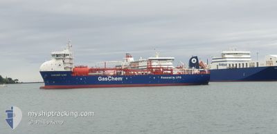
GASCHEM ILIAD
Tanker
Current Trip
| Time Travelled | 4 days |
|---|---|
| Remaining Time | 2 days |
| Distance Travelled | 1334.99 nm |
| Remaining Distance | 707.62 nm |
| AVG Speed | 10.6 Knopen |
| MAX Speed | 14.5 Knopen |
| AVG Wind | 13.2 knots |
| MAX Wind | 26.5 knots |
| MIN Temp | 24.8°C / 76.64°F |
| MAX Temp | 29.6°C / 85.28°F |
| Diepgang | 6.4 M |
| Positie ontvangen | 18 h, 27 m geleden |
Current Position
| Lengtegraad | --- |
|---|---|
| Breedtegraat | --- |
| Status | Under way using engine |
| Snelheid | 13.6 Knopen |
| Koers | 340.8° |
| Gebied | Coral Sea |
| Station | T-AIS |
| Positie ontvangen | 18 h, 27 m geleden |
Info
Information
The current position of GASCHEM ILIAD is in Coral Sea with coordinates -13.13074° / 143.78880° as reported on 2025-03-02 08:18 by AIS to our vessel tracker app. The vessel's current speed is 13.6 Knopen and is heading at the port of DARWIN. The estimated time of arrival as calculated by MyShipTracking vessel tracking app is 2025-03-05 07:14 LT
The vessel GASCHEM ILIAD (IMO: 9919838, MMSI: 636093033) is a Tanker It's sailing under the flag of [LR] Liberia.
In this page you can find informations about the vessels current position, last detected port calls, and current voyage information. If the vessels is not in coverage by AIS you will find the latest position.
The current position of GASCHEM ILIAD is detected by our AIS receivers and we are not responsible for the reliability of the data. The last position was recorded while the vessel was in Coverage by the Ais receivers of our vessel tracking app.
The current draught of GASCHEM ILIAD as reported by AIS is 6.4 meters
Weather
| Temperature | 27.8°C / 82.04°F |
|---|---|
| Wind Speed | 13 knots |
| Direction | 37° NE |
| Pressure | 1009.6 hPa |
| Humidity | 79.3 % |
| Cloud Coverage | 80 % |
Featured Company
Last Port Calls
| Port | Arrival | Departure | Time In Port |
|---|---|---|---|
| 2025-02-25 15:45 | 2025-02-26 06:43 | 14 h | |
| 2025-02-17 19:32 | 2025-02-18 10:08 | 14 h | |
| 2025-02-11 15:45 | 2025-02-12 06:32 | 14 h | |
| 2025-02-06 19:15 | 2025-02-07 12:36 | 17 h | |
| 2025-01-27 19:44 | 2025-01-28 10:00 | 14 h | |
| 2025-01-19 14:54 | 2025-01-20 09:01 | 18 h | |
| 2025-01-12 19:32 | 2025-01-13 10:05 | 14 h | |
| 2025-01-10 06:52 | 2025-01-10 18:12 | 11 h | |
| 2025-01-07 11:12 | 2025-01-08 22:28 | 1 d | |
| 2025-01-03 22:00 | 2025-01-04 14:01 | 16 h |
Last Trips
| Origin | Departure | Destination | Arrival | Distance | |
|---|---|---|---|---|---|
| 2025-02-18 21:08 | 2025-02-26 01:45 | 1060.86 nm | |||
| 2025-02-12 16:32 | 2025-02-18 06:32 | 1094.25 nm | |||
| 2025-02-07 22:36 | 2025-02-12 01:45 | 332.79 nm | |||
| 2025-01-28 21:00 | 2025-02-07 05:15 | 1297.56 nm | |||
| 2025-01-20 19:01 | 2025-01-28 06:44 | 1179.82 nm | |||
| 2025-01-13 21:05 | 2025-01-20 00:54 | 1062.13 nm | |||
| 2025-01-11 05:12 | 2025-01-13 06:32 | 195.90 nm | |||
| 2025-01-09 09:28 | 2025-01-10 17:52 | 311.35 nm | |||
| 2025-01-05 01:01 | 2025-01-07 22:12 | 629.73 nm | |||
| 2025-01-02 15:55 | 2025-01-04 09:00 | 537.27 nm |
Events
| Tijd | Evenement | Details | Positie / Bestemming | Info |
|---|---|---|---|---|
| 2025-03-02 08:25 | Status Changed | Default Under way using engine |
-13.10628 / 143.77985
AU DRW
|
Snelheid: 13.6 kn Koers: 340.8° |
| 2025-03-02 08:18 | Buitenbereik |
-13.13074 / 143.78880
Coral Sea
AU DRW
|
Snelheid: 13.6 kn Koers: 340.8° |
|
| 2025-03-02 08:06 | Status Changed | Under way using engine Default |
-13.17328 / 143.80433
AU DRW
|
Snelheid: 13.6 kn Koers: 338° |
| 2025-03-02 07:56 | Status Changed | Default Under way using engine |
-13.20701 / 143.81786
AU DRW
|
Snelheid: 13.6 kn Koers: 340.7° |
| 2025-03-02 07:34 | Status Changed | Under way using engine Default |
-13.28738 / 143.84809
AU DRW
|
Snelheid: 13.7 kn Koers: 331° |
| 2025-03-02 07:25 | Binnenbereik |
-13.28738 / 143.84809
Coral Sea
AU DRW
|
Snelheid: 13.8 kn Koers: 332.2° |
|
| 2025-03-02 03:28 | Status Changed | Default Under way using engine |
-14.03290 / 144.39415
AU DRW
|
Snelheid: 13.7 kn Koers: 317.9° |
| 2025-03-02 03:21 | Buitenbereik |
-14.05357 / 144.41264
Coral Sea
AU DRW
|
Snelheid: 13.7 kn Koers: 317.9° |
|
| 2025-03-02 02:58 | Status Changed | Under way using engine Default |
-14.11975 / 144.47484
AU DRW
|
Snelheid: 13.7 kn Koers: 305° |
| 2025-03-02 02:56 | Status Changed | Default Under way using engine |
-14.12266 / 144.47900
AU DRW
|
Snelheid: 13.7 kn Koers: 295° |