
GANADO EXPRESS
Livestock Carrier
Current Trip
| Time Travelled | 17 days |
|---|---|
| Remaining Time | --- |
| Distance Travelled | 5295.95 nm |
| Remaining Distance | --- |
| AVG Speed | 13.5 Knopen |
| MAX Speed | 19.9 Knopen |
| AVG Wind | 13.7 knots |
| MAX Wind | 30 knots |
| MIN Temp | 12.2°C / 53.96°F |
| MAX Temp | 20.4°C / 68.72°F |
| Diepgang | 6.3 M |
| Positie ontvangen | 1 d geleden |
Current Position
| Lengtegraad | -9.77498° |
|---|---|
| Breedtegraat | 42.22680° |
| Status | Under way using engine |
| Snelheid | 13.1 Knopen |
| Koers | 358.9° |
| Gebied | North Atlantic Ocean |
| Station | T-AIS |
| Positie ontvangen | 1 d geleden |
Info
Information
The current position of GANADO EXPRESS is in North Atlantic Ocean with coordinates 42.22680° / -9.77498° as reported on 2024-05-13 15:23 by AIS to our vessel tracker app. The vessel's current speed is 13.1 Knopen and is heading at the port of GREENORE. The estimated time of arrival as calculated by MyShipTracking vessel tracking app is 2024-05-16 04:30 LT
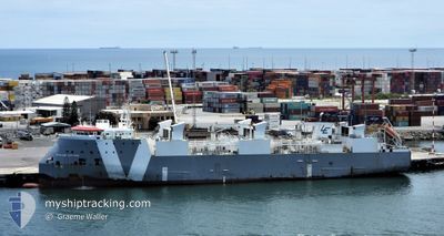
The vessel GANADO EXPRESS (IMO: 9621209, MMSI: 255915562) is a Livestock Carrier that was built in 2013 ( 11 Jaar oud ). It's sailing under the flag of [PT] Portugal.
In this page you can find informations about the vessels current position, last detected port calls, and current voyage information. If the vessels is not in coverage by AIS you will find the latest position.
The current position of GANADO EXPRESS is detected by our AIS receivers and we are not responsible for the reliability of the data. The last position was recorded while the vessel was in Coverage by the Ais receivers of our vessel tracking app.
The current draught of GANADO EXPRESS as reported by AIS is 6.3 meters
Weather
| Temperature | 12.7°C / 54.86°F |
|---|---|
| Wind Speed | 21 knots |
| Direction | 292° WNW |
| Pressure | 996.9 hPa |
| Humidity | 89 % |
| Cloud Coverage | 100 % |
Featured Company
Events
| Tijd | Evenement | Details | Positie / Bestemming | Info |
|---|---|---|---|---|
| 2024-05-13 15:29 | Status Changed | Default Under way using engine |
42.24833 / -9.77500
IE - GRN
|
Snelheid: 13.1 kn Koers: 358.9° |
| 2024-05-13 15:23 | Buitenbereik |
42.22680 / -9.77498
North Atlantic Ocean
IE - GRN
|
Snelheid: 13.1 kn Koers: 358.9° |
|
| 2024-05-13 15:04 | Status Changed | Under way using engine Default |
42.16015 / -9.78239
IE - GRN
|
Snelheid: 13 kn Koers: 4° |
| 2024-05-13 14:38 | Status Changed | Default Under way using engine |
42.05833 / -9.79333
IE - GRN
|
Snelheid: 13.5 kn Koers: 0.9° |
| 2024-05-13 14:07 | Gevonden in zee | Spanish part of the North Atlantic Ocean |
41.87454 / -9.80124
North Atlantic Ocean
IE - GRN
|
Snelheid: 13.5 kn Koers: 0.9° |
| 2024-05-13 13:26 | Status Changed | Under way using engine Default |
41.75863 / -9.80364
IE - GRN
|
Snelheid: 14 kn Koers: 2° |
| 2024-05-13 12:50 | Status Changed | Default Under way using engine |
41.64834 / -9.80667
IE - GRN
|
Snelheid: 13.4 kn Koers: 359.9° |
| 2024-05-13 12:27 | Status Changed | Under way using engine Default |
41.54225 / -9.80786
IE - GRN
|
Snelheid: 12 kn Koers: 1° |
| 2024-05-13 12:27 | Binnenbereik |
41.54225 / -9.80786
North Atlantic Ocean
IE - GRN
|
Snelheid: 13.4 kn Koers: 359.9° |
|
| 2024-05-13 11:06 | Buitenbereik |
41.26678 / -9.81688
North Atlantic Ocean
IE - GRN
|
Snelheid: 13.6 kn Koers: 3.5° |