
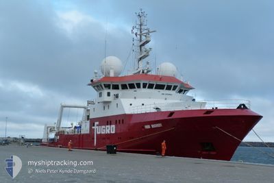
FUGRO DISCOVERY
Research/Survey Vessel
Current Trip
SURVEY AREA
| Time Travelled | 10 days |
|---|---|
| Remaining Time | --- |
| Distance Travelled | 867.64 nm |
| Remaining Distance | --- |
| AVG Speed | 6 Knopen |
| MAX Speed | 11.6 Knopen |
| AVG Wind | 14.3 knots |
| MAX Wind | 29 knots |
| MIN Temp | 12.7°C / 54.86°F |
| MAX Temp | 16.1°C / 60.98°F |
| Diepgang | 5.8 M |
| Positie ontvangen | 1 h, 12 m geleden |
Current Position
| Lengtegraad | --- |
|---|---|
| Breedtegraat | --- |
| Status | Restricted manoeuverability |
| Snelheid | 5.4 Knopen |
| Koers | 329.6° |
| Gebied | Mediterranean Sea - Western Basin |
| Station | T-AIS |
| Positie ontvangen | 1 h, 12 m geleden |
Information
The current position of FUGRO DISCOVERY is in Mediterranean Sea - Western Basin with coordinates 38.10652° / 11.36154° as reported on 2025-03-11 04:17 by AIS to our vessel tracker app. The vessel's current speed is 5.4 Knopen
The vessel FUGRO DISCOVERY (IMO: 9152882, MMSI: 372698000) is a Research/Survey Vessel that was built in 1997 ( 28 Jaar oud ). It's sailing under the flag of [PA] Panama.
In this page you can find informations about the vessels current position, last detected port calls, and current voyage information. If the vessels is not in coverage by AIS you will find the latest position.
The current position of FUGRO DISCOVERY is detected by our AIS receivers and we are not responsible for the reliability of the data. The last position was recorded while the vessel was in Coverage by the Ais receivers of our vessel tracking app.
The current draught of FUGRO DISCOVERY as reported by AIS is 5.8 meters
Weather
| Temperature | 15.7°C / 60.26°F |
|---|---|
| Wind Speed | 9 knots |
| Direction | 269° W |
| Pressure | 1008.6 hPa |
| Humidity | 85.3 % |
| Cloud Coverage | 44 % |
Featured Company
Last Port Calls
| Port | Arrival | Departure | Time In Port |
|---|---|---|---|
| 2025-02-25 06:45 | 2025-02-28 07:06 | 3 d | |
| 2025-01-27 08:12 | 2025-01-30 11:53 | 3 d | |
| 2025-01-11 14:54 | 2025-01-11 15:11 | 17 m | |
| 2025-01-11 14:21 | 2025-01-11 14:38 | 16 m | |
| 2025-01-11 13:17 | 2025-01-11 13:31 | 13 m | |
| 2025-01-11 10:57 | 2025-01-11 11:04 | 7 m | |
| 2025-01-11 09:04 | 2025-01-11 09:06 | 1 m | |
| 2025-01-11 08:14 | 2025-01-11 08:20 | 5 m | |
| 2025-01-11 07:17 | 2025-01-11 07:20 | 2 m | |
| 2025-01-06 07:02 | 2025-01-07 07:18 | 1 d |
Last Trips
| Origin | Departure | Destination | Arrival | Distance | |
|---|---|---|---|---|---|
| 2025-01-30 12:53 | 2025-02-25 07:45 | 2610.45 nm | |||
| 2025-01-11 16:11 | 2025-01-27 09:12 | 1824.41 nm | |||
| 2025-01-11 15:38 | 2025-01-11 15:54 | 1.41 nm | |||
| 2025-01-11 14:31 | 2025-01-11 15:21 | 4.07 nm | |||
| 2025-01-11 12:04 | 2025-01-11 14:17 | 11.16 nm | |||
| 2025-01-11 10:06 | 2025-01-11 11:57 | 9.33 nm | |||
| 2025-01-11 10:06 | 2025-01-11 10:04 | 9.33 nm | |||
| 2025-01-11 08:20 | 2025-01-11 09:14 | 4.76 nm | |||
| 2025-01-07 08:18 | 2025-01-11 08:17 | 451.92 nm | |||
| 2025-01-04 09:18 | 2025-01-06 08:02 | 258.21 nm |
Events
| Tijd | Evenement | Details | Positie / Bestemming | Info |
|---|---|---|---|---|
| 2025-03-11 04:29 | Status Changed | Default Restricted manoeuverability |
38.12337 / 11.34898
SURVEY AREA
|
Snelheid: 5.4 kn Koers: 329.6° |
| 2025-03-11 04:17 | Buitenbereik |
38.10652 / 11.36154
Mediterranean Sea - Western Basin
|
Snelheid: 5.4 kn Koers: 329.6° |
|
| 2025-03-11 04:16 | Status Changed | Restricted manoeuverability Default |
38.10519 / 11.36253
SURVEY AREA
|
Snelheid: 5.6 kn Koers: 329° |
| 2025-03-11 03:38 | Status Changed | Default Restricted manoeuverability |
38.05483 / 11.39949
SURVEY AREA
|
Snelheid: 5.3 kn Koers: 331.9° |
| 2025-03-11 03:33 | Status Changed | Restricted manoeuverability Default |
38.04823 / 11.40404
SURVEY AREA
|
Snelheid: 5.3 kn Koers: 332° |
| 2025-03-11 03:08 | Status Changed | Default Restricted manoeuverability |
38.01438 / 11.42634
SURVEY AREA
|
Snelheid: 5.3 kn Koers: 333.3° |
| 2025-03-11 03:03 | Status Changed | Restricted manoeuverability Default |
38.00737 / 11.43074
SURVEY AREA
|
Snelheid: 5.3 kn Koers: 333° |
| 2025-03-11 02:45 | Status Changed | Default Restricted manoeuverability |
37.98318 / 11.44597
SURVEY AREA
|
Snelheid: 5.2 kn Koers: 297.9° |
| 2025-03-11 02:25 | Status Changed | Restricted manoeuverability Default |
37.96928 / 11.46747
SURVEY AREA
|
Snelheid: 3.9 kn Koers: 172° |
| 2025-03-11 02:07 | Binnenbereik |
37.96928 / 11.46747
Mediterranean Sea - Western Basin
|
Snelheid: 4.6 kn Koers: 191.6° |