

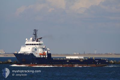
FS BALMORAL
Offshore Supply Ship

Current Trip
SEAFOX 7
| Time Travelled | 2 days |
|---|---|
| Remaining Time | --- |
| Distance Travelled | 409.50 nm |
| Remaining Distance | --- |
| AVG Speed | 10.1 Knopen |
| MAX Speed | 12 Knopen |
| AVG Wind | 21.6 knots |
| MAX Wind | 23 knots |
| MIN Temp | 1.1°C / 33.98°F |
| MAX Temp | 7.2°C / 44.96°F |
| Diepgang | 4.3 M |
| Positie ontvangen | 1 m geleden |
Current Position
| Lengtegraad | --- |
|---|---|
| Breedtegraat | --- |
| Status | Under way using engine |
| Snelheid | 9.8 Knopen |
| Koers | 67.1° |
| Gebied | North Sea |
| Station | T-AIS |
| Positie ontvangen | 1 m geleden |
Information
The current position of FS BALMORAL is in North Sea with coordinates 53.49752° / 5.12777° as reported on 2025-02-20 16:26 by AIS to our vessel tracker app. The vessel's current speed is 9.8 Knopen
The vessel FS BALMORAL (IMO: 9402330, MMSI: 232007020) is a Offshore Supply Ship that was built in 2008 ( 17 Jaar oud ). It's sailing under the flag of [GB] United Kingdom.
In this page you can find informations about the vessels current position, last detected port calls, and current voyage information. If the vessels is not in coverage by AIS you will find the latest position.
The current position of FS BALMORAL is detected by our AIS receivers and we are not responsible for the reliability of the data. The last position was recorded while the vessel was in Coverage by the Ais receivers of our vessel tracking app.
The current draught of FS BALMORAL as reported by AIS is 4.3 meters
Weather
| Temperature | 7.2°C / 44.96°F |
|---|---|
| Wind Speed | 23 knots |
| Direction | 190° S |
| Pressure | 1015.6 hPa |
| Humidity | 92.1 % |
| Cloud Coverage | 100 % |


Featured Company
Last Port Calls
| Port | Arrival | Departure | Time In Port |
|---|---|---|---|
| 2025-02-17 19:06 | 2025-02-17 20:43 | 1 h | |
| 2025-02-16 07:42 | 2025-02-16 18:20 | 10 h | |
| 2025-02-14 19:29 | 2025-02-16 06:53 | 1 d | |
| 2025-02-10 08:36 | 2025-02-14 19:10 | 4 d | |
| 2025-02-01 11:45 | 2025-02-05 01:53 | 3 d | |
| 2025-01-29 16:23 | 2025-01-30 13:51 | 21 h | |
| 2025-01-28 13:36 | 2025-01-29 15:44 | 1 d | |
| 2025-01-20 18:53 | 2025-01-23 10:01 | 2 d | |
| 2025-01-17 14:30 | 2025-01-20 18:28 | 3 d | |
| 2025-01-15 20:14 | 2025-01-17 09:23 | 1 d |
Most Visited Ports (Last year)
| Port | Arrivals | |
|---|---|---|
| 55 | ||
| 8 | ||
| 3 |
Last Trips
| Origin | Departure | Destination | Arrival | Distance | |
|---|---|---|---|---|---|
| 2025-02-16 18:20 | 2025-02-17 19:06 | 52.10 nm | |||
| 2025-02-14 19:10 | 2025-02-16 07:42 | 10.16 nm | |||
| 2025-02-14 19:10 | 2025-02-14 19:29 | 2.90 nm | |||
| 2025-02-05 01:53 | 2025-02-10 08:36 | 398.37 nm | |||
| 2025-01-30 13:51 | 2025-02-01 11:45 | 94.34 nm | |||
| 2025-01-20 18:28 | 2025-01-29 16:23 | 89.95 nm | |||
| 2025-01-20 18:28 | 2025-01-28 13:36 | 84.91 nm | |||
| 2025-01-20 18:28 | 2025-01-20 18:53 | 2.98 nm | |||
| 2025-01-17 09:23 | 2025-01-17 14:30 | 7.92 nm | |||
| 2025-01-15 17:12 | 2025-01-15 20:14 | 25.21 nm |
Events
| Tijd | Evenement | Details | Positie / Bestemming | Info |
|---|---|---|---|---|
| 2025-02-20 15:15 | Destination Changed | SEAFOX 7 DEN HELDER |
53.41910 / 4.81888
SEAFOX 7
|
Snelheid: 10.2 kn Koers: 65.4° |
| 2025-02-20 15:15 | ETA Changed | 2025/02/20 23:00 2025/02/19 11:00 |
53.41910 / 4.81888
SEAFOX 7
|
Snelheid: 10.2 kn Koers: 65.4° |
| 2025-02-20 14:48 | Binnenbereik |
53.38935 / 4.71087
North Sea
|
Snelheid: 10.1 kn Koers: 62.8° |
|
| 2025-02-20 11:49 | Buitenbereik |
52.89261 / 4.59642
North Sea
|
Snelheid: 10.5 kn Koers: 310° |
|
| 2025-02-20 10:53 | Binnenbereik |
52.97350 / 4.78648
North Sea
|
Snelheid: 9.7 kn Koers: 310.8° |
|
| 2025-02-20 08:44 | Buitenbereik |
52.98614 / 4.76419
North Sea
|
Snelheid: Koers: 169.4° |
|
| 2025-02-20 07:43 | Binnenbereik |
52.98614 / 4.76424
North Sea
|
Snelheid: Koers: 169.4° |
|
| 2025-02-20 04:46 | Buitenbereik |
52.98633 / 4.76504
North Sea
|
Snelheid: Koers: 176.3° |
|
| 2025-02-20 04:46 | Binnenbereik |
52.98633 / 4.76504
North Sea
|
Snelheid: Koers: 176.3° |
|
| 2025-02-20 00:25 | Buitenbereik |
52.98628 / 4.76505
North Sea
|
Snelheid: Koers: 265.2° |