
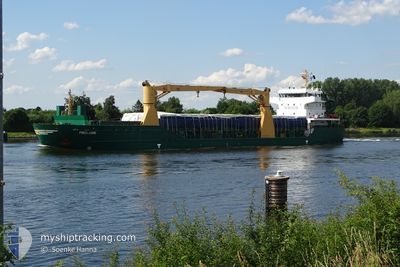
FROLAND
General Cargo
Current Trip
| Time Travelled | 3 days |
|---|---|
| Remaining Time | --- |
| Distance Travelled | 796.40 nm |
| Remaining Distance | --- |
| AVG Speed | 9.9 Knopen |
| MAX Speed | 15.5 Knopen |
| AVG Wind | 10.7 knots |
| MAX Wind | 24 knots |
| MIN Temp | 0.1°C / 32.18°F |
| MAX Temp | 9.2°C / 48.56°F |
| Diepgang | 8.3 M |
| Positie ontvangen | 1 m geleden |
Current Position
| Lengtegraad | --- |
|---|---|
| Breedtegraat | --- |
| Status | Under way using engine |
| Snelheid | 11 Knopen |
| Koers | 257.1° |
| Gebied | North Sea |
| Station | T-AIS |
| Positie ontvangen | 1 m geleden |
Info
Information
The current position of FROLAND is in North Sea with coordinates 53.86829° / 6.66113° as reported on 2024-12-27 07:57 by AIS to our vessel tracker app. The vessel's current speed is 11 Knopen and is heading at the port of SFAX. The estimated time of arrival as calculated by MyShipTracking vessel tracking app is 2025-01-06 17:00 LT
The vessel FROLAND (IMO: 9505584, MMSI: 305714000) is a General Cargo that was built in 2011 ( 13 Jaar oud ). It's sailing under the flag of [AG] Antigua Barbuda.
In this page you can find informations about the vessels current position, last detected port calls, and current voyage information. If the vessels is not in coverage by AIS you will find the latest position.
The current position of FROLAND is detected by our AIS receivers and we are not responsible for the reliability of the data. The last position was recorded while the vessel was in Coverage by the Ais receivers of our vessel tracking app.
The current draught of FROLAND as reported by AIS is 8.3 meters
Weather
| Temperature | 6.9°C / 44.42°F |
|---|---|
| Wind Speed | 3 knots |
| Direction | 176° S |
| Pressure | 1034.4 hPa |
| Humidity | 95.5 % |
| Cloud Coverage | 100 % |
Featured Company
Last Port Calls
| Port | Arrival | Departure | Time In Port |
|---|---|---|---|
| 2024-12-22 07:43 | 2024-12-23 22:58 | 1 d | |
| 2024-12-20 13:48 | 2024-12-21 16:04 | 1 d | |
| 2024-12-15 18:50 | 2024-12-17 12:14 | 1 d | |
| 2024-12-01 19:12 | 2024-12-03 19:32 | 2 d | |
| 2024-11-24 16:05 | 2024-11-29 22:38 | 5 d | |
| 2024-11-10 21:14 | 2024-11-10 22:29 | 1 h | |
| 2024-11-06 06:43 | 2024-11-09 11:10 | 3 d | |
| 2024-11-02 12:20 | 2024-11-03 17:31 | 1 d | |
| 2024-10-22 19:37 | 2024-10-24 17:02 | 1 d | |
| 2024-10-17 07:37 | 2024-10-19 15:06 | 2 d |
Last Trips
| Origin | Departure | Destination | Arrival | Distance | |
|---|---|---|---|---|---|
| 2024-12-21 17:04 | 2024-12-22 09:43 | 124.54 nm | |||
| 2024-12-17 13:14 | 2024-12-20 14:48 | 845.09 nm | |||
| 2024-12-03 20:32 | 2024-12-15 19:50 | 2241.01 nm | |||
| 2024-11-29 23:38 | 2024-12-01 20:12 | 296.73 nm | |||
| 2024-11-10 23:29 | 2024-11-24 17:05 | 2269.92 nm | |||
| 2024-11-09 12:10 | 2024-11-10 22:14 | 378.62 nm | |||
| 2024-11-03 18:31 | 2024-11-06 07:43 | 550.14 nm | |||
| 2024-10-24 19:02 | 2024-11-02 13:20 | 2111.12 nm | |||
| 2024-10-19 16:06 | 2024-10-22 21:37 | 462.71 nm | |||
| 2024-10-06 09:18 | 2024-10-17 08:37 | 2643.77 nm |
Events
| Tijd | Evenement | Details | Positie / Bestemming | Info |
|---|---|---|---|---|
| 2024-12-27 07:55 | Status Changed | Under way using engine Default |
53.86940 / 6.67030
FIRAU > TNSFA
|
Snelheid: 10.9 kn Koers: 257° |
| 2024-12-27 07:52 | Status Changed | Default Under way using engine |
53.87127 / 6.68534
FIRAU > TNSFA
|
Snelheid: 10.8 kn Koers: 257.2° |
| 2024-12-27 07:05 | Status Changed | Under way using engine Default |
53.90563 / 6.91750
FIRAU > TNSFA
|
Snelheid: 10.5 kn Koers: 253° |
| 2024-12-27 06:58 | Status Changed | Default Under way using engine |
53.91087 / 6.95082
FIRAU > TNSFA
|
Snelheid: 10.4 kn Koers: 254.7° |
| 2024-12-27 06:26 | Status Changed | Under way using engine Default |
53.93436 / 7.09988
FIRAU > TNSFA
|
Snelheid: 10.3 kn Koers: 254° |
| 2024-12-27 06:18 | Status Changed | Default Under way using engine |
53.94018 / 7.13871
FIRAU > TNSFA
|
Snelheid: 10.2 kn Koers: 257.2° |
| 2024-12-27 05:58 | Status Changed | Under way using engine Default |
53.95424 / 7.23293
FIRAU > TNSFA
|
Snelheid: 10.1 kn Koers: 255° |
| 2024-12-27 05:53 | Status Changed | Default Under way using engine |
53.95763 / 7.25556
FIRAU > TNSFA
|
Snelheid: 10.2 kn Koers: 257.5° |
| 2024-12-27 05:33 | Status Changed | Under way using engine Default |
53.97181 / 7.34974
FIRAU > TNSFA
|
Snelheid: 10.3 kn Koers: 254° |
| 2024-12-27 05:22 | Status Changed | Default Under way using engine |
53.97943 / 7.39924
FIRAU > TNSFA
|
Snelheid: 10.2 kn Koers: 257.4° |