
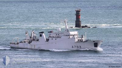
FRENCH WARSHIP LPC
Military ops
Current Trip
Unknown
| Time Travelled | 5 days |
|---|---|
| Remaining Time | --- |
| Distance Travelled | 565.05 nm |
| Remaining Distance | --- |
| AVG Speed | 8.5 Knopen |
| MAX Speed | 13.5 Knopen |
| AVG Wind | 6.6 knots |
| MAX Wind | 17.9 knots |
| MIN Temp | 11.4°C / 52.52°F |
| MAX Temp | 15.3°C / 59.54°F |
| Diepgang | 0 M |
| Positie ontvangen | 2 d geleden |
Current Position
| Lengtegraad | -1.68868° |
|---|---|
| Breedtegraat | 49.70533° |
| Status | Under way using engine |
| Snelheid | 10.9 Knopen |
| Koers | 326.4° |
| Gebied | English Channel |
| Station | T-AIS |
| Positie ontvangen | 2 d geleden |
Info
Information
The current position of FRENCH WARSHIP LPC is in English Channel with coordinates 49.70533° / -1.68868° as reported on 2024-05-19 17:45 by AIS to our vessel tracker app. The vessel's current speed is 10.9 Knopen
The vessel FRENCH WARSHIP LPC (MMSI: 228793000) is a Military ops It's sailing under the flag of [FR] France.
In this page you can find informations about the vessels current position, last detected port calls, and current voyage information. If the vessels is not in coverage by AIS you will find the latest position.
The current position of FRENCH WARSHIP LPC is detected by our AIS receivers and we are not responsible for the reliability of the data. The last position was recorded while the vessel was in Coverage by the Ais receivers of our vessel tracking app.
Weather
| Temperature | 13.7°C / 56.66°F |
|---|---|
| Wind Speed | 9 knots |
| Direction | 62° ENE |
| Pressure | 1013 hPa |
| Humidity | 89.3 % |
| Cloud Coverage | 13 % |
Featured Company
Most Visited Ports (Last year)
| Port | Arrivals | |
|---|---|---|
| 9 | ||
| 2 | ||
| 2 | ||
| 1 | ||
| 1 | ||
| 1 |
Events
| Tijd | Evenement | Details | Positie / Bestemming | Info |
|---|---|---|---|---|
| 2024-05-19 17:45 | Buitenbereik |
49.70533 / -1.68868
English Channel
|
Snelheid: 10.9 kn Koers: 326.4° |
|
| 2024-05-19 17:45 | Binnenbereik |
49.70533 / -1.68868
English Channel
|
Snelheid: 10.9 kn Koers: 326.4° |
|
| 2024-05-18 22:21 | Buitenbereik |
50.08105 / .27997
English Channel
|
Snelheid: 7.8 kn Koers: 72.1° |
|
| 2024-05-18 08:05 | Start beweging | 19.76 nm, North of FECAMP |
50.07547 / .21830
|
Snelheid: 6.4 kn Koers: 265.5° |
| 2024-05-18 07:52 | Stop beweging | 19.81 nm, North of FECAMP |
50.07686 / .22104
|
Snelheid: 0.3 kn Koers: 511° |
| 2024-05-17 12:52 | Status Changed | Restricted manoeuverability Under way using engine |
49.89023 / -.32834
|
Snelheid: 7.2 kn Koers: 71.3° |
| 2024-05-17 12:04 | Binnenbereik |
49.91963 / -.53903
English Channel
|
Snelheid: 11.6 kn Koers: 106.4° |
|
| 2024-05-17 06:01 | Buitenbereik |
49.75117 / -2.03565
English Channel
|
Snelheid: 11.2 kn Koers: 100.8° |
|
| 2024-05-17 05:54 | Wijzig zee gebeid | French part of the English Channel Guernsey part of the English Channel |
49.73174 / -2.04965
English Channel
|
Snelheid: 12.3 kn Koers: 19.6° |
| 2024-05-17 05:29 | Wijzig zee gebeid | Guernsey part of the English Channel French part of the English Channel |
49.64775 / -2.08783
English Channel
|
Snelheid: 12.7 kn Koers: 359.5° |