

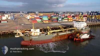
FREEWAY
Dredging or underwater ops
Current Trip
| Time Travelled | 7 days |
|---|---|
| Remaining Time | --- |
| Distance Travelled | 942.68 nm |
| Remaining Distance | --- |
| AVG Speed | 7.2 Knopen |
| MAX Speed | 13.5 Knopen |
| AVG Wind | 9.5 knots |
| MAX Wind | 19 knots |
| MIN Temp | 4.9°C / 40.82°F |
| MAX Temp | 17.9°C / 64.22°F |
| Diepgang | 4 M |
| Positie ontvangen | 1 m geleden |
Current Position
| Lengtegraad | --- |
|---|---|
| Breedtegraat | --- |
| Status | Restricted manoeuverability |
| Snelheid | 7.5 Knopen |
| Koers | 126.5° |
| Gebied | North Sea |
| Station | T-AIS |
| Positie ontvangen | 1 m geleden |
Information
The current position of FREEWAY is in North Sea with coordinates 52.76600° / 4.57027° as reported on 2025-03-27 13:24 by AIS to our vessel tracker app. The vessel's current speed is 7.5 Knopen
The vessel FREEWAY (IMO: 9691682, MMSI: 212368000) is a Dredging or underwater ops It's sailing under the flag of [CY] Cyprus.
In this page you can find informations about the vessels current position, last detected port calls, and current voyage information. If the vessels is not in coverage by AIS you will find the latest position.
The current position of FREEWAY is detected by our AIS receivers and we are not responsible for the reliability of the data. The last position was recorded while the vessel was in Coverage by the Ais receivers of our vessel tracking app.
The current draught of FREEWAY as reported by AIS is 4 meters
Weather
| Temperature | 7.8°C / 46.04°F |
|---|---|
| Wind Speed | 12 knots |
| Direction | 218° SW |
| Pressure | 1020.3 hPa |
| Humidity | 84.7 % |
| Cloud Coverage | 16 % |
Featured Company
Last Port Calls
| Port | Arrival | Departure | Time In Port |
|---|---|---|---|
| 2025-03-19 06:32 | 2025-03-19 19:07 | 12 h | |
| 2025-03-10 06:09 | 2025-03-10 18:44 | 12 h | |
| 2025-03-05 07:34 | 2025-03-05 12:05 | 4 h | |
| 2025-02-28 07:48 | 2025-02-28 17:43 | 9 h | |
| 2025-02-26 09:44 | 2025-02-26 15:05 | 5 h | |
| 2025-02-23 12:55 | 2025-02-24 17:58 | 1 d | |
| 2025-02-18 15:10 | 2025-02-20 15:14 | 2 d | |
| 2025-01-12 07:55 | 2025-02-18 08:37 | ||
| 2025-01-08 04:58 | 2025-01-09 01:37 | 20 h | |
| 2025-01-07 21:42 | 2025-01-07 21:46 | 3 m |
Most Visited Ports (Last year)
| Port | Arrivals | |
|---|---|---|
| 354 | ||
| 196 | ||
| 51 | ||
| 31 | ||
| 9 | ||
| 5 |
Last Trips
| Origin | Departure | Destination | Arrival | Distance | |
|---|---|---|---|---|---|
| 2025-03-10 18:44 | 2025-03-19 06:32 | 1114.39 nm | |||
| 2025-03-05 12:05 | 2025-03-10 06:09 | 609.88 nm | |||
| 2025-02-28 17:43 | 2025-03-05 07:34 | 532.52 nm | |||
| 2025-02-26 15:05 | 2025-02-28 07:48 | 127.02 nm | |||
| 2025-02-24 17:58 | 2025-02-26 09:44 | 88.67 nm | |||
| 2025-02-20 15:14 | 2025-02-23 12:55 | 191.65 nm | |||
| 2025-02-18 08:37 | 2025-02-18 15:10 | 41.65 nm | |||
| 2025-01-09 01:37 | 2025-01-12 07:55 | 778.49 nm | |||
| 2025-01-07 21:46 | 2025-01-08 04:58 | 22.80 nm | |||
| 2025-01-07 21:29 | 2025-01-07 21:42 | 0.25 nm |
Events
| Tijd | Evenement | Details | Positie / Bestemming | Info |
|---|---|---|---|---|
| 2025-03-27 10:57 | Start beweging | 1.51 nm, North West of HARGEN |
52.73949 / 4.62737
PETTEN DREDGING
|
Snelheid: 6.2 kn Koers: 330.1° |
| 2025-03-27 10:30 | Stop beweging | 1.42 nm, North West of HARGEN |
52.73753 / 4.62847
PETTEN DREDGING
|
Snelheid: 0.3 kn Koers: 35° |
| 2025-03-27 07:42 | Start beweging | 1.52 nm, North West of HARGEN |
52.73845 / 4.62617
PETTEN DREDGING
|
Snelheid: 7.6 kn Koers: 308.3° |
| 2025-03-27 07:19 | Stop beweging | 1.42 nm, North West of HARGEN |
52.73716 / 4.62833
PETTEN DREDGING
|
Snelheid: 0.3 kn Koers: 33° |
| 2025-03-27 04:26 | Start beweging | 1.61 nm, North West of HARGEN |
52.74000 / 4.62481
PETTEN DREDGING
|
Snelheid: 8.4 kn Koers: 320° |
| 2025-03-27 03:58 | Stop beweging | 1.5 nm, North West of HARGEN |
52.73892 / 4.62721
PETTEN DREDGING
|
Snelheid: 0.2 kn Koers: 112° |
| 2025-03-27 01:03 | Start beweging | 1.46 nm, North West of HARGEN |
52.73780 / 4.62748
PETTEN DREDGING
|
Snelheid: 4.6 kn Koers: 243° |
| 2025-03-27 00:39 | Stop beweging | 1.45 nm, North West of HARGEN |
52.73935 / 4.62943
PETTEN DREDGING
|
Snelheid: 0.3 kn Koers: 189° |
| 2025-03-26 23:28 | Start beweging | 9.4 nm, North West of HARGEN |
52.81788 / 4.45355
PETTEN DREDGING
|
Snelheid: 3.1 kn Koers: 131° |
| 2025-03-26 22:33 | Stop beweging | 8.61 nm, North West of HARGEN |
52.80312 / 4.46314
PETTEN DREDGING
|
Snelheid: 0.3 kn Koers: 335° |