
FREE STATE
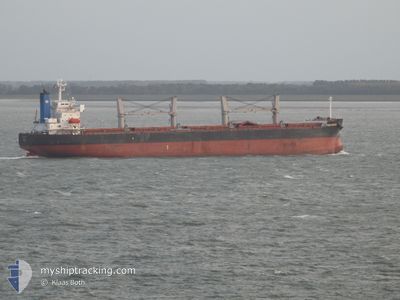
Bulk Carrier
Current Trip
| Time Travelled | 7 days |
|---|---|
| Remaining Time | --- |
| Distance Travelled | 33.73 nm |
| Remaining Distance | --- |
| AVG Speed | 4.4 Knopen |
| MAX Speed | 7.5 Knopen |
| AVG Wind | 12.1 knots |
| MAX Wind | 21 knots |
| MIN Temp | 14.4°C / 57.92°F |
| MAX Temp | 20°C / 68°F |
| Diepgang | 11.5 M |
| Positie ontvangen | 10 h, 43 m geleden |
Current Position
| Lengtegraad | --- |
|---|---|
| Breedtegraat | --- |
| Status | At anchor |
| Snelheid | |
| Koers | 84° |
| Gebied | Mediterranean Sea - Eastern Basin |
| Station | T-AIS |
| Positie ontvangen | 10 h, 43 m geleden |
Info
Information
The current position of FREE STATE is in Mediterranean Sea - Eastern Basin with coordinates 31.20318° / 29.76322° as reported on 2026-01-07 06:11 by AIS to our vessel tracker app. The vessel's current speed is 0 Knopen
The vessel FREE STATE (IMO: 9386392, MMSI: 538007004) is a Bulk Carrier that was built in 2008 ( 18 Jaar oud ). It's sailing under the flag of [MH] Marshall Is.
In this page you can find informations about the vessels current position, last detected port calls, and current voyage information. If the vessels is not in coverage by AIS you will find the latest position.
The current position of FREE STATE is detected by our AIS receivers and we are not responsible for the reliability of the data. The last position was recorded while the vessel was in Coverage by the Ais receivers of our vessel tracking app.
The current draught of FREE STATE as reported by AIS is 11.5 meters
Weather
| Temperature | 19°C / 66.2°F |
|---|---|
| Wind Speed | 6 knots |
| Direction | 52° NE |
| Pressure | 1020.1 hPa |
| Humidity | 68.6 % |
| Cloud Coverage | 3 % |
Featured Company
Last Port Calls
| Port | Arrival | Departure | Time In Port |
|---|---|---|---|
| 2025-12-31 12:21 | 2025-12-31 17:52 | 5 h | |
| 2025-12-18 01:05 | 2025-12-23 21:49 | 5 d | |
| 2025-12-14 21:19 | 2025-12-14 22:49 | 1 h | |
| 2025-12-01 08:09 | 2025-12-11 05:40 | 9 d |
Most Visited Ports (Last year)
| Port | Arrivals | |
|---|---|---|
| 2 | ||
| 2 | ||
| 2 | ||
| 1 | ||
| 1 | ||
| 1 |
Last Trips
| Origin | Departure | Destination | Arrival | Distance | |
|---|---|---|---|---|---|
| 2025-12-23 21:49 | 2025-12-31 12:21 | 918.90 nm | |||
| 2025-12-14 22:49 | 2025-12-18 01:05 | 148.38 nm | |||
| 2025-12-11 05:40 | 2025-12-14 21:19 | 911.77 nm | |||
| 2025-10-27 16:08 | 2025-12-01 08:09 | 3128.31 nm |
Events
| Tijd | Evenement | Details | Positie / Bestemming | Info |
|---|---|---|---|---|
| 2026-01-07 06:17 | Status Changed | Default At anchor |
31.20318 / 29.76325
EGEDK
|
Snelheid: Koers: 84° |
| 2026-01-07 06:11 | Buitenbereik |
31.20318 / 29.76322
Mediterranean Sea - Eastern Basin
|
Snelheid: Koers: 179° |
|
| 2026-01-07 06:05 | Gevonden in zee | Egyptian part of the Mediterranean Sea - Eastern Basin |
31.20325 / 29.76318
Mediterranean Sea - Eastern Basin
|
Snelheid: Koers: 184° |
| 2026-01-07 06:03 | Destination Changed | EGEDK EGALY |
31.20328 / 29.76318
EGEDK
|
Snelheid: Koers: 86° |
| 2026-01-07 06:03 | ETA Changed | 2026/12/28 18:00 2025/12/28 20:00 |
31.20328 / 29.76318
EGEDK
|
Snelheid: Koers: 86° |
| 2026-01-07 06:02 | Status Changed | At anchor Default |
31.20328 / 29.76318
EGALY
|
Snelheid: Koers: 85° |
| 2026-01-07 05:46 | Binnenbereik |
31.20325 / 29.76318
Mediterranean Sea - Eastern Basin
|
Snelheid: Koers: 184° |
|
| 2025-12-31 17:13 | Stop beweging | 3.95 nm, North West of EL DEKHEILA |
31.20438 / 29.76962
EGALY
|
Snelheid: 0.3 kn Koers: 270° |
| 2025-12-31 15:52 | Vertrekhaven |
|
31.16027 / 29.83452
EGALY
|
Snelheid: 8.1 kn Koers: 242° |
| 2025-12-31 15:41 | Start beweging |
31.17250 / 29.85590
[EG] ALEXANDRIA
|
Snelheid: 4.4 kn Koers: 220° |