
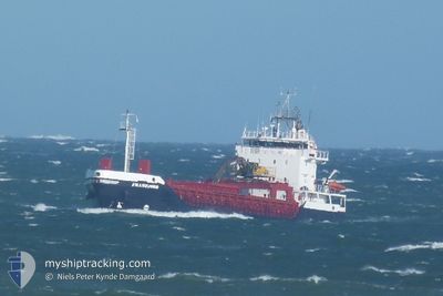
FRAMFJORD
General Cargo
Current Trip
| Trip Time | 19 h, 58 mins |
|---|---|
| Trip Distance | 164.40 nm |
| AVG Speed | 8.6 Knopen |
| MAX Speed | 10.7 Knopen |
| Diepgang | 4 M |
| AVG Wind | 16 knots |
| MAX Wind | 23.9 knots |
| MIN Temp | -0.6°C / 30.92°F |
| MAX Temp | 3°C / 37.4°F |
| Positie ontvangen | Nu |
Current Position
| Lengtegraad | --- |
|---|---|
| Breedtegraat | --- |
| Status | Under way using engine |
| Snelheid | |
| Koers | 61° |
| Gebied | North Sea |
| Station | T-AIS |
| Positie ontvangen | Nu |
Information
The current position of FRAMFJORD is in North Sea with coordinates 57.11851° / 8.59506° as reported on 2025-03-13 12:23 by AIS to our vessel tracker app. The vessel's current speed is 0 Knopen and is currently inside the port of HANSTHOLM.
The vessel FRAMFJORD (IMO: 9340738, MMSI: 258356000) is a General Cargo that was built in 2006 ( 19 Jaar oud ). It's sailing under the flag of [NO] Norway.
In this page you can find informations about the vessels current position, last detected port calls, and current voyage information. If the vessels is not in coverage by AIS you will find the latest position.
The current position of FRAMFJORD is detected by our AIS receivers and we are not responsible for the reliability of the data. The last position was recorded while the vessel was in Coverage by the Ais receivers of our vessel tracking app.
The current draught of FRAMFJORD as reported by AIS is 4 meters
Weather
| Temperature | 1.8°C / 35.24°F |
|---|---|
| Wind Speed | 17 knots |
| Direction | 25° NNE |
| Pressure | 999.2 hPa |
| Humidity | 82.9 % |
| Cloud Coverage | 100 % |
Featured Company
Last Port Calls
| Port | Arrival | Departure | Time In Port |
|---|---|---|---|
| 2025-03-13 11:33 | |||
| 2025-03-12 13:10 | 2025-03-12 15:35 | 2 h | |
| 2025-03-11 20:06 | 2025-03-11 22:57 | 2 h | |
| 2025-03-10 16:36 | 2025-03-11 19:30 | 1 d | |
| 2025-03-10 14:20 | 2025-03-10 15:55 | 1 h | |
| 2025-03-10 09:11 | 2025-03-10 14:05 | 4 h | |
| 2025-03-09 20:42 | 2025-03-09 21:28 | 46 m | |
| 2025-03-09 13:30 | 2025-03-09 16:05 | 2 h | |
| 2025-03-09 10:25 | 2025-03-09 11:33 | 1 h | |
| 2025-03-08 16:16 | 2025-03-08 19:25 | 3 h |
Last Trips
| Origin | Departure | Destination | Arrival | Distance | |
|---|---|---|---|---|---|
| 2025-03-12 16:35 | 2025-03-13 12:33 | 164.40 nm | |||
| 2025-03-11 23:57 | 2025-03-12 14:10 | 138.40 nm | |||
| 2025-03-11 20:30 | 2025-03-11 21:06 | 5.03 nm | |||
| 2025-03-10 16:55 | 2025-03-10 17:36 | 5.25 nm | |||
| 2025-03-10 15:05 | 2025-03-10 15:20 | 2.31 nm | |||
| 2025-03-09 22:28 | 2025-03-10 10:11 | 108.01 nm | |||
| 2025-03-09 17:05 | 2025-03-09 21:42 | 40.54 nm | |||
| 2025-03-09 12:33 | 2025-03-09 14:30 | 18.94 nm | |||
| 2025-03-08 20:25 | 2025-03-09 11:25 | 138.77 nm | |||
| 2025-03-07 15:41 | 2025-03-08 17:16 | 218.13 nm |
Events
| Tijd | Evenement | Details | Positie / Bestemming | Info |
|---|---|---|---|---|
| 2025-03-13 11:45 | Stop beweging |
57.11855 / 8.59469
[DK] HANSTHOLM
|
Snelheid: 0.3 kn Koers: 70° |
|
| 2025-03-13 11:33 | Aankomsthaven |
|
57.12652 / 8.59200
[DK] HANSTHOLM
|
Snelheid: 6.2 kn Koers: 179° |
| 2025-03-13 07:51 | Wijzig zee gebeid | Danish part of the North Sea Norwegian part of the North Sea |
57.46159 / 7.87905
North Sea
|
Snelheid: 8.6 kn Koers: 131.8° |
| 2025-03-12 15:35 | Vertrekhaven |
|
59.00437 / 5.66692
DUSAVIK
|
Snelheid: 6.7 kn Koers: 351° |
| 2025-03-12 15:34 | Start beweging |
59.00154 / 5.66780
[NO] DUSANIK
|
Snelheid: 5.1 kn Koers: 350° |
|
| 2025-03-12 13:17 | Stop beweging |
58.99963 / 5.66594
[NO] DUSANIK
|
Snelheid: 0.3 kn Koers: 123° |
|
| 2025-03-12 13:10 | Aankomsthaven |
|
59.00293 / 5.66568
[NO] DUSANIK
|
Snelheid: 4.6 kn Koers: 179° |
| 2025-03-11 22:57 | Vertrekhaven |
|
60.79469 / 5.07827
DUSAVIK
|
Snelheid: 6.3 kn Koers: 20° |
| 2025-03-11 22:56 | Start beweging |
60.79238 / 5.07629
[NO] MONGSTAD
|
Snelheid: 5.2 kn Koers: 25° |
|
| 2025-03-11 20:26 | Destination Changed | DUSAVIK MONGSTADBASE |
60.79093 / 5.07311
[NO] MONGSTAD
|
Snelheid: Koers: 153° |