

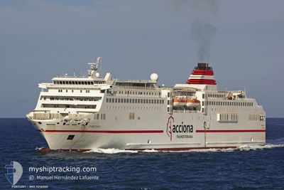
FORTUNY
Passenger

Current Trip
| Time Travelled | 4 h, 9 mins |
|---|---|
| Remaining Time | 1 h, 16 mins |
| Distance Travelled | 83.81 nm |
| Remaining Distance | --- |
| AVG Speed | 20.6 Knopen |
| MAX Speed | 21 Knopen |
| AVG Wind | 15.2 knots |
| MAX Wind | 17.9 knots |
| MIN Temp | 17.5°C / 63.5°F |
| MAX Temp | 18.6°C / 65.48°F |
| Diepgang | 5.8 M |
| Positie ontvangen | 1 m geleden |
Current Position
| Lengtegraad | --- |
|---|---|
| Breedtegraat | --- |
| Status | Under way using engine |
| Snelheid | 21 Knopen |
| Koers | 81.5° |
| Gebied | North Atlantic Ocean |
| Station | T-AIS |
| Positie ontvangen | 1 m geleden |
Information
The current position of FORTUNY is in North Atlantic Ocean with coordinates 28.78213° / -13.96815° as reported on 2025-02-13 03:29 by AIS to our vessel tracker app. The vessel's current speed is 21 Knopen and is heading at the port of ARRECIFE. The estimated time of arrival as calculated by MyShipTracking vessel tracking app is 2025-02-13 04:47 LT
The vessel FORTUNY (MMSI: 224675000) is a Passenger It's sailing under the flag of [ES] Spain.
In this page you can find informations about the vessels current position, last detected port calls, and current voyage information. If the vessels is not in coverage by AIS you will find the latest position.
The current position of FORTUNY is detected by our AIS receivers and we are not responsible for the reliability of the data. The last position was recorded while the vessel was in Coverage by the Ais receivers of our vessel tracking app.
The current draught of FORTUNY as reported by AIS is 5.8 meters
Weather
| Temperature | 17.5°C / 63.5°F |
|---|---|
| Wind Speed | 14 knots |
| Direction | 54° NE |
| Pressure | 1019.9 hPa |
| Humidity | 80.3 % |
| Cloud Coverage | 2 % |


Featured Company
Last Port Calls
| Port | Arrival | Departure | Time In Port |
|---|---|---|---|
| 2025-02-12 17:21 | 2025-02-12 23:22 | 6 h | |
| 2025-02-12 04:44 | 2025-02-12 11:17 | 6 h | |
| 2025-02-11 17:24 | 2025-02-11 23:09 | 5 h | |
| 2025-02-11 04:44 | 2025-02-11 11:09 | 6 h | |
| 2025-02-10 17:08 | 2025-02-10 23:24 | 6 h | |
| 2025-02-10 05:08 | 2025-02-10 11:19 | 6 h | |
| 2025-02-10 01:56 | 2025-02-10 03:28 | 1 h | |
| 2025-02-08 17:07 | 2025-02-09 20:39 | 1 d | |
| 2025-02-08 04:47 | 2025-02-08 11:11 | 6 h | |
| 2025-02-07 17:09 | 2025-02-07 23:26 | 6 h |
Last Trips
| Origin | Departure | Destination | Arrival | Distance | |
|---|---|---|---|---|---|
| 2025-02-12 11:17 | 2025-02-12 17:21 | 99.91 nm | |||
| 2025-02-11 23:09 | 2025-02-12 04:44 | 100.10 nm | |||
| 2025-02-11 11:09 | 2025-02-11 17:24 | 97.71 nm | |||
| 2025-02-10 23:24 | 2025-02-11 04:44 | 100.08 nm | |||
| 2025-02-10 11:19 | 2025-02-10 17:08 | 110.64 nm | |||
| 2025-02-10 03:28 | 2025-02-10 05:08 | 32.97 nm | |||
| 2025-02-09 20:39 | 2025-02-10 01:56 | 100.34 nm | |||
| 2025-02-08 11:11 | 2025-02-08 17:07 | 110.87 nm | |||
| 2025-02-07 23:26 | 2025-02-08 04:47 | 110.55 nm | |||
| 2025-02-07 11:15 | 2025-02-07 17:09 | 109.19 nm |
Events
| Tijd | Evenement | Details | Positie / Bestemming | Info |
|---|---|---|---|---|
| 2025-02-13 03:17 | Status Changed | Under way using engine Default |
28.76267 / -14.04661
LPA/ESP>>ACE/ESP
|
Snelheid: 20.8 kn Koers: 62° |
| 2025-02-13 02:57 | Status Changed | Default Under way using engine |
28.70926 / -14.16099
LPA/ESP>>ACE/ESP
|
Snelheid: 20.8 kn Koers: 61.8° |
| 2025-02-13 02:01 | Status Changed | Under way using engine Default |
28.55935 / -14.48208
LPA/ESP>>ACE/ESP
|
Snelheid: 20.5 kn Koers: 61° |
| 2025-02-13 01:52 | Status Changed | Default Under way using engine |
28.53311 / -14.53553
LPA/ESP>>ACE/ESP
|
Snelheid: 20.5 kn Koers: 60.4° |
| 2025-02-13 01:49 | Status Changed | Under way using engine Default |
28.52585 / -14.55014
LPA/ESP>>ACE/ESP
|
Snelheid: 20.5 kn Koers: 61° |
| 2025-02-13 01:35 | Status Changed | Default Under way using engine |
28.48402 / -14.63099
LPA/ESP>>ACE/ESP
|
Snelheid: 20.3 kn Koers: 58.4° |
| 2025-02-13 00:13 | Status Changed | Under way using engine Default |
28.27724 / -15.10176
LPA/ESP>>ACE/ESP
|
Snelheid: 20.6 kn Koers: 64° |
| 2025-02-13 00:11 | Status Changed | Default Under way using engine |
28.27366 / -15.10990
LPA/ESP>>ACE/ESP
|
Snelheid: 20.6 kn Koers: 63.3° |
| 2025-02-12 23:22 | Vertrekhaven |
|
28.14508 / -15.39089
LPA/ESP>>ACE/ESP
|
Snelheid: 12.1 kn Koers: 114° |
| 2025-02-12 23:15 | Start beweging |
28.15770 / -15.39982
[ES] LAS PALMAS
|
Snelheid: 4.9 kn Koers: 179° |